Posted on 21 Comments

Return to “Neddyshire” (Cotswolds)

Return to Neddyshire

I have recently been spending time with my parents in the Cotswolds in Gloucestershire.  On a bright sunny Sunday morning I explored some of the winding tracks of a near by village called Chalford and Chalford Hill. Where is that? In the South West-ish of the English Midlands ( see map below). The Parish of Chalford is contained in the Cotswold Area of Outstanding Beauty

map of Wales and west of England
Location of Chalford/Stroud in England


Parish of Chalford
Parish of Chalford (see pdf at bottom of blog for link)

Chalford Parish stretches a fair way over this part of the Cotswolds. Chalford Hill is a steep valley within the parish. There are  four other historic settlements in the parish. The villages are Chalford Hill (1 on map above),  France Lynch (2),  Brownshill (3),  Old Bussage (4),  Chalford Vale (5) and  Manor Village (aka Bussage) (6). Much of my information comes from a publication by the Chalford Parish Council (see the last link at the bottom of the blog)

Map of Chalford
Map of Chalford
Donkey track along the top of the valley - photo: Emma Cownie
Donkey track along the top of the valley – photo: Emma Cownie

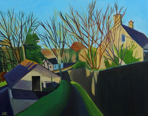
The original villages of Chalford, Chalford Hill, France Lynch, Bussage and Brownshill were squatter settlements for handloom  weavers and other cloth workers as a result of the expansion of the woollen industry in the early Middle Ages and later. The valley  road through Chalford was first developed in the late 17th and early 18th centuries. From the later 18th century, when the valley bottom offered no further sites, cottages were built on the hillsides above, an area sometimes referred to as Little Switzerland.

View of Chalford Hill from Canal path:photo credit Emma Cownie


As the wool trade ebbed and flowed, so did the population and prosperity of the area, though the opening of the Thames and Severn Canal in 1789 helped to create further, if different, jobs, at least for a time. The next important change was the opening of the Great Western Railway line in 1845, built along the valley beside the canal. A station was opened in Chalford village in 1897 and there was also a halt west of the village. Both stations closed in 1964. Today the next station stop is Stroud.

The Parish is renowned for its steep hillsides and scarp edges as well as it’s narrow roads and footpaths many of which have a gradient between 10% and 25% Behind many of the honey-coloured houses are narrow paths that stretch over an incredible 28 km within the parish. These tracks lead up some very steep hillsides.  In the past the narrow mud tracks allowed workers to quickly reach the mills in the valley by foot – a majority of the paths leading straight down hill.  Although you might be forgiven for thinking this is mountain goat country it was donkeys that did all the heavy carrying in the past. Today this is 4×4 country.

Donkey track along the top of the valley - photo: Emma Cownie
Donkey track leading down the hillside- photo: Emma Cownie

These tracks enabled goods (food and coal) to be transported up and down the hill by donkey. These days alpacas are  becoming a common sight in Britain and Ireland but back in the day Chalford was the domain of the donkey aka “Neddy” or “Ned”.

The Chalford Donkey back in the day
The Chalford Donkey back in the day: Photo from The Stroud News


Donkeys were used until the 1930s to deliver bread, coal and other household items to people’s doorsteps (Jennie being the name of one of the donkeys). In fact, many front doors can still only be accessed by a winding network of ‘donkey paths’. In those times Chalford was known as ‘Neddyshire’ which derives its name from the use of donkeys.

Chalford_donkey_1935 (1)
Chalford_donkey from 1935


A Road Through Chalford_Emma Cownie


I am looking forward to exploring more of these tracks when I return as well as the path along the canal at the bottom of the valley.

Bridge across the canal, Chalford: Photo credit Emma Cownie


Find out more:-

Chalford Hill

Click to access Design-Statement-low-resolution-for-web.pdf

Posted on 13 Comments

Cotswolds Tracks and the Chalford Donkeys

Chalford_donkey_1935 (1)
Stroud from the Train
Stroud From the Train

My parents live near Stroud in the Cotswolds. The best thing about the Cotswolds, like South Wales, is the hills. It provides many higgle piggedly vistas and views. Their house is part of a modern estate in the village of Bussage at the top of a very steep hill.

EASTCOMBE ARTFINDER
Eastcombe

I enjoy exploring the donkey tracks behind the houses. The village of Eastcombe is a 10 minute walk from their house. This is 4×4 territory, especially in winter when the steep lane are unpassable for regular car and quite treachorous for walkers too.

Chalford_donkey_1935 (1)
Chalford Donkey 1935

The other side of Bussage runs into the top (and flatter) end of Chalford. Chalford Hill and Chalford have an extraordinary number of paths (28 km within the parish as a whole), winding up the steep hillsides. They allowed workers to quickly reach the mills in the valley – a majority of the paths leading straight down. They also enabled goods to be transported up and down the hill by donkey. They were used until the 1930s to deliver bread, coal and other household items to people’s doorsteps (Jennie being the name of one of the donkeys). In fact, many front doors can still only be accessed by a winding network of ‘donkey paths’. In those times Chalford was known as ‘Neddyshire’ which derives its name from the use of donkeys.

There was a modern version of this donkey delivery that ran for 5 years from 2008 to 2013. Sadly it seems to have stopped now. The donkey delivery service was run by to Anna Usbourne and her four and eight-year-olds, Chester and Teddy. They did run the Chalford Community Store’s weekly delivery service. You can watch a video about it here. If they had ranged as far away as Bussage (one and a half miles aay up a very steep hill), I know for a fact that my mother would have been ordering her groceries from the Chalford Village shop so she could have got a visit from Chester and Teddy the donkeys! Here’s a film about them delivering the groceries in the snow in 2011.

Donkey Delivery

220px-Jamie_Dornan_January_2013
Jamie Doran

The Northern Irish actor Jamie Dornan, who starred in Fifty Shades of Grey and The Fall, also lives in Chalford near Stroud and my mother says he’s been spotted in the local tiny Tescos Express with Eddie Redmayne. He has to shop somewhere. Anyway, sad to say that I have never seen either of them in there!

Country Lane
Country Lane

There’s a track that leads down the hill from my parents’ house to the Ram pub. You can also drive to it as there is a single track road to it. In the field beyond the pub there lives a black horse and a donkey. I don’t think the donkey there was ever a delivery donkey.

Back of Ram Bussage
Back of the Ram


Posted on 5 Comments

Cotswolds roofs and chimneys

EASTCOMBE ARTFINDER.jpg

The Cotswolds is an area that takes its name from the Cotswold Hills in Southern England. I think of it being in Gloucestershire because that’s the part of the Cotswolds I am familar with, but it stretches into Oxfordshire, Somerset, Wiltshire, Worcesterhire and even as far as Warwickshire.   It is about 25 miles across and 90 miles long, stretching south-west from just south of Stratford-Upon-Avon (where all 6th form students studying English “A” level use to be taken to see a Shakespeare play) to just south of Bath.

Lots of people have lived here for hundreds of years. Domesday Book (complied. 1086) is testament to that. It records the names of the same villages you’d see on a map today. It lists villages full of people and animals, especially sheep. It is from the sheep that the Cotswold originally derived it wealth. From their fleeces. The steep hills later provided the fast running streams for the water-power woollen mills that line the bottom of the Stroud Valleys.

The thing that marks a town out as being part of the “Cotswold” is the honey colour limestone that all the houses are built from.  The little village of Eastcombe is no different. It is nestles alongside the village Bussage, where my parents live. I often walk down to the post office at Eastcombe when I am visiting. The part of Eastcombe that I have painted here is accessed down a steep single track road and it can be pretty treacherous in the winter ice. Once upon a time, donkeys carried people’s burdens down these tracks. These days its 4x4s!  I like hilly places (I live in Wales, after all) because houses end up sprawling higgedly piggedly up the hills and I find that pattern pleasing. The Cotswold is a generally a tidy, rather manicured place, unlike the wild unkemptness of the Gower. I enjoy the contrast.