Posted on 21 Comments

Walking the Gower Coast: Caswell Bay & Brandy Cove

After my adventures on my first walk along (or rather off) the coastal path from Limeslade to Caswell, I was left with legs that were covered with scratches from the sleeping-beauty-brambles that smothered the path I was stupidly trying follow. I didn’t discover these until later on that day when I was in the bath. I looked down at my legs and marveled at all the scratches that I didn’t realise were there. I had walked just under 3 miles but I was very tired and very stiff the next day. My toes hurt, my legs were stiff and my back ached from carrying my rucksack.  The going up and down hills is more arduous that you’d think.

Caswell Map

It took a weekend’s rest and a sunny forecast to tempt me out again. It was the spring Equinox. The day when light and dark are balanced before the days lengthen into spring. I got up earlier this time and caught the 9.20am 2C bus on Oystermouth Road to Caswell. The same bus driver from my first bus trip to Limeslade was driving this bus.

Unlike the bus to Limeslade that snaked all around the houses Langland before it reached its destination, the bus to Caswell is pretty direct, travelling through the villages of Mumbles and up a hill into Newton then before the long descent  of Caswell Road, past the Summercliffe Chalet park with its very expensive chalets (£150K to buy one, if you are asking). There are some very different chalets nearby, tucked away in the woods and easily missed. These chalet fields are Holtsfield and Owensfield.  They started as holiday huts but became permanent homes after families were bombed out of their homes during the second World War.

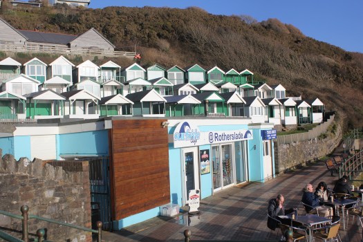
At the bottom of the hill is the beach. Caswell is a very popular beach with locals and tourists alike. In the summer the car park fills up and  if you leave too late in the day, they close the car park and you just cannot get in!

After School
After School

When I arrived at Caswell the tide has just turned. High tides make a big difference to how much beach there is here and all along the Gower coast. This is because the Bristol Channel has the second-highest tidal range in the world. The low tides expose vast stretches of golden sands while the high tides flood the bays create cozy bays of sheltered water. When the tide is out there is more than enough beach for everyone.

This morning, however, the high water meant that Caswell Bay was cut into two small bays.

So why are there two bays at Caswell? Apparently it because there are two neighbouring faults, one along Caswell Valley (beneath the car park) and another directly under that ugly block of apartments behind the western arm of the Bay.  At the foot of the western cliff (called Redley Cliff) runs a small brook, which starts at nearby spring.  In the past water from this stream was stored in a massive concrete cistern and supplied to the houses of the bay by gravity-feed from a wind-pump situated on the top of the cliff. You can just about make out the windmill on the top left hand-side of the old postcard below.

OLD CASWELL BAY

We have a wonderful insight into what Caswell used to look like in the mid-19th century, thanks to photography pioneer, John Dillwyn Llewelyn. John was what you might call a Victorian playboy scientist. He was very rich did not have a “proper job”. His father Lewis Weston Dillwyn managed the family-owned Cambrian Pottery in Swansea. This meant he was in the very lucky position of being able to pursue his interests in science, botany and astronomy full-time. John’s wife, Emma, was the cousin of pioneer photographer William Henry Fox Talbot and this clearly inspired John to take up this new science. John actually became a one of the most important amateur photographers in the 1850s and he took photographs of the holiday home, Caswell Cottage, he built at Caswell.

Caswell Cottage.jpg
Caswell Cottage

He was also an inventor of new techniques. One of his innovations was a camera shutter that allowed him to capture the movement of waves at Caswell at approximately 1/25th of a second.

caswell-bay-amp-beach-beautiful-sunny-day-overlooking-caswell-bay-gower-peninsula-wales-uk_4 (1)-001
Redcliffe Appartmments

These photographs of an unspoilt Caswell make me sad because in the 1960s the local planning authority decided that this beautiful bay would be “improved” by the knocking down Caswell Cottage to make a car park and also knocking down Redcliffe House (once home to the family of Dylan Thomas’s poet friend Vernon Watkins) to build the brutalist-style Redcliffe apartment block. As my husband says, “I like 60s’ architecture, but it’s like an office block has been randomly dropped into the countryside”. This makes painting nice paintings of the bay difficult because the 1960s block, in my opinion, is not very pretty. It might be great to live in, with lovely views, but its not great to look at, or paint.

Bay House Caswell.jpg
Bay House, Caswell

Still, at least we are still left with the handsome Bay House. Three sisters Emma, Agnes and Alice Morgan built and lived in this house in 1877. The sisters also planted many of the bay’s distinctive pine trees.

If you look closely at the photo to the right you may well be able to spot a helicopter. This house is currently owned by the flamboyant boss of the Welsh supermarket chain “CK’s” who is a keen helicopter pilot. He’s got into trouble a few years ago when he flew his helicopter into Heathrow airspace and caused a security alert. In Chris Kiley’s defense he was late for lunch at a nearby country house, and although he’d been given directions he didn’t have coordinates! Its seems that he’s gone off living Caswell because the house is up for sale for £2.5 million (that’s around $3.5 million dollars).

Bay House, Caswell.JPG
Bay House, Caswell Bay

Today, the tide was in, so I had to walk along the road, to find the coastal path. Usually I’d walk across the beach and climb up the cliff path, which is what I did in 2016 (see photos below).

I decided to take the higher path and this time I was determined to follow the map. I find it hard to follow instructions, I don’t know whether its my sense of curiosity, laziness or plain stupidity that makes me think I know a better way. Mind you, looking at my Pathfinder Guide, I realise why I find it so difficult. Although the maps are useful, the rest of the page is pretty much solid text, no gaps, bullet points, paragraphs, so its difficult to follow. No wonder I just look at the maps!

Not today. My coastal path map (picked up for free from one of those information points in Swansea) has no instructions just a big map on both sides of the page. That suits me just fine. The map tells me that the path joins the road further up the hill so I start walking. This road, however, does not have a pavement for pedestrians for much of its length so I have to keep stepping back onto a narrow grass verge when cars pass by.

IMG_0941
View From Bay House’s Driveway

Eventually, towards the top of the road I find the path and follow it although it did not feel very “coastal”. In fact the path takes a short cut across Redley Cliff and down a long flight of steps cut into the earth to Brandy Cove. I love going down steps like these.

The woods on the way from Bishopston to Brandy Cove inspired an early painting of mine; Brandy Cove Stile (see below).

Brandy Cove Stile.jpg
Brandy Cove Stile

Writer Wynford Vaughn Thomas called the Gower Peninsula “a secret people hug to themselves”. Brandy Cove is bit of a secret places in Gower because you can only get here on foot. You can walk down narrow lanes and paths from Bishopston village or via the coastal path. It is a little cove that is made of mostly pebbles and rocks at high tide but at low tide looks very different as golden sands stretch out into the Bristol Channel. Its a lovely place to swim in the summer and usually deserted.

I had read somewhere that it used to be known as Hareslade. All the locals call it Brandy Cove, however, thanks to the pirates/smugglers who used to maraud the length of the Bristol Channel and unload their illegal tobacco and alcohol goods here during the eighteenth century. Think Ross Polark with a Welsh accent and you’d be about right.

IMG_0160.JPG
Brandy Cove at Low Tide

In the 19th century Brandy Cove was later home to a silver and lead mine, although mining had probably taken place in this area in Roman times.

Maime StuartOne of the mine shafts was put to a much darker used in the early part of the 20th century when the dismembered body of Mamie Stuart were dumped by her murderer. Mamie, from Sunderland in the industrial North East of England, was dubbed a “chorus girl” by the local press. She had been used to a life on the stage but she’d given that that up and married Cardiff-born George Shotton in 1918 and moved to Swansea. The marriage was mistake. It was a very unhappy one and Mamie wrote to her parents complaining that her new husband beat her. After these complaints they heard no more from her. She vanished.

Her suitcase turned up in a Swansea hotel. Despite a national serach, she was never heard of again. It turned out that there was already a Mrs Shotton who was living in Cardiff with a daughter. George did 18 months’ “hard labour” in prison for bigamy, but the cad got away with murder because by the time her remains were discovered in Brandy Cove in 1961, he had been dead three years. Poor Mamie.

In my next post I carry on and visit one of Gower “hidden” villages and visit a Gower bay that many people have never heard of.

Brandy Cove.jpg
Brandy Cove
Posted on 37 Comments

Walking the Gower Coast; Limeslade and Langland Bays

Gower Coast without a Car 2016
The Old Leaflet

This was all my sister’s idea. She suggested I walk along the Gower coast and paint the bays and beaches. I had no idea how difficult the logistics of this would be. I had the daft idea that catching buses and walking the coastline would be easy. After all I had a jolly looking-leaflet “Gower Coast and Countryside with out a Car” with a photo of a bus on the front.

Sadly, it turns out that Swansea Council have changed their mind and aren’t that keen for walkers to come and visit this “Area of Outstanding Natural Beauty” (since 1956, you know).

Tourist Info.jpg
Closed

I’d picked up that leaflet two years ago. I had called into the Swansea Tourist Office,  sensibly located next to the bus station. There were two helpful ladies who gave me lots of leaflets where told me where I could get up to date bus timetables.

When I tried to revisit them last week, however, I was horrified to discover that the office was closed. There was no notice about where to get tourist information. Swansea council claims that 11,100 people are employed in tourism in Swansea but they can’t find the money to fund two people and some leaflets in a tourism office!

Bus Info.jpg
Bus Station Info Point

Not to be defeated, I called by the bus station, in the hope of getting up-to-date timetables for Gower bus services. I had to wait several long seconds whilst the youth on the information desk pondered over his suduko puzzle, sighed, and looked up. When I asked about buses round Gower he tore off two A5 sheets of paper for the week-day buses to North Gower and to Rhossili. He then went back to his puzzle. I wasn’t filled with confidence about getting around the coast by public transport.

Tescoes IP
Tescos

I went home to look up on the internet where the office had been moved to.  It hadn’t; it was gone. The tourist information office in Mumbles has been closed too. I emailed the tourism people for help. I was tartly informed that information was moved online and supplemented by a series of “information points” around the city where I could get help. I initially thought that these might be sort if dedicated tourism-related computer terminals. turns out that these “information points” are leaflet racks. I wqs informed by the tourism person that they were “a network of Visitor Information Points (VIPs) across the destination, offering a drop-in facility for visitors with plenty of advice, maps and leaflets at the ready!” I didn’t feel very encouraged by this. So I went back into to town to have a look. The first information point I visited was in the foyer of Tescos. There was no one to speak to here.

IMG_20180328_110321 (2)
Grand Theatre

I then visited the foyer of the Grand Theatre where they had a number of racks filled with leaflets. There were staff there. They were sitting behind a glass screen at a counter. There was a queue of people waiting to buy tickets. When the queue went so did the counter staff. I lost heart. I didn’t think they’d thank me for asking them about buses to Port Eynon and I knew that they’d direct me to the bus station, so I left. Whilst was at the Grand Theatre, I did pick up a leaflet which spoke volumes about Swansea Tourism’s much reduced ambitions for tourism the area.

teaserbox_56937528

Instead of “Gower Coast and Countryside without a car”  it’s  now “Mumbles and the City of Swansea without a car.” Swansea and Gower really need the money that tourism can bring to the local economy but the local council just fail to provide the infrastructure that is needed. I’ll come back to the issue of bus timetables later, as it is something that has kept  me awake at night trying to figure out how to go and get back from places in Gower.

Mumbles to Caswell.JPG
Caswell to Mumbles Head

Limeslade. This is where I decided to started my Gower Coastal Walk in 2018. The “First Cymru” buses from Swansea Bus station run every hour along Oystermouth Road. It is a very good service. As a shy teenager I had a terrible fear of speaking to bus drivers. Not anymore. These days, I gabble at them and give them long questions about the right ticket and the correct time.

IMG_0495
My first bus stop

The bus travels along the seafront road to Mumbles and then snakes its way around the bungalows of Langland. Many cheerful white-haired passengers got on and off the bus with their bus passes. Many of them seemed to know each other and they chatted away to each other and waved at friends out of the window. The sunshine has cheered everyone’s spirits. Finally, at the bottom of Plunch Lane, the sea reappeared and I dismounted.

IMG_0507.JPG
The bus at Limeslade

Here there is a little rocky bay called Limeslade Bay, which is a five minute walk round the corner from Mumbles Pier and Bracelet Bay.

Why is Limeslade called Limeslade? Well, limestone is a big feature of the Gower landscape. From Mumbles to Oxwich, the coast is made entirely of Carbonifeous Limestone that has been faulted and folded. There are many little valleys along the Gower coast called “something-slade” and that’s what “slade” means -in an old English word (“slaed”) meaning a low valley, dingle or an open space between banks or woods. Which might surprise you that a Welsh coastline has so many names of Old English origin rather than Welsh. This reflects that fact that Norman landlords claimed the more fertile southern part of the peninsula and left the wilder, less profitable northern parts to the Welsh.

There are two paths you can take from here. There is the official Coastal path which snakes along above the sea following the many inlets. I have taken this path many times before.

IMG_8870.JPG
The Coastal Path

The second one, sneaks up alongside the left hand side of Fortes ice cream parlour, up a steep muddy track onto the Rams Tor. This is the path I took.

IMG_0510
Forte’s, with the steps to the higher path to the left

It is worth the climb. There is a great view of the lighthouse and the Coastguard station, and if its clear enough, further across Swansea Bay to to Port Talbot and Porthcawl.

IMG_9028.JPG
Mumbles Lighthouse from Rams Tor

This is where the coast feels more like West Wales. The stubby trees and gorse bushes all lean lean to the left thanks to the prevailing westerlies. Once on the headland the walk is quite easy, if not a bit muddy. You pass by a few of the houses that lookout over the sea but as you carry on further along the path, the houses recede, with fields in the way. Quite quickly, Langland Bay comes into view. I love the view of the coast where you can see the bays of Gower off into the distance.

Rotherslade

IMG_3727
Rotherslade

There is a small cove before the main sweep of Langland Bay. This is Rotherhide. Beteen the two bays is Storrs Rock which the French Impressionist painter Alfred Sisley painted in 1897 whilst on staying  at the Osborne Hotel, which overlooked both Langland Bay and Rotherslade Bay, which was also called Lady’s Cove. His stay here must have been very a bitter sweet. He had come come  to marry his partner, so as to legitimize their two children, but both he and his wife were dying of cancer. He painted Storr’s Rock at many times of the day.

IMG_3915.JPG
Storr’s Rock 2018


Storr’s Rock (2018)

Langland 

IMG_0587.JPG
Langland Bay

Langland Bay is very popular with surfers and day trippers but its unusual for modern day sea-side towns, as it has not been hollowed out by holiday lets. That’s because Langland is an expensive place to live and its tiny lanes are often filled with Mercedes and BMWs. Wales’s first millionaires, the Merthyr iron-masters the Crawshays, set the tone in the mid-19th century when they built their massive summer residence here. It was originally known as Llan-y-Llan and looks as if it was ripped intact from the Scottish Highlands. It was later part of the Langland Bay Hotel but is now called Langland Bay Manor and been converted into swanky apartments that wont leave much change from £300K.

langland3.jpg
Old Postcard of Langland
IMG_3750.JPG
Langland Bay 2018

The clean lines of green and white beach huts have become another status symbol. These  striking green and white huts were built in Victorian and Edwardian times. They used to be dolled out to families on a lottery basis, at the very reasonable price of £236 for a three months lease. More recently, however, a cash strapped council decided it would raise money by selling some of the refurnished hut’s leases at a whooping £10,000. You would get to use of your hut for ten years and although the huts can be used every days of the year, you cannot sleep in them in overnight. I don’t know if anyone checks this! None of the huts were in use when I walked past but it was a chilly midweek day in March.

IMG_0003.JPG
Langland from Snaple Point

IMG_9978.JPG

Gower Coastal Path from Langland to Caswell

I continued my walk around the bay and again instead of following the official Coastal Path, I climbed up Newton Cliff which is alongside Langland Golf Club to look across Langland Bay.

IMG_0810
Langland Bay from Newton Cliffs at Sunset

After the climb up Newton Cliff I was starting to get tired. This is when I made a stupid mistake. I left the beaten track. In stead of following the footpath down the hill to rejoin the official coastal path, with its easy tarmacked surface, I decided to try and follow what I thought was a path along the top of cliff along the edge of the golf course. The sun had gone in and it started to spot with rain. This was a disaster, I ended up struggling down paths covered in brambles sleeping-beauty-style, only to eventually admit defeat and retrace my steps. It was a long detour. I ended up asking directions from some rather bemused looking golfers. I could tell one of them wanted to tell me off for being on the golf course but I was apologising so much, he just said “you shouldn’t really be here” and then directed me back to the official path.

By the time I reached Caswell Bay, I was very tired indeed. I had eaten the single banana I’d brought to eat long ago so I queued for minutes in the very crowded “Surfside Cafe” and bought a chocolate ice-cream which revived my spirits considerably. I then waited at the bus stop for the hourly bus back to Swansea.

What I learnt

  1. It hard to write notes on a bus.
  2. Take sandwiches.
  3. Stay on the beaten track – if there’s no post it’s not a path.
  4. Look at the map – put it in your pocket, don’t leave it in your rucksack.
  5. Leave longer than you think
  6. Leave the book on Gower History at home.  It’s heavy.
  7. Don’t believe the weather forecast. It can go from warm sun to wind and rain.
  8. Most importantly, check your camera lens for smudges. Most of the photos I took today were no good (see below).
IMG_0675.JPG
Langland Bay with smudge on the left side of the lens!

What I got right

  1. Coat with hood
  2. Walking boots
  3. Bananas are great
  4. Water bottle – its heavy to start with but you end up drinking most of it.

Next post – Will lots of chocolate biscuits see me through to see the stunning views from Pennard Cliffs?

P.S. Here’s some drone footage of the coast and Langland Bay (BTW The sea isn’t usually this colour)

Posted on 10 Comments

Walking the Gower Coast: Mumbles

Mumbles

I love looking at maps. I have been gazing at the map of coastal path around Gower for days now. The Peninsula juts out westwards into the Bristol Chanel. Its about 17 miles in length and 8 miles width at its widest point. I am planning to walk around its coastline, approximately 38 miles in length, maybe a bit less.

I am, however, going to start with a map of Swansea Bay. People who have never been to Swansea make jokes about the place as if its somewhere to avoid. Quite the opposite. The hilly city sits alongside the sparkling sea and beautiful sandy five-mile beach.

Swansea Bay
Swansea Bay

I have decided to illustrate this series of post with my paintings and with (mostly) my own photographs. The paintings have been completed in recent years, some as a result of this trek, other are older. The photos are mostly from 2018 but a few are from my 2016 attempt to walk the Gower coast. I started my first attempt at Mumbles in 2016.

26907770_1925593071038159_2048231183779527812_n.jpg
Photo Credit: Gower Flight Centre

The pretty Victorian village of Mumbles sits at the far end of the western arm of Swansea Bay. This is where my journey around the Gower coast begins.

Round Mumbles Bend.jpg
Round Mumbles Bend

Mumbles was originally a fishing village. It did not catch fish but rather, oysters. It was, for a time, a thriving industry. Part of Mumbles is known as Oystermouth and many people often use the two names interchangeably to mean the same place.

The Strange Afternoon.jpg
The Strange Afternoon (Mumbles & Oystermouth Castle)

Many people often associate South Wales with coal mining, and coal was certainly vital in locating the copper industry in nearby Swansea. It was the need for limestone, however, that changed Mumbles’ fortunes. Limestone was used as a fertilizer, in steel making, pharmaceuticals, and also as a construction aggregate (in other words, gravel).

Tide's In, Mumbles
Tide’s In (Mumbles)

Mumbles was made of limestone and that fact brought the modern world to the front door of this tiny fishing village in 1804 when the Oystermouth railway line was built in order to transport limestone from the quarries of Mumbles to Swansea Docks. This track was the world first passenger line, the Swansea and Mumbles Railway, carrying at first horse-drawn carriages, and later steam locomotives.

Mumbles Pier From Knab Rock.jpg
Mumbles Pier from Knab Rock

The trains also brought many day trippers for a time. The railway is now long gone, closed in 1960, but there remains a sturdy promenade that runs along the sea front where the trains used to run. Locals and visitors alike still love to walk its length and admire the spectacular view across the sweep of Swansea Bay.

Afternoon Stroll in Mumbles.jpg
Afternoon Stroll in Mumbles

The promenade runs up to Verdis, a popular ice-cream parlour and thence to the Mumbles Pier. The Victorian pier was built in the last years of the 19th century and was the last stop for the Railway. Here tourists could catch a paddle steamers for a tour along the River Severn and Bristol Channel. The Pier hosts a great cafe (with self-playing piano), an amusement arcade and tiny art gallery.

Mumbles Piers.jpg
Mumbles Pier

On the other side of Mumbles Head is Bracelet Bay.  Mumbles Head comprises two tidal islands. At low tide those with stout boots can walk out to the islands and look at the much-photographed lighthouse.

Towards Mumbles Lighthouse (2).JPG
Towards Mumbles Lighthouse


The octagonal lighthouse lighthouse was built in 1794 by Swansea architect William Jernegan, who also designed Singleton Abbey which later became part of Swansea University. This was the second attempt to built a lighthouse here. The first one started a few years earlier, designed by someone else, collapsed before it was even finished!

Clouds Gathering Over Mumbles Head
Gathering Clouds over Mumbles Head

This is where the real Gower coast walk begins! In my next post I puzzle over myriad bus timetables and eventually feel brave enough to leave the car behind!
In the meantime here’s a cool video of a drone flying around Mumbles Head.
https://youtu.be/MvGQhPzQlKo

Paintings of Gower Book

UK- See the book on Amazon.co.uk by clicking here

USA – See the book on Amazon.com by clicking here 

Posted on 21 Comments

Welsh Coastal Magazine

Welsh mag 3

I am delighted to have been featured in April’s edition of Welsh Coastal Magazine as part of their ongoing series “Inspirations” on contemporary artists in Wales. I have included some images but you can read the online version here.

If you would like to buy prints from artmajeur.com click here.

Article clip

Clip #1

Posted on 22 Comments

Walking the Gower Coast. The Rules.

Coloured Sands at Three Cliffs.jpg
Coloured Sands at Three Cliffs Bay

One result of developing PTSD over 5 years ago is that for a long time I had limited energy. I honestly cannot tell whether my energy levels have returned to “normal” levels yet, or ever will. I find that it takes me a couple of days to recover from social events (and no, it’s not a hang-over as I don’t drink alcohol) or from traveling/visiting family or another town. Maybe, everyone my age is like, I don’t know.

I used to have ambitions or even a sort of “bucket list” of things I wanted to get round to doing, some time. I don’t much care for the term “bucket list”. If you haven’t heard about the term “bucket list”, it is a list of all the goals you want to achieve, dreams you want to fulfill and life experiences you desire to experience before you die. Here was mine.

  1. Learn to surf
  2. Learn to Meditate
  3. Walk the coastline of Gower
  4. Run a marathon
  5. Walk the pilgrimage route to Santiago del Compostela
  6. Visit Japan

I did learn to surf and I was very keen for a while, but I was never terribly good at it. I also once went on a 10-day meditation course. There was no talking for 10 days. Strangely, that was the easy part. I was running 20-25 miles on a weekly basis when my life took a swift left turn and everything ground to a halt in 2012. I am still active but I don’t run very far at all these days. I know I won’t be able to run a marathon unless I gave up everything else and just trained, ate and slept. There would be no energy left over for painting and making a living, so that’s out of the window. I cant afford to travel, not at the moment so it’s going to have to be number 3.Walk the coastline of Gower.

Gower-Map-M-1024x516.png

I have a curiosity about exploring the whole coastline of Gower. I know and love certain parts of it very well, such as Three Cliffs Bay. As a painter of the Gower peninsula there are parts that I have visited and painted many times. However, there are also parts I have not visited for years, and a few places I have never visited. I did plan and start to walk the Gower coast in 2016, but it all came to a halt as I tried to cope with the repercussions of being made redundant from my teaching post where I had worked since 1999.

So start again. Here are my rules

  1. Travel in a clockwise direction around the Gower coast
  2. Travel by public transport and by foot.
  3. Walk on sunny days.
  4. Erm, that’s it.

I will document the walk with photos, sketches, and paintings. However, I am nervous about this. The big challenge for me will be in terms of my energy levels. The whole coastline is something like 38 miles long and I know I will have to divide that up into many short walks that will be very tiring for me. I will probably need a week to recover in between walks. I am nervous that I won’t have the determination to finish this, or something will happen to put me off, such as in 2016 when I got part way through in 2016 and gave up. I hate not finishing things.

Worms Head Coast Watch Station.jpg
Coast Watch Station, Rhosilli

It will also be challenging for me mentally. When I was younger, I did many brave things on my own. I traveled around the UK and spoke at Academic conferences, I even traveled to Texas very soon after I passed my driving test and drove a hire car. The PTSD has had the result of reducing my life and what I do, either because I get tired or because I am fearful. PTSD means that my brain goes into anxiety mode very easily. My head will worry about the coming back before I have even left the house.  I will convince myself that none of the buses will arrive and I will be stranded in the wilds of the Gower and have to sleep under a bush. Yes, it all sounds stupid when I type it, but that’s the sort of thing that keeps me awake at 3am in the morning.

So I will have to prepare well, take a load of bus timetables and set off early and challenge the fear. A few weeks ago I panicked and jumped into the sea, thinking I was about to get washed off some rocks. Bizarrely, the evidence has given me confidence. The boots and I survived. It was uncomfortable but the boots dried out on my radiator. So I will make a start this week, even if it takes months to complete the challenge.


Posted on 1 Comment

Two’s Company

Delighted to say I have just SOLD the original oil painting of “Langland Beach Huts” which will be going to the same loving home as “Pobbles Bay” – they will look lovely together in their vibrant hues!

langland beach huts
Artist’s description: I love these cheerful summer colours, representative in their way of Swansea and the Gower coastline, painted across these quaint beach huts, looking onto the glorious bay at Langland, near Swansea, Wales. There is a touch of the 1930s postcards and tourist posters about this painting’s graphic feel and joyful colouring; unconsciously inspired by them no doubt.
Materials used: oil painting on linen canvas