These three villages Landimore, Llanrhidian and Llanmadoc, are on the northern side of Gower, away from the busy beaches of Caswell, Three Cliffs Bay, Oxwich and Port Eynon. The “Llan” part of the place names originally refered to an enclosed area of land- usually a church or monastic cell. Landimore is the English version of the placename, in Welsh it is “Llandimore”. I liked the challenge of painting these lesser-known Gower villages (I am sure they are very well-known to the locals) especially the Britannia Inn at Llanmadoc from high up!
We have now been back in Swansea since the end of January. The move from Derry with three cats and a dog was very tiring indeed!
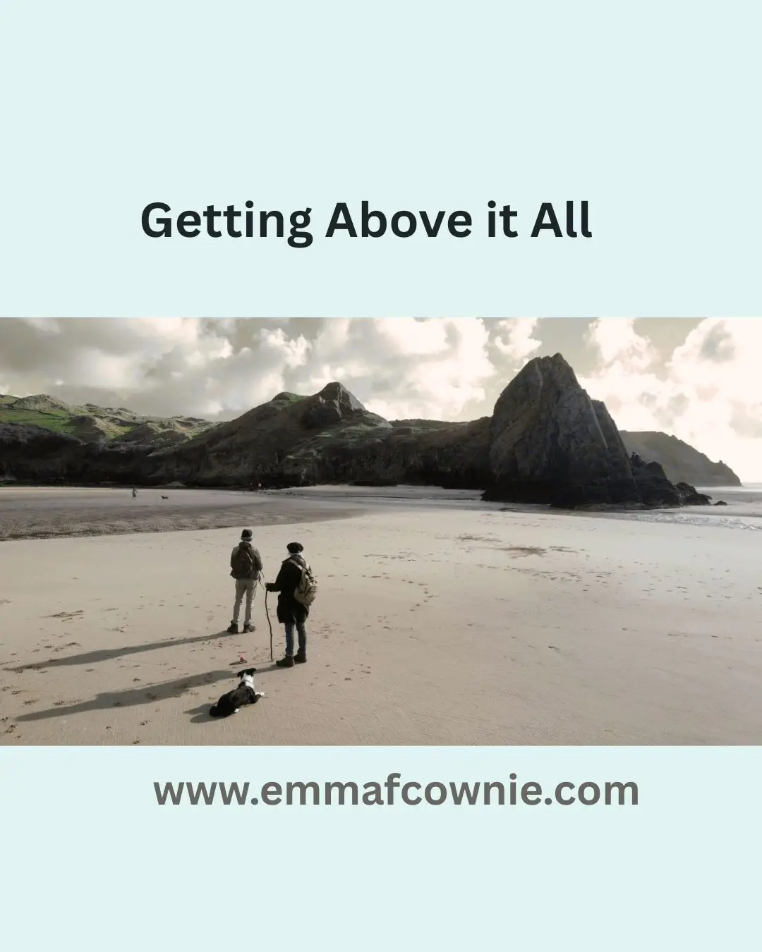
Until last week’s six days of glorious sunshine, it has rained almost constantly here. This has kept us indoors, reluctantly, and unable to enjoy the Gower Coast, or able to look for inspiration for subject matter for paintings. It has been a pretty depressing to be honest. So with last week’s sun, we spent nearly every day re-aquainting ourselves with this wonderful landscape. By we, I mean my husband, myself and our dog, Effie the collie, who absolutely loved running herself into the ground, or sand, in the beautiful beaches of Three Cliffs Bay, Tor Bay, Mewslade Bay and Rhossili Bay. My husband, Seamus, also managed to fit in the Knave, a gorgeous area between Mewslade and Port Eynon.
The Knave
I have been using my Canon camera but my husband has also been experimenting with compositions photographed by drone. We have (had – one was lost near Mewslade) two DJI Mini 2 drones which are fairly basic compared to some but which are quality enough to take drone photography good enough to paint from, which is really the whole point.
We initially used drone photography partly as a response to living in Ireland, especially the Republic of Ireland, where some beautiful landscape was sometimes inaccessible or on private land so we would have fly above it to get a good view of it.
We also found that the drone did not have to be that high off the ground to be produce interesting shots. Compositions seemed to improve from only 10 or 20 foot in the air. We rarely go too far above the landscape feature we are trying to photograph.
Coming back to Swansea and intending to repaint “old ground”, so to speak, it is important for me to keep things fresh, otherwise my work can become laboured or even slightly bored painting the same subject matter in the same way as before. So drone photography helps freshen up the process. It also helps one to re-imagine compositions in terms of landscape painting.
It has helped me see composition in a new way and it has also helped us to become more aware of how various bits of Gower landscape “fit ” together.
There are no longer isolated, and seemingly unconnected, areas anymore.
For example, the photo above shows the Worms Head area with Fall and Mewslade bays behind and the Knave beyond that. The various areas of landscape now form a more coherent whole. I will give some examples below of the images we have been capturing down in Three Cliffs Bay and Tor Bay and how they have resulted in a couple of paintings.
Three Cliffs
Droning is also good fun, flying around the countryside having a bird’s eye view of the landscape is strangely liberating and, at times, exhilarating – so says Seamus (I find it quite alarming at times, I dont have his nerves of steel).
Effie, our dog, had her first excursion down Three Cliffs which saw us walk down the rocky paths and great sandy swathes from Penmaen car park to Three Cliffs Bay.
How great it was to see those monumental stacks again, like seeing an old friend, rising impossibly from the sandy ground. Effie was pretty good with the other dogs on the beach who were trying to join in with her ball chasing fun. Fortunately she is ball-chasing obsessed and as long as she has a job to do, some work, she is fairly singleminded and behaves well.
This was a relief, as we were worried it might take some adjustment for her as her previous experience of beaches were 2-mile empty beaches in Inishowen and in West Donegal where she rarely came across other dogs. Also, Donegal people are often so polite that they leave the beach when you arrive and let you have free run of it to yourself. It is great having a beach to yourself, a real treat and luxury!
Great Tor, GowerEffie at Three Cliffs, Gower (I have the ball)
In Gower, even in early Spring, there are numerous other dogs to contend with, but most are just out having a great time like Effie, so are generally not much trouble. It has been great seeing Effie have so much fun, she loves running on the beach.
Effie on Rhossili Beach with Worms Head behind (again I have the ball and her attention!)
My husband droned Three Cliffs the week before when the tide was in. It was out when we were there.
Three Cliffs, Gower
My first drone photography inspired paintings were both of Great Tor and I am presently working on my first Three Cliffs paintings since I have returned.
I have been working on commissions in the last few weeks.
Although this is of the same Tor it looks very different. Drone photography allows you to explore different aspects of the same subject matter. It allows you to see things differently from different heights and angles. Much like a person’s face can appear different from different profiles. This keeps the creative juices flowing as it is possible to re-imagine similiar subject matter in so many more ways.
Plus all these aspects can combine with photographying at different times of the year with different light. For example as the days draw longer, it will be possible to drone on the other side of Great Tor, a side usually in dark shade at present. Longer Summer days will provide new aspects and new compositions.
The possibilties for composition are greatly increased with droning. For example, the colours in this second painting seem warmer as the drone is lower and reflects the sandy orange rather than in Great Tor #1 where the drone is higher and is reflecting the sky and the painting is more imbued with blue-tinged light. It took a while to realise how the height of the drone greatly influences colour. This is an area which I find very interesting. With a camera, light and colour is relatively more stable and predictable. With a drone so many more variables around light, colour and composition come into play.
So that is it for now. I will blog again soon and hope to blog more frequently in future.
Three Cliffs Bay never disappointed. It did not matter how many times I saw it. The sight of it always caused me to catch my breath; when I saw it from the road, from the slopes of Cefn Bryn or from Pennard Cliffs.
It is one of the things I miss about living in South Wales. I imagine it in sunshine, although I am pretty sure the Summer in Wales this years has been as poor as it has been in Ireland. It may well improve. Septembers were often best for sunshine. Just as the schools had gone back!
Here’s me posing with the painting! – Sunny Morning Haze on Three Cliffs Bay (Gower)
I used to get up early in the morning and drive down to Pennard to walk along the edge of the golf course, past the dog walkers, to see the sea and take photos. This is a new painting (see above).
Once I found an excellent parking spot opposite the corner shop in Pennard, only to find I had forgotten to put the battery in my camera. I wasn’t carrying a spare. So, I had to drive all the way back to Swansea to fetch the battery. The journey seemed to take forever (as I cursed my stupidity all the waythere and back) but when I got back the conditions were still lovely.
It was low tide and you could see the river, the Pennard Pill, at its meandering best. When you first come to Three Cliffs you assume you can easily cross the Pill in your bare feet. You can at the shoreline but it get deeper quite quickly. There are stepping stones further up stream. In boot-wearing weather, its a short walk inland to cross at the stones. My painting (see below) Two Rock, Three Cliffs is near to the stepping stones.
Here’s a footnote to Sunday’s post about waiting for gaps in the clouds. The sun was peeping over the top of the three peaks, illuminating the edges beautifully. I particularly liked the way the sea and the river, Pennard Pill, merge here. It’s not clear where saltwater and freshwater meet.
I used to like painting landscapes and cityscapes with clear blue skies. I waited for the bright sunny days of early summer to walk around, taking photos and looking for inspiration. Thus, my series of urban minimal paintingsof Swansea, made the town look a bit like a Mediterranean location!
What a joke. It rains a lot in Wales. It has rained incessantly for the past two days. Since my extended visits to Donegal, however, I have become increasing inspired by cloudscapes and the silvery light along the Atlantic coast. With my “new eyes” I have started waiting cloudy days in Wales to go out looking for inspiration. Not overcast days, but days with patches of blue sky and sunshine.
I drove down to Pennard, with the idea that I wanted to paint Pennard Pill, the river that follows into the sea at Three Cliffs Bay. The BBC forecast claimed that it would be sunshine and clouds all morning. When I looked at the Mumbles and Caswell Bay webcam, one showed sun and the other was overcast. I set off, anyway. I would go for a walk, regardless. On my way there the sun came and went. As I drove past Mumbles head, I could see it swathed in a light misty cloud. I wondered whether there would be anything to see when I got to Pennard.
Thankfully, the sun was shinning at Pennard as I made down the path that runs alongside the golf club. The tide was coming in and I could just see Great Tor in the distance, through the peaks of dunes. When got close enough for a clear view the sun promptly went in! I looked up at the sky and looked for blue patches. There were quite a few. So I carried on towards Pennard Castle, which is situated on the top the of the high dunes, further inland. I hoped the sun would reappear by the time I got to Pennard Castle. I tried to work out which way the clouds were traveling. Usually, they move from Oxwich Bay towards Three Cliffs. Today they were going the other way. The sun came out a few times on my walk. Just as I was climbing up the sandy path the castle I came out and lit everything up like a technicolor Hollywood film!
Pennard Castle
The sun promptly went in again. I stood in the ruins of the castle and waited. I thought about the fairies who had supposedly destroyed the castle with a sandstorm when the lord of the castle had refused to invite them to his wedding party. Eventually, the sun broke through and lit part of the valley below.
Pennard Pill
I watched the light move across the valley and the colours burst into life.
Pennard Pill in sunshine
I then decided to walk back towards the sea and see if I could photograph the three peaks that give the bay its name. The clouds rolled in.
Clouds over Pennard Golf Course
I would have gone home at this point, as there was a cold wind and it was almost lunchtime but I could see bright light off in the distance. It was on the far side of the Bristol channel. I could see a ship on the horizon lit by this light.
Ship on the Bristol Channel
How wide was this stretch of water? Miles. How long would it take for that shaft of sunlight to make its way over to the Gower coast? A while. So I waited. I am not very good at standing still so I walked around a bit, watching the dog walkers and small family groups vanish from the landscape.
The clumps of large mushrooms spotted about the grassy parts of the dunes, made me think of the fairies again.
I climbed dunes, trying to decide good locations for photos for when that shaft of sunshine arrived. It was definitely coming my way. A new set of walkers was arriving on the beach. They were all optimists too!
Cloudy Three Cliffs Bay
Hunger was starting to make itself known. I slouched down against a dune. Patience. Patience. What was the point of giving up now when I had waited so long? Impatience comes from wanting to be somewhere else. I needed to be here now. I thought of a line I heard Van Morrison sing at his 2015 Live 70th Birthday Concert at Cypress Avenue, Belfast “It has always been now” (52 mins into the clip). He’s a genius. He captures the joy of being truly present in the moment. Just as I was saying that to myself when the sun arrived and the technicolor lights were on!
The three peaks
That doesn’t quite capture it. Here let me show you. My view of the world.
A Gap in the Clouds (SOLD)
That’s more like it.
Now I could go home and eat lunch. Paint and listen to Van Morrison.
I managed to make it down to Rhossili Bay this week. It has been raining on and off for weeks. I have been painting in my attic studio listening to the rain thundering down and I have got quite tired of that sound. So when I was greeted by clear skies I decided, on a whim, to drive down to Rhossili to see the autumn colours.
Rhossili has a wonderful windy wildness to it. It’s unlike the rest of the Gower Peninsula. The trees all lean heavily away from sea and the prevailing westerly wind. As I drove into the village I was caught up in a sheep-jam. A herd of sheep was being moved from one field to another. They were packed into the little road and had stopped the traffic (it was three cars actually). I watched the mob of sheep as they swirled in front of my car and past me. They were Welsh Mountain sheep; only a few had horns. Their creamy fleeces were spotted with brightly coloured red and purple “smit” marks. These are marks painted by their farmers that denote ownership. One moment they were packed around me and the next they had moved on.
There was space in the church car park so I parked and put my donation in a slot in the wall. This car park is closer to Rhossili Beach. If I had wanted to walk to Worms Head itself the National Trust Car park with its facilities (loo block and shop) would have been better. From here I walked down a stepped concreted path down towards the beach. It seems strange but I have never walked on this particular path before. I don’t know why. I have always walked parallel to the beach along the cliffs paths (one on the top of the downs and one in front of the rectory). I wrote about the coastal path in several blog posts and in my book, Footnotes: An Artist’s Journey Around the Gower Coast.
Rhossili Bay (View From the Path)
So I followed the path downhill and got a different view of the Worm. The bracken had died back to a wonderful russet colour (one that I associate with wales) and the sea was a beautiful turquoise blue. The tide was out and the tidal island, the Worm (Wurm) rose up above the waves on the horizon. I looked at how the light caught the back of the Dragon and remembered how arduous walking across it was.
Over to Worms Head SOLD
The walk down to the sea was quite steep but easy. The final descent was down a ramp of gravel. The vast beach was surprisingly populated for a term-time day in the week.
Worms Head Rhossili
Of course, I could not pass up the opportunity to visit the remains of the Helvetia on Rhossili Beach. The Helvetia was a Norwegian ship bound for Canada that was wrecked in south-easterly gale on Rhossili Bay over 130 years ago on 1st November 1887. In the Instagram age, given its picturesque location, its not surprising that it has been photographed and shared countless times.
The Wreck Of The Helvetia, Rhossili, Gower SOLD
I walk across the beach to bottom of the vast 200-foot cliffs, looking at the colours and light. There are seagulls scattered across the beach and when I turn back I can see the Rhossili Downs and the Od Rectory reflected in the outgoing tide.
Rhossili Reflection
On the far edge of the beach, I was surprised to discover the remains of another shipwreck in the sand. A bit of online research and I discover that this is Vennerne, apparently, it is known locally as the Vernani, and it was dashed to pieces under the Rhossili cliffs in 1894.
Another Wreck on Rhossili Bay
There is quite a strong breeze. When the clouds roll in it starts to feel cold. The clouds create a softer light. The grays and purples dominate. I am glad I have my woolly scarf on and start to make my way back to my car. The path hill is pretty steep and the climb warms me up.
Cloudy Worms Head
The next day, I am tired from walking across the sand but it doesn’t matter as its raining again.
I am delighted to announce the publication of my latest book “Footnotes, An Artist’s Journey Around the Gower Coast” which is based on my walks and blogs of 2018.
My book on Medieval History
Many years ago I turned my Ph.D. on Medieval History into an academic book. That was jammed packed with footnotes and had almost no pictures (except for the front cover) but it did have some maps hand-drawn by me. I felt quite odd when that was published. I suffered terribly from imposture syndrome, then as now, and it almost felt like someone else had written it when I looked at the words on the book. Don’t get me wrong, I had written every last bit of it, the text, the footnotes, the index but it didn’t feel like it had much of “me” in it, except maybe in my dedications. I think my parents and Seamas, who was my boyfriend back then, appreciated being thanked for their support.
This book is quite different. Ironically, despite the name, the only “footnote” in it is the title. It’s a bit of a joke, I guess! This book has a lot more of “me” in it. Yes, there still some local history and stories about Gower, but its mostly about the walk and dealing with my anxieties.
I had spent weeks editing it and sort of ran out of steam when I reached the part where I had to upload it to the Kindle website. Thankfully, my husband, Seamas, came to rescue and was midwife to the whole venture. He did the final editing and proof-reading and it uploaded to the website. Which sort of sums up our relationship, he’s always there to help me over the “humps”, not just as a cheerleader but as technical support and he also provides so much inspiration. So thank you, Seamas.
I also want to thank my parents who have always supported whatever I have done. My mother is a fervent “liker” on Facebook. Their house has many of my paintings hanging on their walls, which is a compliment in its self as superfluous objects are either returned to the donor or end up in the local Charity shops. I also want to thank supporters on Instagram who tell me that they have downloaded from Kindle or bought the physical book.
I hope that people enjoy it as much for the walks and stories about Gower, as for my paintings!
Life as an artist is a very insecure one, you never know where your next sale is going to come from. You can plan and prepare for exhibitions and work on your social media, but it’s impossible to know how many people will see and respond to them.
That’s why it’s really important to take stock, and celebrate the success you have achieved and thank all the supporters and collectors who have helped you over the year; whether it’s a positive comment on a blog post, a “like” on facebook or an instagram post, the sale of a mounted print, a greeting card, a commission or the sale of a painting. They all help keep me going! You may not believe it, but artists have fragile egos (this one has, anyway) and they need encouragement, especially if they venture off into new directions, as I so often do.
Here’s a review of some of my sales of paintings and mounted prints from the first part of 2018. Many were sold via the online gallery Artfinderbut increasing I have sold direct via my own website. Each painting is a unique work. I don’t paint generic people or landscapes. They are all real people and locations. In April’s collection you can see many of the Gower painting I did as part of the Gower Coastal Path Project. Bloggers’ comments and encouragement really helped me complete that project. Thank you, all.
January Sales 2018February Sales 2018
March Sales 2018
April Sales 2018
My next post will complete the review. Thank you to the brilliant people who have supported me and bought my work this year, I couldn’t do it without you!
I did not walk the length of Worms Head at the same time as my other Gower coastal Walks. This was because you cannot walk its full length between the 1st March and the 31st of August – as the last part of the Worm, the Outer Head, is closed in order to protect nesting seabirds.
So I waited until late October for a sunny morning and a low tide to set off on my adventure. It was certainly an adventure as I travelled alone and there was plenty of scope for “mild peril” and twisted ankles and, at one point, there was definitely outright fear. More of that later.
The drive down to Rhossili was beautiful. Autumn sunshine lit the russet trees and the long shadows stretched across the road. The forecast was for a fine sunny day but by the time I arrived at Rhossili, it had clouded over. I got of my car and wished I had brought a woolly hat instead of my sunhat jammed at the bottom of my bag underneath my sandwiches, banana, and the compulsory chocolate biscuits. The biscuits had been lurking down there since my last walk several months ago, but as they were individually wrapped I decided they’d still be very edible. The walk down the National Trust car park to the coast guard station at the end of the headland took longer than I expect it.
Worms Head (from Rhossili Downs)
I think this is because I am usually so mesmerized by the sight of the “Worm” that I don’t really pay attention to how far I am walking. The Worm (“Wurm”) means dragon, and it was given this name by the Vikings who regularly sailed the Bristol Channel over a thousand years ago.
Worms Head
It is a long tidal island that undulates westward like a sea beast. The shape of it changes depending on which angle you approach it. Sometimes it seems coiled, other times in snakes from side to side.
Towards Worms Head (SOLD)
I think I look up the tide times for Gower more often than most people, except for surfers. Every time I go to the coast I like to know if it going to be a low or high tide, depending on whether I want to photograph it or swim in it. If you want to visit Worms Head, a low tide is essential because the causeway over to the islands is only safe to cross 2 and a half hours either side of low tide.
I know that to be caught out ensures an extra long stay on the island (as happened to Dylan Thomas once), because swimming across the short stretch of water is very dangerous and I can remember a man who died attempting in it a few years ago.
Coast Watch Station
Fortunately, if you have forgotten to look up the tide timetable, it is clearly displayed outside the coast watch station and on the path down to the causeway. That is pretty much, the point of the coast watch station, as I have mentioned before. To watch out for fishermen and people who might get trapped by the rising tide.
Map of Worms Head (Note: High Tide)
When you arrive at the coast guard station at the end of the headland you will see the path in front of you dropping down to the causeway. Now, don’t believe any guide that tells you that this is “easy” as I have seen elsewhere online. It is not. Parts of the island are easy. Most of it and the causeway, in particular, is very very, rocky.
It resembles an assault course rather than a “walk”. There are slightly easier routes than others but they are all energetic to some degree and require a fair bit of climbing, jumping, or in my case sliding down rock faces on my backside. I was better prepared than the time I walked across it on whim one summer with my sister and my 7-year niece. That time I was wearing sandals. This time I was wearing sturdy walking boots. I regretted, however, wearing my drainpipe jeans. There were many times I could not tell if I was stiff with age or stiff from my sartorial stupidity. Nevertheless, I soldiered on.
Looking across the so-called causeway, I could not see an easy route. I could not even see an obvious way down to the causeway. Hence I ended up sliding down the rocks, hoping that I didn’t twist my ankle. That was a recurring thought throughout the morning. The trick is to stay focus 100% on where you are putting your feet, if you need to look up, then stopping to do so. Walking along and looking around at the same time was out of the question. I decided to follow a mother and her two young sons, hoping that they would find a sensible route across the rocks.
The Causeway
I think they must have been part- mountain goat because they zoomed across the rocks, sure-footed and totally fearless, happily chatting away to each other. I struggled to keep up. I started off feeling a bit chilly but by the time I reach the island 20-25 minutes later I was hot and thinking of taking off my jacket. Again you will read in some guides that it takes “about 15 minutes to cross the jagged and slippery rocks” but I found it took longer. Perhaps I stopped and looked at the view too often.
Worms Head OS Map (Low Tide)
Arriving at Inner Head, I was greeted by more warning signs, a tide timetable and a bell to ring to gain attention, if you are trapped by the incoming tide. Here, I had a choice of paths. Either to climb the back of the Worm and walk along its spine, or to take the easier lower path to the west. I took the easy path. It was my favourite path of the day. I could trundle along it, looking at the view, without worrying that I was going to trip up!
I quickly reached Low Neck which bends round to Devil’s Bridge.
Devil’s Bridge, Worms Head, Rhossili
Here, I could see I had to cross another assault course of massive fractured rocks to get to Devil’s Bridge. This is all that remains of a collapsed sea cave. It too will collapse one day, dividing the Middle Head in two. I decided instead follow a long climb over the tooth-like slabs down to the rocky “beach” part of Worms Head, to take some photographs of the Worm’s reflection in the still seawater.
I then had the joy of trying to make it back onto the path. It was a long scramble/climb and at several points I wondered if it was possible but I did eventually make it without injury.
So I finally reached the Outer Head. I was greeted by a warning sign telling people not to visit during nesting season. There were yet more rocks to clamber over before I finally reached the dragon’s head.
Here the path got steep. The grass became much thinner and the rocks were worn smooth with years of walkers’ boots on them. I scrambled up where I thought the path would flatten out a bit. Then I realise that the final part of the “walk” involved a climb up an almost sheer cliff. The mother and two sons I followed across the causeway earlier, were already fearlessly climbing up the rock face. I noted that the mother wasn’t totally cavalier about letting her boys follow her as she told them in no uncertain terms that they must listen to her instructions and have “three points of contact with the ground at all time”. I bore this advice in mind, for the rest of my trip on the Worm.
I watched, with my heart in my mouth, as they zoomed up the rock face like sure-footed monkeys. I don’t like heights at the best of times, and I knew this was beyond me. I could not face trying to climb up there, in case I freaked out half-way up. More eager climbers made their way past me. The prospect of an audience decided it for me. I turned around and started my return journey, muttering to myself “I know my limits”.
Trust me, it’s a long way down.
As I walked back I ponder my long distinguish career as a scaredly-cat. As a child I freaked out in some underground caves, Cheddar or Wooky Hole, I’m not sure which, discovered to my surprise that I was decidedly claustrophobic. As an adult, on a school trip to Disneyland Paris, I was persuaded to go on Space Mountain. I only survived the experience by keeping my eyes tightly closed for the whole trip. Apparently a lot of it happens in the dark but never once opened my eyes to find out. More recently I climbed almost to the top of Mount Snowdon, in North Wales, only to decide I could not make it to the summit. The path was very narrow and there were hoards of people. I was convinced that I’d get pushed off the path to my death. So I sat down with my eyes closed (again) and waited for my brave husband to make the journey to the top and back on his own. Yet, I enjoy watching films about Mountaineers, like “Touching the Void” and “Everest”, go figure!
I stopped and ate some biscuits and sandwiches, drank a lot of water and admired the view along the Worms’ back in both directions, towards its head and in the other direction towards Rhossili Bay and Gower. This time I walked over Devils Bridge and started the scramble over more rocks to Inner Head.
Seal, off Worms Head
I paused as I see another walker looking out to sea and I realised there is little head looking up at us out of the water. It was a seal. I could see his whiskers. He reminded me of a dog. I don’t know if he’s a common or grey seal, as they are very hard to tell apart, especially when they are in the water. He disappeared and then popped up again, before finally vanishing for good.
Keeping an eye on time time, and making sure I have more than enough time to cross the causeway, I made my way back to the south-eastern end of the tidal island. I notice a group of people are watching something on the stony beach below the cliffs. More seals! I settled down on the grass to watch. To start with, I could not get a good view, as there were so many people. Eventually after a lot of loud “Oh” and “Ahhhh-ing” (I don’t think the seals liked this as they kept looking up), the people moved on and I had the seals all to myself. I love this.
I watched them, very happily in silence, for quite a while and make some film clips to show my husband later. I am guessing they are the smaller, common seals, but I could be wrong.
I am very tired now and as I start my walk across the causeway, I see people still crossing over from Rhossili. I look at my watch. They still have two hours to cross and back it back again. I start off with confidence, only to have to retrace my steps because the drop from the rocks I am on is too high.
As I am struggling down from a lower crag I am surprised by a strange animal-like snorting sound. It sounded a bit like an alarmed dog. I looked around at what I thought were barren rocks, only to realise that I have a pair of anxious eyes looking at me. It an adolescent seal, stranded all on his own in the rocks. I quickly retreated. I didn’t want to frighten him any more than I already had.
Hidden amongst the rocks
He must have been stuck here ever since the tide went out three hours ago. I briefly worried about the other walkers finding him, as some of them have dogs with them, but I decided that if I keep quiet, maybe no one else will discover him. I know that the usual advice with wild animals is to retreat and leave them alone. After all, he is so well camouflaged, I would not have seen him if he had stayed silent. In fact I did not seen him when I came across earlier.
Spot the seal
Thankfully, crossing the causeway was slightly easier on the return journey. I think the tide was further out so I could walk alone the pebbly edge, although the climb back up the to main path was brutal.
Worms Head, Rhossili, Gower
I was relieved to be back on the main land, but there is some thing very special about being on an island, even if it’s only a tidal island like Worms Head. I think its because you are surrounded by the sea and that is an exhilarating feeling. The Gower is a bit like a tricorn hat, with a tidal island at each “corner”. This journey around the Gower coastal path started with Mumbles, with its lighthouse built on a tidal island; Burry Holmes is a tiny full stop marking the north end of Llangennith Beach but Worms Head is a comma. Not so much a footnote, but a wiggly tail making off towards the Celtic Sea. The open sea and more adventure.
Map of Gower Peninsula
To see landscape paintings available to buy please clickhere
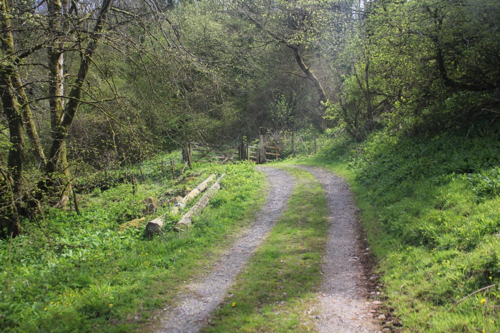
This is the last stretch of my walk around the Gower coastal path. I started this particular walk at Llanmadoc, which is three miles along a generally flat, but not always obvious, grassy and often muddy path.
Path to Llanrhidian
As I approach Llanrhidian, the atmosphere changes from rural scruffiness to urban tidiness; where the grass is kept short by electric mowers rather than by sheep. I pass along a path with a wooden fence along the one side. This seemed a bit of a shock after all the open spaces.
Llanridian itself is picturesque. It feels very much like a village that has been here for hundreds of years.
There is a unique church dedicated to Saints Illtyd and Rhydian in the village. The village that grew up around the 6th century church was founded by St. Rhidian, hence it’s name – “Llan” (meaning religious enclosure) “Rhydian” (the founder’s name). Rhydian dedicated the church to St Illtyd, another Celtic saint who was believed to have lived here. You may remember St Illtyd, he was the Celtic founder of the sea-side church at Oxwich and has many churches dedicated to him across Gower and South Wales.
Llanridian Church
The church that exists in the village today was built in 14th century. It has a holy well and something known locally as a “leper stone”, as well as a 11th century wheeled cross shaft near it.
Remains of Wheeled Cross
The so-called leper stone is a probably the remains of a door lintel, or maybe even or tombstone lid and dates from the 9th century. I probably did not have any connection with lepers was, other than in the imaginations of the Victorian who discovered it near the west tower doorway it in 1865 and subsequently had it moved to the church porch.
Leper Stone, Llanridian Church
According to tradition, when St. Illtyd lived on this spot as hermit, the sea often flooded the site, destroying the saint’s cell and chapel. Several times he built an embankment of mud and stones to protect himself, but in vain. He asked an angel to help him and the sea obeyed the saint, subsiding. He then struck his crozier on the dry shore and a holy well gushed forth, instantaneously. This well still flows today and is said to have curative properties. It is located in a private garden near the Church. It also known as the “milk well” or “butter well” , by locals, as in 1185 milk and butterfat was seen flowing in it instead of water, according to the Annals of Margam. This miraculous event was said to have lasted for at least three hours.
Here I joined the coastal road. The atmosphere changes back to the marsh wildness with the mild peril of possible flooding.
Flooding Warning Sign, Llanridian Marsh
It the only true coastal road on Gower. It skirts along the side of the wide marsh from Llanridian to Crofty.
Crofty in the distance
I could see Crofty off in the distance, but I wasn’t going to be fooled into thinking it was close because I could see it. I can see Port Talbot from Swansea Beach, it’s still 13 miles away an in no sense “close”. Same goes for Crofty. Turns out its three miles from Llanridian, which was possibly further than I realised when I decided to trudge it’s length. It figured, its flat. It’ll be easy!
The Marsh, North Gower
Well it was flat but it was also a very long road. It was a very empty road. I passed only three cars/vans and one cyclist in the two hours I was walking on it. The cyclist nearly ran into me when I walked into his path.
Lone Cyclist
I was my fault as I didn’t look over my shoulder when I heard a noise behind me, but I was very tired at this point.
Pergyl! Danger!
I stopped several times to take photos and enjoyed watching the light change as the clouds moved above my head. It may seem to strange to say, that this was probably my favourite part of all my Gower walks. Strange, it was very beautiful but I decided that I wasn’t going to paint this landscape. It’s too flat for my painting tastes. Maybe that’s why I enjoyed it all the more. It’s even hard to capture its essence in a photograph.
Llanridian Marsh
I haven’t attempted to paint it but I loved the sense of wilderness here that it’s present anywhere else along the Gower coastline.
Marsh Road, North Gower
At one point there must have been a lull in the cold wind and a silence fell and then I heard a rustling in the trees and bushes behind me and then a moment later, I felt its force. It was rather eerie to feel the force of nature.
Llanridian Marsh
Off in the distance was an aeroplane circling round and round the estuary off over Burry Port where Amelia Earhart landed all those years ago. Amelia was the first woman to fly (or be flown) across the Atlantic Ocean in 1928, when she flew across the Atlantic, this time as the pilot and on her own, four years later she landed in Northern Ireland.
I finally reached the village of Crofty.
Crofty, North Gower
It had a distinctly urban feel to it, not like Llanrhidian. By now had drunk both of my 500l bottles of water. I had very sore and stiff legs but I forced myself the trudge with purpose because I knew that I had about 20 minutes to make it to “New Road”, the main road, and catch the bus back home.
As I cut through the streets of Crofty, the roads all seemed unreasonably long but I eventually found the main road and I started walking in the direction of Llanridian. A bus shelter stop appeared.
A Miracle!
It seemed like a miracle to my tired legs. A bus appeared – a number 116 it its distination read “Llanridian” and not Swansea. I was so excited to see a bus with the number I was looking for I hailed it. The rotund bus driver looked at me slowly. No, this wasn’t the bus to Swansea. The stop for that was on the other side of the road. I looked across the road. So he pulled off and I crossed to the other side of the road, although there was no bus shelter or bus sign there. So I waited and waited. After about ten minutes, a school bus pulled up and some street-wise-looking teenagers got off. None of them looked like they were rushing home to do their homework.
Eventually, after I started wondering if Crofty had a taxi service or I’d have to stumble another two miles up the road to Penclawdd, a number 116 bus appeared. It said Swansea on the front. The bus indicated that it was stopping before I put out my hand to hail it. That was handy, I thought. I stepped onto the bus to show the driver my return ticket and as I glanced into his sour face, I realised that he was the same bus driver I spoke to twenty minutes earlier. Not a flicker of recognition passed over his face. I walked to the my seat, glad to sit down after 4 hours walking, chuckling to myself.
I had covered 6 miles and my feet were throbbing. It was a funny end to the walk. I had not seen the sea or river all day but I had smelt the salt and felt the wind. I had hardly seen a soul. It certainly the wildest and flattest part of the coastal path. I was glad it was over and my challenge was finally complete, Well, almost.
Post Script
This isn’t quite my last Gower coastal walk. I haven’t walked out along the causeway to Worms Head. However, you cannot climb to the top of the outer headland between the 1st March and the 31st of August – as it is closed in order to protect the many breeding sea birds, so I am waiting until September to do this final walk.
Below is a short video clip of the marshes near Llanmadoc. I’m afraid its rather poor, turn off the sound, but it’ll give you a good sense of of how vast and flat the marshes are.