Posted on 20 Comments

Gower Coastal Walks – Llanmadoc to Crofty

Part 2: Llanridian to Crofty

This is the last stretch of my walk around the Gower coastal path. I started this particular walk at Llanmadoc, which is three miles along a generally flat, but not always obvious, grassy and often muddy path.

Path to Llanrhidian
Path to Llanrhidian

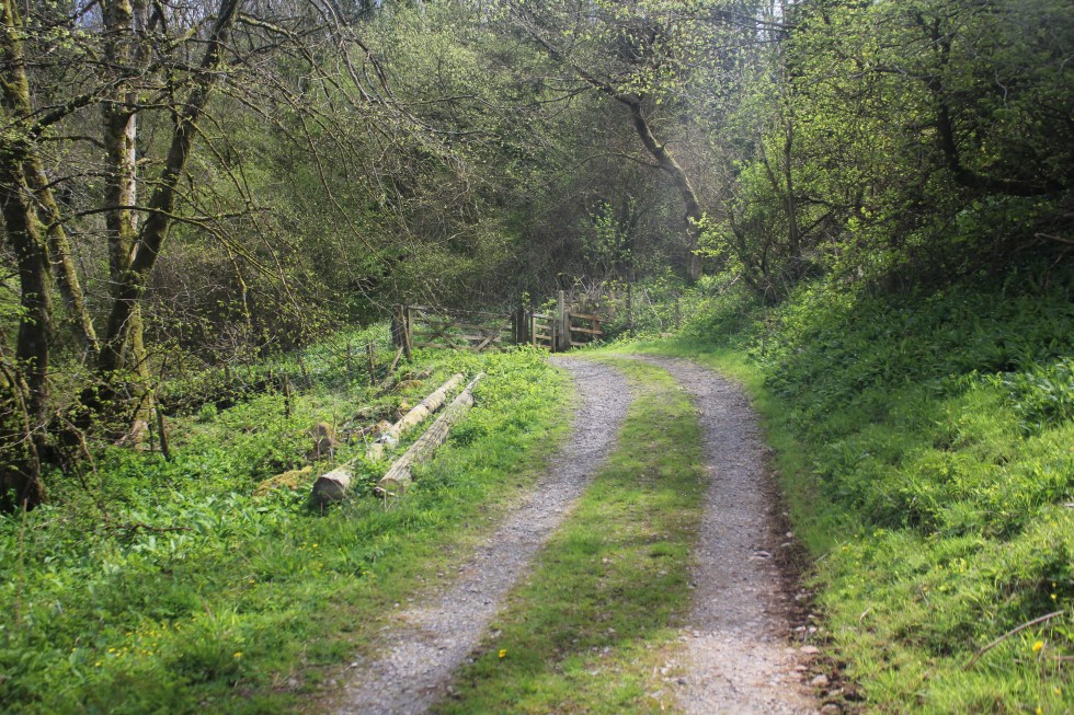
As I approach Llanrhidian, the atmosphere changes from rural scruffiness to urban tidiness; where the grass is kept short by electric mowers rather than by sheep. I pass along a path with a wooden fence along the one side. This seemed a bit of a shock after all the open spaces.

Llanridian itself is picturesque. It feels very much like a village that has been here for hundreds of years.

There is a unique church dedicated to Saints Illtyd and Rhydian in the village.  The village that grew up around the 6th century church was founded by St. Rhidian, hence it’s name – “Llan” (meaning religious enclosure) “Rhydian” (the founder’s name). Rhydian dedicated the church to St Illtyd, another Celtic saint who was believed to have lived here. You may remember St Illtyd, he was the Celtic founder of the sea-side church at Oxwich and has many churches dedicated to him across Gower and South Wales.

Llanridian Church
Llanridian Church

The church that exists in the village today was built in 14th century. It has a holy well and something known locally as a “leper stone”, as well as a 11th century wheeled cross shaft near it.

Remains of Wheeled Cross

The so-called leper stone is a probably the remains of a door lintel, or maybe even or tombstone lid and dates from the 9th century. I probably did not have any connection with lepers was, other than in the imaginations of the Victorian who discovered it near the west tower doorway  it in 1865 and subsequently had it moved to the church porch.

Leper Stone, Llanridian Church

According to tradition, when St. Illtyd lived on this spot as hermit, the sea often flooded the site, destroying the saint’s cell and chapel. Several times he built an embankment of mud and stones to protect himself, but in vain. He asked an angel to help him and the sea obeyed the saint, subsiding. He then struck his crozier on the dry shore and a holy well gushed forth, instantaneously. This well still flows today and is said to have curative properties. It is located in a private garden near the Church. It also known as the “milk well” or “butter well” , by locals, as in 1185 milk and butterfat was seen flowing in it instead of water, according to the Annals of Margam. This miraculous event was said to have lasted for at least three hours.

Here I joined the coastal road. The atmosphere changes back to the marsh wildness with the mild peril of possible flooding.

Llanridian Marsh
Flooding Warning Sign, Llanridian Marsh

It the only true coastal road on Gower. It skirts along the side of the wide marsh from Llanridian to Crofty.

Gower Marsh Road
Crofty in the distance

I could see Crofty off in the distance, but I wasn’t going to be fooled into thinking it was close because I could see it. I can see Port Talbot from Swansea Beach, it’s still 13 miles away an in no sense “close”. Same goes for Crofty. Turns out its three miles from Llanridian, which was possibly further than I realised when I decided to trudge it’s length. It figured, its flat. It’ll be easy!

North Gower Marshland
The Marsh, North Gower

Well it was flat but it was also a very long road. It was a very empty road. I passed only three cars/vans and one cyclist in the two hours I was walking on it. The cyclist nearly ran into me when I walked into his path.

Marsh Road, Gower Peninsula
Lone Cyclist

I was my fault as I didn’t look over my shoulder when I heard a noise behind me, but I was very tired at this point.

Danger sign on North Gower Marsh
Pergyl! Danger!

I stopped several times to take photos and enjoyed watching the light change as the clouds moved above my head. It may seem to strange to say, that this was probably my favourite part of all my Gower walks. Strange, it was very beautiful but I decided that I wasn’t going to paint this landscape. It’s too flat for my painting tastes. Maybe that’s why I enjoyed it all the more. It’s even hard to capture its essence in a photograph.

North Gower Marsh
Llanridian Marsh

I haven’t attempted to paint it but I loved the sense of wilderness here that it’s present anywhere else along the Gower coastline.

Gower Peninsula
Marsh Road, North Gower

At one point there must have been a lull in the cold wind and a silence fell and then I heard a rustling in the trees and bushes behind me and then a moment later, I felt its force. It was rather eerie to feel the force of nature.

North, Gower, Llanridian Marsh
Llanridian Marsh

Off in the distance was an aeroplane circling round and round the estuary off over Burry Port where Amelia Earhart landed all those years ago.  Amelia was the first woman to fly (or be flown) across the Atlantic Ocean in 1928, when she flew across the Atlantic, this time as the pilot and on her own, four years later she landed in Northern Ireland.

I finally reached the village of Crofty.

North Gower, Marsh Road
Crofty, North Gower

It had a distinctly urban feel to it, not like Llanrhidian. By now had drunk both of my 500l bottles of water. I had very sore and stiff legs but I forced myself the trudge with purpose because I knew that I had about 20 minutes to make it to “New Road”, the main road, and catch the bus back home.

As I cut through the streets of Crofty, the roads all seemed unreasonably long but I eventually found the main road and I started walking in the direction of Llanridian. A bus shelter stop appeared.

Bus stop at Crofty
A Miracle!

It seemed like a miracle to my tired legs. A bus appeared – a number 116 it its distination read “Llanridian” and not Swansea. I was so excited to see a bus with the number I was looking for I hailed it. The rotund bus driver looked at me slowly. No, this wasn’t the bus to Swansea. The stop for that was on the other side of the road. I looked across the road. So he pulled off and I crossed to the other side of the road, although there was no bus shelter or bus sign there. So I waited and waited. After about ten minutes, a school bus pulled up and some street-wise-looking teenagers got off. None of them looked like they were rushing home to do their homework.

Eventually, after I started wondering if Crofty had a taxi service or I’d have to stumble another two miles up the road to Penclawdd, a number 116 bus appeared. It said Swansea on the front. The bus indicated that it was stopping before I put out my hand to hail it. That was handy, I thought. I stepped onto the bus to show the driver my return ticket and as I glanced into his sour face, I realised that he was the same bus driver I spoke to twenty minutes earlier. Not a flicker of recognition passed over his face. I walked to the my seat, glad to sit down after 4 hours walking, chuckling to myself.

I had covered 6 miles and my feet were throbbing. It was a funny end to the walk. I had not seen the sea or river all day but I had smelt the salt and felt the wind. I had hardly seen a soul. It certainly the wildest and flattest part of the coastal path. I was glad it was over and my challenge was finally complete, Well, almost.

Post Script

This isn’t quite my last Gower coastal walk. I haven’t walked out along the causeway to Worms Head. However, you cannot climb to the top of the outer headland between the 1st March and the 31st of August – as it is closed in order to protect the many breeding sea birds, so I am waiting until September to do this final walk.


Below is a short video clip of the marshes near Llanmadoc. I’m afraid its rather poor, turn off the sound, but it’ll give you a good sense of of how vast and flat the marshes are.

Posted on 14 Comments

Gower Coastal Walk: Blue Pool Bay

The Gower boasts two gems that most visitors never see.  I have lived in Swansea for 19 years and this was the first time that I saw them. These are Three Chimneys, a sea arch that used to be two arches,  and a massive rock pool known as Blue Pool. These two marvels are not easy to find. They are tucked to the north of Broughton Bay. They are located on Blue Pool Bay, in the northern-eastern corner of the peninsula. You cannot drive to this bay but have to walk.

I ended up doing the walk twice in one week. The first time,  it was sunny when we set off from Swansea. We had sun hats too. The car park next to Broughton Caravan Park, where we start the walk, was free. This is a rare thing on Gower. We are forever pawing through our change to find enough pound coins for the ticket machines. They never seem to take £5 notes or credit cards. This car park sits next to a large static caravan park. Many of the people who own caravans here live close by in Swansea. It has a friendly family feel to it, it has palm trees and little gardens.

Almost as soon as we got out the car it clouded over. We walked through the large static caravans and along a path covered in wooden slats, which was wonderfully easy to walk along.

As the path snaked around the hill and entered dunes the clouds came lower. The further along the path we progress the mistier it got.

IMG_3956.JPG
Not a lot to see!

Eventually, we see can Three Chimneys from the top of the dunes. It was clearly two arches, once upon a time, but one has collapsed.

IMG_4024-001.JPG
Three Chimneys

We walk on until we reach Burry Holms, another of Gower’s three tidal islands (the others are Mumbles and Worms Head). Just over nine thousand years ago, it was not an island but a hill nine miles from the sea.  There is a lot of archaeology here, including a Mesolithic site, a Bronze Age burial mound, an Iron Age fort with a deep defensive ditch and bank, and the remains of a monastic settlement founded in the 11th century and abandoned during the 17th century. There are also a number of post-Medieval quarries and limekilns are along the cliff edges.

IMG_3962.JPG
Burry Holms in the Mist

No one knows why it is called Burry Holms. There is a port across the Loughor estuary called Burry Port, but Burry Port in Welsh is Porth Tywyn which means White House Port (I think). I’m not sure what the Burry means in this case, but Anglo-Saxon a “burh” usually means a fortified town. Many of them date back to 9th century when raids and invasions by Vikings prompted Alfred the Great to develop a network of burhs and roads to use against them. I know that the island’s name of “Holm” comes from the Old Norse meaning “island in an estuary” (think of Flat Holm and Steep Holm further out in the Bristol Channel). This also reflects the Norse domination of the waterways in this area, which lasted up until the 11th century. After all Worms Head (Wurm – meaning dragon) is also a Norse name.

The ruins of  the 14th-century chapel dedicated to Saint Cenydd can also be seen at the eastern end of the island. St Cenydd, sometimes Anglicized as Saint Kenneth, was a Christian hermit who founded a church at Llangennith, to the south of Burry Holms. The story of St Cenydd’s early life is wonderfully fantastical and not to be taken at face value. Cenydd was supposedly a Breton Prince, born of from an incestuous relationship, at Loughor (this is a modern day suburb of Swansea).

Baby Cenydd was born with some sort of disability, and on account of this he was put in a willow basket/cradle and launched into the River Loughor, like a Celtic Moses. This willow basket eventually washed up on Worms Head and the local seagulls and angels looked after the baby and somehow managed to bring him up as a Christian. Interestingly, St David, Wales’s patron saint, cured Cenydd of his disability in later life. Was St Cenydd at all grateful? Not a bit of it. He wasn’t happy about this at all and actually prayed for his disability to be restored!

IMG_3982-001
What is going on here?

So we sat looking out at Burry Holms eating biscuits. We watched a seagull swoop and circle the cliffs again and again. He did this at least ten times. I was trying to decide if he’s was scaring off some jackdaws or was jealous of a courting couple.

IMG_3977-001
Love is in the air!

Another pair of gulls sit cosily together on a ledge. Then, suddenly the male mounted the female and a quick bit of mating takes place. The male then abruptly flies off. “To the pub!” my husband drily observes.

On the way back I try and find the rock pool, Blue Pool. We seem to have missed it on our way to Burry Holms. I clamber down a hill and finally spot it nestling in the rocks below.

IMG_4033.JPG
Blue Pool

I can see people in wetsuits leaping into the famed rock pool. I am very jealous. Local legend says it is bottomless. The swimmers seem to be very confident they won’t hit the bottom as they leap into it.

IMG_4057-001
Jumping in!

Two women climb to the top of the highest lip of the pool and leap into the water. It looks great fun. I read later that it is very deep. Anything from four to eight metres deep, depending on tidal and weather conditions. As much as I enjoyed watching the fun and games I was a little frustrated.

I’ll show you why. This is what I was hoping for compared with what we saw.

So I went back to get another look at Blue Pool and in sunshine this time. I returned early one morning later in the week alone. I set off at 8.15 am hoping to catch the low tide because I have the idea that you can walk around the headlands and walk to Blue Pool Bay. This time, it is cloudy in Swansea but brightens up as I reach Llangennith which is just down the road from Broughton Bay.

So I walk onto the beach full of confidence that I will be able to walk to Blue Pool Bay along the shore. I couldn’t.

IMG_4651.JPG
View Across Broughton Bay

I don’t know if it wasn’t a particularly low tide, I have discovered since that not all low tide are the same. Some are lower than others. Just as some high tides are higher than others.  So I had to retrace my steps and I clambered up the rocks as a short cut to the coastal path. I eventually made my way along to Blue Pool Bay – I found a different path that led down the dunes and some very steep rocks.

IMG_5110.jpg
Three Chimneys on a sunny day
Three Chimneys Blue Pool Bay.JPG
Three Chimneys, Blue Pool Bay


I kept my rucksack with me, so that if I fell, I’d have my phone with me, or at the very least water and biscuits! I did have the over-dramatic thought that if I fell, no one would find me for hours/days. I chickened out of climbing all the way down to the sandy beach as the tide has just turned. I knew the tide came all the way in, leaving no beach at all.  I wasn’t sure how quickly the water would come in.

Blue Pool.jpg
Blue Pool Close up.

I climbed back up to the coastal path OK. I then carried on to Burry Holmes and the vast three-mile expanse of Rhossili Bay.

IMG_4920-002
Burry Holms

I walked along the beach towards Worms Head. I ate my banana and put the skin back into my bag. I had seen enough rubbish on the foreshore to depress me. I watched the little wadding birds, sanderlings, I think running along the surf on their delicate long legs.

I retrace my step along the path through the dunes and I enjoy the silence which was broken only by the song of a skylark, one of my favourite sounds. I pass the caravan site and carry on along the sweep of Broughton Bay.

IMG_5162

I saw the white tails of rabbit disappering into the undergrowth in a fields filled with sheep and their lambs. I then come across another caravan park. This one is called Whiteford Bay Caravan Park. It seems an unfriendly place. There are lots of warning signs and no trees. Broughton Bay Caravan Park seems much more relaxed, with its palm trees and little gardens and free car park.

IMG_5181

IMG_5172

I pass a group of senior hikers, including a chap who must be in his 80s. There’s a role model, I think. The path climbs up a sandy path up to Hills Tor.

IMG_5197.JPG
The View Across the Estuary

I sat down on a sandy ledge to admire the expansive view towards Whiteford Point and try and make out the rusty iron Victorian lighthouse. I can just about see it. You can’t see it in the photos. It is very breezy up here.

IMG_5191.JPG
View Towards Whitford Point

I ate two chocolate biscuits. They are delicious but I have drunk most of my water with only a couple of mouthfuls left. So because I know I have so little water left, I start obsessing about water on my walk back to the car. I cross a little stream that runs from Moorlake into Broughton Bay and consider trying to take a mouthful of it. It is quite marshy here behind the burrows. The sea is out of sight. I decide that in future I will carry two bottles of water with me.

There are Two boys are playing on the tops of the dunes. They are school-aged- why aren’t they in school, I think to myself. Once a teacher, eh? I say nothing and pass on.

IMG_5264.JPG

By the time I reach Broughton farm it has clouded over. My calfs are now aching from so much walking on sand. They carry on aching later on in bed. I’m not surprised when I work out that I walked 6 and a half miles, and a lot of that was on sand.

Next walk is Whiteford Point for a close up view of that iron lighthouse.

Painting of Three Chimneys Arch, Gower
Three Chimneys Arch, Gower
Posted on 22 Comments

Gower Coastal Walk: Rhossili Bay

Do believe the hype. In 2014, Rhossili Bay was voted the UK’s number one beach, by TripAdvisor users, it also ranked third best in Europe, and 9th best in the world. They are not wrong. The bay is spectacular. the wide flat beach curves along for 3 miles (5 km) and is backed with sand dunes along the northern half. It is quite vast.

IMG_4206.JPG
Rhossili Bay

How I have missed Gower and walking over the past weeks!  I have been stuck in doors invigilating exams for one of the local universities, longing for the sea breezes and the sort-of-quiet of outside. The Gower is actually quite noisy with the sound of surf, sheep and birdsong, but they are all nice sounds.

The fresh air is a tonic. There is plenty of it at Rhossili. One thing you notice on the long narrow road to the tiny village is that there are only a few wind-blasted trees, permanently bent westwards. At Rhossili, itself there are none. It is an isolated place on the far tip of the Gower peninsula. It has two tidal islands at either end of the bay, Worms Head to the south and Burry Holms to the north.

IMG_2513.aJPG
Rhossili Sunset

In the days before cars and buses, it must have felt a lot like the edge of the known world here. Celtic monks, presumably drawn by its isolation and wilderness,  came here in the 6th century. They founded a church here,  dedicated to St. Sulien or St. Sili, that was founded in the 6th Century. The name St. Sili together with the Welsh word for moorland, ‘Rhos’, gives Rhossili its name. The first church,  along with a tiny village, was tucked away at the foot of Rhossili Downs, on the apron of flat land ground, north of the present village, known as the Warren. The present-day old rectory is located here. Evidence for this first community was revealed at the end of 1979 when a severe storm exposed some of the old buildings on Rhossili Warren.

Rhossili Shadow
Rhossili Shadow (SOLD)

The Normans conquered Rhossili in the 12th century, but how did the village of Rhossili come to move? It’s a familiar sounding story involving storms and sand (remember the story about Pennard Castle and the angry fairies?) a massive storm in the 13th century sent mountains of sand ashore at Rhossili too, engulfing both village and church. As a result of the this environmental calamity,  it was decided to rebuilt the village and build a new church, dedicated to the Virgin Mary, on the high clifftop 200 ft (60m) above, away from the vulnerable low lying sand and sea. Hence the wind!

IMG_6147
Rhossili, Gower

There are two paths across to Llangennith, one high and one low. Today I decided that I would walk both in a loop. Starting with the high and returning along the lower one to Rhossili.

Rhossili Map - l;arge.JPG
Map of Rhossili and Rhossili Downs

IMG_6612-001The coastal path starts just to the the right of the National Trust Car park and the bus stop. There is a choice of paths. There is the one that climbs high along the top of the Rhossili downs and the coastal path along the flat land at the foot of the downs, the Warren.

I have decided to do both by walking in a loop across the top and then along the bottom back to Rhossili. So instead of going through the gate, I head along the path on the right. Up a long steep path.

The climb and views below are breath-taking.

IMG_6149.JPG
Worms Head to the south
Worms Head
Worms Head

It’s a long climb before the terrain flattens out. The wind up here is very powerful, indeed. Its blowing so hard that it makes my ears hurt. I pull up the hood of my coat to try and protect my ears.

IMG_6163-001
View to the north, Burry Holmes in the distance

In the past I have seen hang-gliders take off from here and fly over the bay. There’s no one here today. I think its probably too windy. I am scared of heights so I find the thought of hang gliding terrifying – so this youtube clip is more than mildly distressing for me but it gives you a good idea of the wonderful views here.

The path is bare, and the surrounding land is heath land, covered in wash-out brownish heather. Later in the early autumn as the heather blooms, the downs become a delightful riot of pinks and purples. I must come again in September.

IMG_6189
Path Across the Top of the Downs

I finally reach the Beacon. The trig point (its proper name is triangulation station or triangulation pillar) is part of the massive network of points built by the Ordnance Survey (OS)  team as they mapped the country in the 1930s.  At the towering height of 193 metres (632ft.) above sea level, the top of Rhossili Downs, the Beacon, is the highest point in Gower allowing unparalleled 360° views of the peninsula.

IMG_6208
The Trig point on the Beacon

I usually like to walk to the edge of the downs to look down at the Old Rectory below on the Warren but it’s too windy today. I will look at it more closely on the return journey later.

Paddling at Llangennith
Paddling at Llangennith Beach

The path continues northwards and dips below the headland so I can take my hood down for a few minutes, but not for long as I reach half way along the down and come across a curious relic from the Second World War; the remains of a radar station. I wonder what it was like to be stationed in this beautiful and remote location listening out for approaching German Bombers headed for Swansea.

IMG_6337

The path continues on to another peak and a good view of Burry Holmes, the tidal island, and the caravan park at Hillend  below.

Then there is a steep descent down to path that passes behind the static caravans. I did not realise that there were so many here and they seem to reach a long way towards Rhossili.

Eventually I leave the mass of caravan behind and follow the path behind an old stone wall. I spy some people walking closer to the edge of the beach.

Rhossili Walk mapo 2.JPG
Not the path I followed

IMG_6485I realise belatedly that I have probably missed the official coastal path and I am following another higher path. I cant see how to make my way down to that path so I carry on. My path takes me closer to the old rectory, anyway but it a bit further.

I am feeling tired now. I stop and eat some biscuits, enjoying the sunshine and the sound of the sheep and lambs happily bleating away.  The Gower sheep here are tough mountain sheep, their long tails left are undocked (unlike lowland sheep) and they are have patchy tanny brown markings.

I can see off in the distance, the old rectory, which has been called the most photographed house in Wales.

The Old Rectory is the only building on the bay so its not surprising that it acts as a focus point for photographs. The vicar of this parish had to look after two churches, St Mary’s at Rhossili and St Cenydd’s at Llangennith. So some bright spark decided that the rectory should be built exactly halfway between the two churches, in neither village. I am not sure that any of the vicar’s wives appreciated the isolation.  I suspect the vicars who lived here weren’t very happy about constant journeying between villages,  as at least one, the Reverend John Ponsonby, is said to haunt Rhossili beach. He travelled between the villages across on the beach on horseback and some believe he can still be seen riding the route today.

IMG_6512.JPG
Old Rectory

The Rectory, itself is also said to be haunted by another vicar and his wife, who some claim to have seen and heard walking down the stairs. It’s not surprising that it haunted as it believed to be built on top of a graveyard (possibly dating back to 6th century?) and on stormy nights a frightening spectre is said to emerge from the foaming waves to stare at the outside of the building, as if angered that it has been built there.

IMG_6520.JPG

Taking the Long View

Apparently, Dylan Thomas once thought about buying the old rectory,  but he decided against it as there was no pub in either villages, there are now, though.

IMG_6543.JPG

The climb up back to Rhossili is quite steep and although tired, but I am happily distracted by the fantastic view of Worms Head and the evening light on the whitewashed houses of Rhossili that look so small from a distance.

Wormms-Head-Rhossili-long-2.jpg
Worms Head, Rhossili

Back in the village we are greeted by some errant sheep, jogging through the streets. Their farmer (out of shot) is rounding them up on a quadbike and a collie.

IMG_6617-001

I will leave you with a drone’s eye view of Rhossili, Worms Head and the Downs. It’s well worth watching.

You can buy original paintings from the Gower Walk project by clicking on the link.

Next week I face the challenge of sea mist and climbing down a steep slope to visit Gower’s incredible swimable (I’m not sure that’s actually a word) tidal rock pool.

Posted on 29 Comments

Walking the Gower Coast: Port Eynon to Rhossili Part 2

One thing I will say for Swansea Tourism is that they provide excellent free maps of the Gower. You can pick them up at “Information Points” around the city. I invariably have one folded into my pocket or in the front of my rucksack. They are small enough to be folded and stored easily like that. Not like my massive Ordnance Survey Explorer map of Gower. It’s about 20 years old so I don’t like to get it out unless I really have to. I am not very good at folded maps back into their original shape. Even the free map when is essentially a A2 sheet of paper (42 x 60 cm or 16.5 x 23.4 inches) printed on both sides causes me trouble in a good breeze.

I don’t really need my map today as the path follows the sea in a logical manner. The coast path signs appear at all junctions to make it clear which way I should be going. I do need the map to work out where something called the Knave is. The knave is a triangular slab of rock. I had come across a beautiful photograph of the Knave by Paul Edwards and was quite intrigued by it, as I had never come across it before.

9b2a7e63821bbd4d9f3199ed7115ecc4
The Knave – Paul Edwards 2012

I did not get to see the Knave from the same angle as Paul’s photograph on this particular walk.

IMG_3564
The Knave from the coast path (west)
IMG_3594
The Knave from the coast path (east)

From the coast path the Knave looks a bit like a dragon beginning to unfurl itself. I say that because there is a much larger dragon ahead, I am looking forward to seeing close up. I don’t have the time or energy to walk down to the Knave beach, today, I will leave that for another time.

The Knave.JPG
The Knave

I carry on the path towards Rhossili and my attention is drawn to the houses and farms  that lie away back from the cliff edge. You can see them from miles away and I wonder what they are like inside, looking out at the sea.

There is lots of wildlife to observe. I can hear a lark’s rising song and I see black crows. Dylan Thomas probably would described them as “bible- black”. I see a robin. I think on every walk I have been on I have seen robins, whether I am in woodland, by a wooded stream, on heath land or on on the clifftops, they really must be very adaptable little birds. I even see a rabbit; his white tail vanishing into the gorse. Apparently rabbits are a vanishing species in the UK, their numbers have fallen by 80-90% in the past 20 years so I am happy to see one out here today. I also see and manage to photograph a solitary tortoiseshell butterfly. Although, it is one of the most widespread butterflies in Britain, it too has suffered a decline in numbers.

IMG_3560
Tortoiseshell Butterfly

It is lambing season and the path is littered with sparkling white-fleeced lambs, twins and singletons sunning themselves along side their mothers. Maybe it’s my imagination but many of them seems to be smiling as they relax in the sun!

The path passes a series of narrow gullies down to the sea, Foxhole and Butterslade, and then the magnificent Thurba Head, a headland with 200 foot sheer cliffs down to the sea.

IMG_7442
Part of Thurba Head
IMG_7398
View from Thurba towards Worms Head
IMG_7430
View from Thurba eastwards – where I have just come from

Mewslade. Here there is a path down to the sea, there is also a long dry stone wall that trails down to the sea. It is in the process of being repaired. I stop to look at the stones and marvel at the craftspeople that know how to arrange the stones to make a sold wall, all without cement.

Round Mewslade
Round Mewslade

If you go down to Mewslade, at low tide there is a beautiful sandy beach but at high tide there no beach at all, just rocky cliffs.

Mewslade.jpg
Mewslade at Low Tide

IMG_7416

Mewslade – tide’s coming in!

At low tide, you can supposedly walk from Mewslade to Fall Bay around the next headland. I think some rock climbing might be involved. When I tried it from the other direction (Fall Bay to Mewslade) I ended up with wet boots (it’s a long story.)

Waves at Fall Bay
Waves at Fall Bay

After Mewslade I am getting excited as I can see Tear Point at the far end of Fall Bay. I have walked this part of the path quite recently and although I am getting very tired, I have a sense that I can do this. This long walk will be completed.

IMG_3736
Tears Point off in the distance

Now onto the climax of this long walk; Worm’s Head. As historian Wynford Vaughan Thomas called it “the Land’s End of Gower”. Its still quite a way until I reach the bus stop in Rhossili but I am now powered on by the sight of the Worm (in Old English “Wurm” means dragon).

IMG_3836.JPG
The Worm (left) and Coastwatch Station (right)

This curious dragon-like, tidal island snakes off into the sea. I have seen seals on the leeward side of the island. Between the cliffs and the Worm is the causeway, it is visible this afternoon. It is a rocky mess of rocks and rock pools, which is open for 2.5 hours either side of low tide. At low-tide, the causeway can be crossed to the island. It is usually fatal to attempt to wade or swim to from back from the Worm when the causeway is flooded or partially so. Sadly, people have died tried to do so.

It’s one of the jobs of the little Coastwatch station, perched on the headland, to stop people from risking their lives doing this. It’s a stout and sturdy single story building is made of granite. It has been sitting alone at the top of the high cliffs that look out towards Worms Head and beyond to Lundy Island and to the Celtic Sea for well over a century. It’s also looking out for fishing and leisure craft who might experience difficulties off the rocky shoreline.  A team of local volunteers look after from the coastwatch station; from 10am till 4pm in the winter and 10am till 6pm in the summer. If at the end of watch the Causeway has not yet flooded and there are members of the public still out on Worm’s Head, the watch is kept open until everyone is safely back on the mainland.

Worm Head Coastwatch station
Coastwatch Station

Kitchen Corner is a small bay to the right of the path that leads down to the Worm’s Head causeway. The boathouse was built in the 1920s and is often used as a location for fishermen although there was no one here today.

Boat House Kicten Corner Rhossili
Kitchen Corner

That little white building in the middle of Rhossili Bay is the old rectory. I will come back to it in my next post on my walk across Rhossili Downs.

Llangennith
Rhossili Bay

I had looked at my watch and discovered that it had just gone 2pm. According to the notes on my post-it note there was a bus back to Swansea at 2.32 pm and then at just before to 4pm. I decided I would try and make the first bus.; It would involve a bit of a speedy march and by now I had a ranging thirst and I knew I would need to refill my lone water bottle somewhere. So I put my head down and forced my limbs to move as fast as I could along the long smooth concrete path from the Worm back up to Rhossili. A classic case of just because you can see it, doesn’t mean it close. It’s actually about a mile in distance.

Even as I am steaming along the path, I still have to pause and take a few photos of the incredible view across Rhossili Bay of Llangennith Beach. I pass people on the way, many different foreign languages floating on the breeze; German, Spanish, Chinese, Hindi. Of all the places on the Gower peninsula, this is the one that draws vistiors from all over the world, everyday, even on a day with bad weather. I love the international aspect of the place. It make me feel like I am citizen of the world.

Paddling at Llangennith.jpg
Paddling at Llangennith Beach

I finally make it up the long path into Rhossili village. I also had time to stop off at the National Trust Conveniences to refill my water bottle. I am relieved to see that there is someone else waiting for the bus too. Always a good sign. An empty bus stop always has me wondering if I have just missed the bus.

It took me four hours to walk from Port Eynon to Rhossili. Was it 6 or 8 miles? It was probably 6 but it felt like 8, will all those ups and downs. I started the walk thinking about a slight twinge in my right knee – latter on I had forgotten that twinge in favour of my aching upper thighs (from going up and down hills), then it was aching calfs and finally whilst sitting on the long bus journey back to Swansea it is my feet that are throbbing.

So what did I learn today?

1. Remember suntan lotion. I should have put on suntan lotion. My right arm is burnt My left arm is fine. I now have a small tube at the bottom of my rucksack.

2 Water. Bring more water. Two bottles. Bringing enough water is more important than bananas, plaster, handbags and so on. I will bring two bottles on my next walk.

3. Finally, “Just because I can see it, doesn’t mean it’s close”. It’s now my walking mantra. However, it can be encouraging to see the end of your journey even if you are not there yet. This can be metaphorical as well are real – I can see the end of this journey now. I am over half way. I have walked over 18 miles out of the 32 or so I will need to do to complete this coast walk. I am buoyed by this feeling.

I have to pause in my journey around the Gower Peninsula because I have exam invigilation work for the next three weeks.


Posted on 21 Comments

Walking the Gower Coast: Port Eynon to Rhossili Part 1

Painting of Port Eynon, Gower
Port Eynon Shadow

This is the most challenging leg of my journey around the Gower coast, thus far. It is the longest walk I have done so far at 6 and a half miles. For some reason, I keep thinking its much further than that. I had convinced myself that it was 8 miles. It felt like that.

Port Eynon - Rhossili.JPG

I have been obsessing over the bus timetables and the information I have garnered from Traveline.com which makes sense of the bus connections for me. I have written all the available buses in my note book which I carry in my rucksack as well as on a cheery yellow post-it note which I have in my coat pocket. I have tried very hard not to think of all the things that could go wrong but at 4 am I have persistent visions of twisted ankles and buses not turning up. I pack two plasters although I suspect they won’t be massively useful if I do twist my ankle.  Yet, it seems that I have done all my worrying in advance for once I set off everything pretty much goes without a hitch.

It is a warm day. I am wearing my light padded jacket for the first time this year. My rucksack, which is actually my husbands old laptop rucksack, contains the following:- Water bottle; food – sandwiches, banana, biscuits; bus timetables for all Gower buses; tide timetable; two plasters; spare socks; camera; handbag. Somehow I haven’t organised myself enough to leave my stupid handbag behind. I know it has many useful things in it like a tape measure, make-up mirror, phone, fold away shopping bags, but I suspect it adds a fair bit of weight.

I dont have to wait long for the number 118 bus to arrive on Gower Road in Swansea. The bus driver blinks at me slowly when I ask “Change at Scurlage?” This is the first time I have been on a NAT bus. That stands for National Adventure Travel. As a car driver, travelling on a bus has a certain amount of novelty for me and looking out the grimy windows is almost a treat! This bus is OK but not as nice as the city First Cymru buses. Buses seem like things of the city to me (I am a townie born and bred) but once we rattle over the cattle grid at the edge of Fairwood Common and leave Swansea behind, there are great views across the common towards Cefyn Bryn, the long hill that extends across Gower. I enjoy the superior height of the bus which means I can look over walls and into people’s gardens as they flash by.

It is high tide as Three Cliffs Bay as we pass, a sight that gives me a small thrill. We pass the campsite at Nicholston and two walkers, a man and woman, get on. I have company. They both have rucksacks. I wonder why they have one each. They can’t both have handbags in there!

Scurlage. Thankfully the connection is waiting. We climb down from our big bus and into the smaller bus with hard seats and a sunroof.

It takes a long and winding route, pause for 3 minutes in a lay by, and then on to Horton, past a vast caravan park and eventually down a steep hill past the church and into Port Eynon.

The Captains Table

Chips at Port Eynon


Port Eynon on a long sandy bay on the South coast of the Gower Peninsula. It is the second largest “indentation” on the coastline. Truth be known, it is my favourite Gower place to visit in summer because it always has plenty of space on the beach, a shallow sea which warms up in the British sun and a wonderful gift shop full of the sort of junk that is absolutely necessary on a beach holiday (kites, snorkels, body boards, flip-flops, rock, postcards), a surf shop, ice cream kiosks  and best of all not one but two fish & chip shops. Oh, and there’s a couple of pubs too if you like that sort of thing. Have I made it sound commercial and tacky?

Last Swim of the Day.jpg
Last Swim of the Day
IMG_2394
One of Port Eynon’s two fish & Chips shops

Well, you’d be wrong because almost nothing on the Gower peninsula is allowed to be commercial and tacky. I say almost nothing because I can’t think of anything at the moment that could be desribed as such, but someone may point out somewhere I have forgotten. Much of that is thanks to the wonderful Gower Society. If you have visited Gower you might think that the Gower Society have just put up some markers stones for their “Gower Way” which snakes across the inland sections of the Peninsula but not a lot else.

IMG_2771
Gower Society Stone Marker

You would be very wrong.  The Society was founded in 1947 by a group of Gower enthusiasts who were originally interested in the Peninsula’s history but soon became involved defending Gower from developers and preserving its natural heritage. I came across a copy of a book about the Gower Society in the excellent Oxfam shop in Swansea town. It’s called “The First Sixty Years” by Ruth Ridge. When I read it I was totally in awe of the tireless work they have done. Here’s a just a few short list of their many achievements

  1. Successfully campaigning for Gower to be recognised as the UK’s Area of Outstanding Natural Beauty (AONB) in 1956
  2. Part of the campaign that successfully fought off a Butlin’s-type holiday camp at Rhossili
  3. Limited and monitored the number and size of caravan sites on Gower
  4. Produced lots of excellent and very affordable  guide books on Gower walks, plant life, castles and caves.
  5. Prevented the building of a cliff railway and zoo at Rhossili
  6. Prevented the construction of wind turbines on the Peninsula.
  7. Campaigned against sand dredging in the Bristol Channel
  8. Helped preserve and partially restore the iron lighthouse at Whiteford Point.
  9. Raised money to purchase numerous tracts of land and donated them to the National Trust e.g. Worms Head and Pennard Cliffs and also to the Glamorgan Wildlife Trust e.g. Overton Cliffs.
  10. Raised concerns and gave grants to help restore and maintain many important Historical buildings such as Oxwich, Pennard, Oystermouth Castles and the Salt House at Port Eynon.

There is loads more they have done to protect and preserve Gower but I thought I’d just give some highlights.

Port Eynon or Porteynon takes its name from a Welsh prince, Einion,  of the 11th century who is meant to have built a “castrum“, a castle or fortified house here. There is no sign of the castle except for its church, St. Cattwg’s, and its dovecot, the extraordinary Culver Hole built into the nearby seacliffs. In Victorian times the village supported itself by Oyster-fishing from September to March and in the summer by limestone quarrying. Ships from Devon crossed the Bristol Channel to pick up the Port Eynon limestone. The trade in Oysters died out in the 1870s, over-fishing seems to have killed it off.

The Church was founded by a missionary saint in the 6th century but the building that stands in the village today is almost all the result of Victorian “restoration”. It is claimed that the church was used as hiding place for smuggled goods around the time of the battle of Trafalgar, kegs of booze being hidden in the altar, and at other times, the goods were buried in the sand-dunes.

In the churchyard is a distinctive looking memorial to three Port Eynon lifeboat men who lost their lives in a terrible storm in the winter of 1916. It may seem odd that the village of about only 500 people felt the need to erect a memorial to the three local men who died at sea when thousands of young men were being killed in far away places like France and Belgium in World War One, but the body of Billy Gibbs, the coxswain was never recovered. This was very much like the experience of families elsewhere in the country who never saw the bodies of their loved ones again. So the local community had a life-sized statute of Billy Gibbs built as a memorial to the sacrifice of all three men.

Port-Eyon-for-web.jpg
The Lifeboat Memorial

The Lifeboat House is now the Youth Hostel. Only one of two on the Gower. As it was low tide I walked across the beach to the Youth Hostel.

On the other side of the hostel are the ruins of something called the “Salt House“. Some these walls were part of Victorian oystermen’s cottages. The main building, however, was used for salt production from the 16th to around the mid-17th centuries. The site was chosen for the high salinity of the bay with little fresh water contamination. The sea water would enter the beach chambers at high tide where it would be stored in a reservoir. The water would be pumped into large iron pans and slowly heated and evaporated. As the salt formed it would be scooped off and stored in the northern part of the main building to dry. Salt was a very valuable commodity, shown by the fact the site was enlarged and fortified during the 17th century, with the inclusion of musket loops within the thick walls.

IMG_2574-001.jpg
Salt House

There was plenty of tall stories about a couple of outlaws called John Lucas, who were pirates and smugglers. The first John Lucas supposedly fortified Culver Hole in the 16th century, hid his loot in there and visited it via an underground passage, although there is little evidence of this. Seven generations later another John Lucas fortified the Salt House and started a smuggling empire. Some people have claimed that John was a Welsh Robin Hood, stealing from the rich and giving to the poor. Sadly, these interesting stories seem to have been totally all made up. This set of nonsense was made up by Rev. Dr. J.H. Spry during the 1830s in a dispute over property. Fake news, we’d call it today. It seems that people have been faking stuff long before the internet was even dreamt of.

IMG_2571.JPG
Old Life Boat Station now YHA

The coastal path runs along the nearside of the Youth hostel.

Up a steep path past disused limestone quarries.

There are wonderful views of the bay to the east.

Salt House at Port Eynon
IMG_3125
The Salt House and Salt House Mere (to the right)

After climbing more steep path there is a great view of the sea to the east. This is Port Eynon Point. It is a nature reserve looked after by The Wildlife Trust of South & West Wales. Part of the cliff top was once ploughed during the Second World War but there is no sign of it now. This area is a nature reserve looked after by The Wildlife Trust of South & West Wales. In fact the whole South Gower Coast from here to Rhossili (Pilton Green) is a SSSI (Site of Special Scientific Interest) which is a term or designation given to an area in the UK which is protected for conservation. It is owned by the National Trust and managed by the Wildlife Trust of South and West Wales.

IMG_3142

If you follow the path northwards you come down a steep hill, past more disused limestone quarries towards Overton Mere.

Overton Mere is a wide bay of limestone rocks, rock-pools, shingle and a few tiny patches of sand. On the eastern side of the bay and about 200 yards west of the point, is Culver Hole – mentioned earlier – the dovecot made from a narrow cave sealed off by a 60 foot high wall. I thought about visiting it but after edging my way along the cliff-edge path for 10 minutes I lost my nerve and decided that should save my energy for the long walk to Rhossili.

Although the tide was out, the waves were very high, this morning, 5 or 6 foot high.  All along this stretch of coast I was accompanied by the booming waves as they broke on the shore. Every now and then, as a particularly large wave broke, there was a crashing sound that almost sound like something cracking. The air was hazy with surf. It made walking along the path even more thrilling.

IMG_3202
Gower Pony

I passed a small red pony who was not the slightest bit thrilled by the waves or me walking past.

IMG_3264
Large Rollers on Overton Cliff

For most of this walk I only passed a couple of walkers with their dogs. The path was pretty deserted. Although two men were working on one of the usually sturdy stiles at Overton Cliff.

IMG_3209
Stile maintance

The path was relatively easy although the drop down to sea was quite hair-raising in places.

IMG_3341.JPG
It’s a long way down!

IMG_3278
Long Hole Cave

Then the path got rather steep.

IMG_3283.JPG
Even steeper!

It got so steep that I started to wonder if I had lost the real path and had wandered on to a sheep track as I have done several times. It was so rocky I could not tell whether there were any human footprints or sheep tracks here. I couldn’t see another path so I kept going although it meant that I was scrambling along using my hands as extra support. Not quite on my hands on knees but not far off it.

On the other side of the crest I came across an odd scene. All the gorse had been burnt. You could smell it. I assume that the gorse had been managed. Its seemed too much of an effort for an arsonist to come all the way out here to commit arson. I assume that this is a way of managing the growth of the gorse. 

IMG_3288

After walking a bit further I realised that off in the distance I could see Worms Head. This was quite exciting. The angle made the long narrow tidal island look like two small islands. It also gave me the idea that Worms Head was not that far away. Now, whilst this was very encouraging and cheered me, by the end the walk I realised that was nonsense.  One lesson I learnt from this walk is “just because you can see it, doesn’t mean it’s close”. It has become my mantra. So on I went, buoyed by the mistaken belief that I was half way to Rhossili already.

IMG_3489

Towards Worms Head
Towards Worms Head

I think I had not bothered to look at my map in a good while because I was caught by surprise when the path headed up hill and inland. I was the first of many “Where the **** has the path gone” moments. When I walking on my own I chat away to myself (like a nutter). Mostly it’s encouraging stuff like “Come on” and “Let’s do it” when I need to get up a hill but its also less ladylike stuff when I get a bit lost and I can’t find the path. I just hope any near-by sheep are not offended. I also say hello to the sheep and lambs. 

I found the path, it had moved inland. It was not at all close to the cliff top so I could no see the sea. Once or twice I tried to sneak a peak at the sea by wandering off the coastal path towards the cliff edge but I decided it was too much effort as I had a long walk to do I didn’t want to waste energy of detours. I also found lots and lots of Gower mud. It was a rather fantastic orangey brown colour.

As I walked along the cliff top I knew I was passing above places with wonderful names like Blackhole Gut, Yellow Top, Foxhole Slade and Paviland Cave. I could not see any of these places from the path. I have always wanted to see Paviland Cave but it is notoriously difficult to get too. It is where the so-called “Red Lady of Paviland” was discovered by the Rev William Buckland in 1823. This was a partial human skeleton dyed in red ochre. The Rev was a man of a times and decided that because there were parts of a necklace made of sea shells and ivory jewelry that this had to be a woman’s skeleton. Today we’d call him “old fashioned”, I think. It turned out that this not a lady at all but a young man and he was buried 33,000 years ago. This was back when woolly rhinoceros and mammoth roamed around what we today call Wales. Incredibly, it is the oldest known ceremonial burial in Western Europe. Sadly, there was no Welsh museums in existence when the “red lady” was discovered so the remains where taken to Oxford, where they still rest despite the fact that we have lots of museums in Wales now. 

Eventually, I reached the point where the path crosses with the one from the village of Pitton. I came a across the first people I’d seen in maybe an hour maybe longer. They were having a break. They complained that the path down from Pitton was extremely muddy. I overtook them but I was starting to feel tired. I had been walking for about 2 hours no-stop.

I was just over half way through this walk. So I found a place amongst some rocky outcrops to eat my lunch. I watched some crows flying above the cliffs. For once I ate my banana first. I was really hungry. The cheese and pickle sandwiches and the chocolate biscuits all tasted wonderful. The outcrop called the Knave is nearby and I will continue the second part of my long walk to Rhossili next week.

IMG_7739

Posted on 24 Comments

Gower Coastal Walk: Oxwich to Horton

IMG_2124-001
Wrapped up

I realise now that my Gower Coastal Walk may have been easier if I waited until summer to do it. It was probably because my 2016 attempt ran into the sand that I have become a bit obsessed with getting it done. I also have work-related commitments in May and June that mean that I won’t be able to go walking during the weeks and I may be too tired to do much at the weekend. So what? Well, cold weather and wind is fine – lots of layers and a padded coat with a hood see to that (see illustrative photo to the right).

The mud’s quite different. It can be quite a hazard. My first walks from Limeslade to  Brandy Cove, were reasonably mud-free. From Pwll Du onwards, however, mud becomes a frequent peril. It’s just as tiring as sand to walk through but offers the excitement of the possibility of a) slipping and falling on my backside or b) slipping and twisting my ankle. Thankfully, neither of these actually happened. I have taken many photos of my muddy boots. Here’s a selection.

I don’t know why I never see other walkers with mega muddy boots like mine, maybe there are more nimble. Anyway, more of mud and other hazards later.

I’ll start with a lovely mud-free church. St Illytd’s church, Oxwich, is in the most beautiful setting. The first painting I ever sold was of St Illtyd’s Oxwich. Unfortunately, I didn’t keep a decent photo of that painting. St Illtyd’s nestles in the woods by the sea, just short walk from the village of Oxwich. At high tide you can hear the waves just the other side of the graveyard wall. The vicar used to live an rectory even closer to the sea (see Thomas Rothwell’s painting below) but it’s gone now, unfortunately, destroyed by the encroaching tide.

Rothwell, Thomas; The Old Rectory, Oxwich

Rothwell, Thomas; “The Old Rectory, Oxwich” (1790)

The very first religious building was built here in the sixth century. St. Illtyd, a native of Brittany, is meant to have built a small cell here. Illtyd is a very significant figure in Celtic Christianity. He is also known as “Illtud Farchog” in Welsh meaning, “Illtud the Knight”.

3365685416_07deeec3b9.jpg
St Illtyd

You may not have heard of this Celtic saint but he was very active on the Gower peninsula and elsewhere in South Wales. Legend connects him to the legendary King Arthur, claiming that he was the King’s cousin and served him as a young soldier. Even if this is not true, it was not unheard of for knights to get up their fighting life for spiritual conflict and enter a monastery. The village of Ilston not far from Oxwich is named after him as well its church. There is also a church dedicated to Sts. Illtyd and Rhydian in the village of Llanrhidian in North Gower. There are churches and schools which bear his name all over South Wales and in his homeland of Brittany.

Illtyd later left Gower and founded a very important monastic school known as “Cor Tewdws”, in Llanilltud Fawr (Llantwit Major) which is further east along the Glamorgan coast. His school is believed to be Britain’s earliest centre of learning. At its height, it had over 1000 pupils and educated many of the great saints of the age, including Saint David, later patron saint of Wales, Gildas the Historian, and Samson of Dol, founder of a monastery on Caldey Island.

IMG_2109
St Illtyd’s Oxwich

The church you see today, however, is not Illtyd’s construction, although the font inside apparently is. Most of this building was rebuilt in the thirteenth century. What is so interesting about the design of the “new” church is the battlemented tower, which looks more suited to a castle that a church.  Almost all the churches in Gower have these fortified towers. Many Gower churches, nine to be precise, were owned by a crusading order called the “Knights Hospitallers” but the design has nothing to do with crusading in foreign lands and everything to do with homeland security.

St Illtyds Oxwich.JPG
St Illtyd’s Oxwich 2018

In the 12th and 13th centuries, the Severn Estuary was riddled with pirates. In the 12th century Viking raiders – based in Ireland, the Isle of Man and the Scottish Isles – still ravaged the Irish Sea coasts. Lundy Island, far out in the Channel but within easy reach of the Gower by sea, was a pirate lair during the first half of the 13th century.  Raiding vessels could easily send crews ashore to take animals and even people for ransom or slavery. Oxwich church tower, with its battlemented roof, could be used as a look out and as it was built of stone, it they could be used as temporary refuge against robbers long enough for help to arrive.

Oxwich church, then, has a very ancient history and setting which is not as peaceful as it first seems.  Its graveyard is also reputed to be haunted by a supernatural beasts known as a “ceffyl dwr” or water horse. The water horse is a horse-like creature, which was apparently been seen walking on its hind legs, and then vanishing down the well c.1894.  The first written account of a sighting appeared in Rev. J.D. Davies’s “History of West Gower” where he tells of his elder brother and father seeing the beast one night, after they had been fishing in the bay. In a letter published in the Swansea Evening Post in May 1963, Mr David Lewis George of Cardiff wrote, “I recent years a similar white form was seen gliding over the graves in Oxwich churchyard around midnight by an elderly person of unquestionable integrity “, thus making at least three witnesses who claim to have seen the ghostly apparition of Oxwich churchyard.

IMG_1705

We did not see any horse-like creatures on our walk. Once again, I am accompanied by Biddy and Mitzy our dogs and Seamas, my husband. Once we passed the church we are presented with a very long flight of steps cut into the earth.

IMG_2121

Although tiring to climb, these steps are a godsend to walkers. We follow the path through the wood and then climb a lot of steps back down the hill.

IMG_2115-001

Here among the trees are cliffs. They are not obvious. The trees largely hide them but  they are a significant height and there are warning signs. I mentally sniggered at the signs when I first saw them as I thought they were over the top. Turns out they are not. The sun then went in.

IMG_2153

Although there are fences along the top of most of the wooded cliffs, not all of them are fenced off.  We were passing another family on the path and Biddy, our Collie-cross, walked towards what looked like the continuation of the path downhill. It was no such thing. It was a cliff edge. I don’t know if was my yelling her name at the top of my lungs, or her natural good sense but Biddy, thank God, paused at the edge.

IMG_2156
Cliff edge masquerading as a path

Not all dogs have sense. A friend’s dog was killed when he fell off a cliff in West Wales. Several years ago our dog, Dottie, the wired haired terrier, was killed on the main road near our house in Swansea when she ran away from me. Actually, she was running towards the beach. She had bolted out of the park, disregarding my calls. I tried running after her but she was too quick, I could not catch her and there was no gate on the entrance. She never got to the beach. There was a busy main road was in the way. The incident broke my heart and cast a long shadow. It is still a very painful subject for us.

So, we peered over the edge and thanked God that Biddy had stopped in time. If she had gone over the edge she would have probably been killed. I have watched her behaviour on walks since, and realise now that she probably paused from natural caution. Dottie was never cautious. So with that near miss playing on my mind and later on that night, I kept replaying that moment when I was shouting at her to stop in my head, we carried on along the path.

IMG_2178
Mud and my unharmed walking companions

The path is very muddy. The colour reminds me of chocolate. It is very slippy. This is the sort of place that I worry I will twist my ankle. I don’t; I just get very muddy boots. For a lot of the path it is so thickly wooded the sea is hardly visible. Occasionally there are gaps in the trees and if you were feeling agile and adventurous you could climb down to the rocks by the sea.

IMG_2161

Eventually, after a long slippy walk, we leave the trees behind and we have a clear view of Three Cliffs across the bay.

IMG_2210.JPG
Three Cliffs from across Oxwich Bay

We can also see Devon across the Bristol channel. The headland is rocky. Very rocky.

I read the warning sign with some trepidation. They seem fair warnings. I did see an adder one summer years ago at the top of Tor Bay. He was crossing the path. I just stood back and let him go on his way. He was not interested in us.

S_1017_common-adder_Z7850364.2e16d0ba.fill-320x213.jpg
Adder (not the one I saw)

Historically, the main hazard around here was to shipping. If you look at the Thomas Rothwell’s 1790 painting of the old rectory again, you can see how rocky Oxwich Bay is along the east side. The headland is even rockier. It not surprising, then, that the coast of Gower has seen something like 250 shipwrecks. Maybe this is due to the high tidal range in the Bristol Channel. More likely it was due to a rocky shoreline and poor weather. Oxwich Bay and Oxwich Point witnessed the floundering and wrecking of  something like 15 ships in just under 50 years from 1822-1866. Wreckage from ships that had sunk further along the coast would also be washed upon the sands of the bay.

The path above the headland is relatively easy to walk along here. It is flat and dry.

IMG_2262

We stopped for jam sandwiches and biscuits, looking out towards the one-time-home of pirates, Lundy Island. It’s a slither of blue on the horizon.

IMG_2286
Biddy (with her expressive big ears) and Mitzy – 100% concentration on that jam sandwich

The sun is long gone and the sky is covered in clouds. There’s a cold wind. I now regret not bringing my woolly hat but take some satisfaction in the fact that I have my warm padded jacket on.  Craggy rocks loom above the path to Horton.

The path to Horton is long but reasonably straight forward.

There are a couple of detours around fields. These detours look like they have been here for years.

The final detour involves a long steep climb up a valley called Slade, just by a sandy slither of beach.

By the time we reach Horton the tide is retreating. My parents tell me we came on a family holiday to Horton when I was two years old. I don’t remember it. It must have been a happy holiday because my younger brother came into the world nine months later!

Horton is separated from Port Eynon by a short stretch of sand dunes. Although they are so close they are two very distinct communities. Horton, I suspect is slightly posher than Port Eynon. At its heart are some grand Victorian villas. There are also a series of very beautiful exclusive houses with long zig-zagging steps down to beach. That said a large detached house in Port Eynon can cost as much as £800,000 – £1.1 million (or US $1m -S1.5m). Not exactly cheap.

Horton.jpg
House at Horton

Yet, it’s all a bit of façade because behind both Horton and Oxwich are a number of vast large parks, full of static caravans. These static caravans cost upwards of £35,995 to buy  and you pay site fees of £2-3000 each year on top of that. (that’s about US $50,000 and annual fees of  US $3000-4000). These are a bit like American trailer parks but you are not allowed to live in them all year around, they usually close for 4 months over the winter.

IMG_2354
Horton

The sun is shinning for my next walk from Port Eynon and get up the courage to get on the bus again and even make a connection.

Posted on 21 Comments

Walking the Gower Coast: Caswell Bay & Brandy Cove

After my adventures on my first walk along (or rather off) the coastal path from Limeslade to Caswell, I was left with legs that were covered with scratches from the sleeping-beauty-brambles that smothered the path I was stupidly trying follow. I didn’t discover these until later on that day when I was in the bath. I looked down at my legs and marveled at all the scratches that I didn’t realise were there. I had walked just under 3 miles but I was very tired and very stiff the next day. My toes hurt, my legs were stiff and my back ached from carrying my rucksack.  The going up and down hills is more arduous that you’d think.

Caswell Map

It took a weekend’s rest and a sunny forecast to tempt me out again. It was the spring Equinox. The day when light and dark are balanced before the days lengthen into spring. I got up earlier this time and caught the 9.20am 2C bus on Oystermouth Road to Caswell. The same bus driver from my first bus trip to Limeslade was driving this bus.

Unlike the bus to Limeslade that snaked all around the houses Langland before it reached its destination, the bus to Caswell is pretty direct, travelling through the villages of Mumbles and up a hill into Newton then before the long descent  of Caswell Road, past the Summercliffe Chalet park with its very expensive chalets (£150K to buy one, if you are asking). There are some very different chalets nearby, tucked away in the woods and easily missed. These chalet fields are Holtsfield and Owensfield.  They started as holiday huts but became permanent homes after families were bombed out of their homes during the second World War.

At the bottom of the hill is the beach. Caswell is a very popular beach with locals and tourists alike. In the summer the car park fills up and  if you leave too late in the day, they close the car park and you just cannot get in!

After School
After School

When I arrived at Caswell the tide has just turned. High tides make a big difference to how much beach there is here and all along the Gower coast. This is because the Bristol Channel has the second-highest tidal range in the world. The low tides expose vast stretches of golden sands while the high tides flood the bays create cozy bays of sheltered water. When the tide is out there is more than enough beach for everyone.

This morning, however, the high water meant that Caswell Bay was cut into two small bays.

So why are there two bays at Caswell? Apparently it because there are two neighbouring faults, one along Caswell Valley (beneath the car park) and another directly under that ugly block of apartments behind the western arm of the Bay.  At the foot of the western cliff (called Redley Cliff) runs a small brook, which starts at nearby spring.  In the past water from this stream was stored in a massive concrete cistern and supplied to the houses of the bay by gravity-feed from a wind-pump situated on the top of the cliff. You can just about make out the windmill on the top left hand-side of the old postcard below.

OLD CASWELL BAY

We have a wonderful insight into what Caswell used to look like in the mid-19th century, thanks to photography pioneer, John Dillwyn Llewelyn. John was what you might call a Victorian playboy scientist. He was very rich did not have a “proper job”. His father Lewis Weston Dillwyn managed the family-owned Cambrian Pottery in Swansea. This meant he was in the very lucky position of being able to pursue his interests in science, botany and astronomy full-time. John’s wife, Emma, was the cousin of pioneer photographer William Henry Fox Talbot and this clearly inspired John to take up this new science. John actually became a one of the most important amateur photographers in the 1850s and he took photographs of the holiday home, Caswell Cottage, he built at Caswell.

Caswell Cottage.jpg
Caswell Cottage

He was also an inventor of new techniques. One of his innovations was a camera shutter that allowed him to capture the movement of waves at Caswell at approximately 1/25th of a second.


caswell-bay-amp-beach-beautiful-sunny-day-overlooking-caswell-bay-gower-peninsula-wales-uk_4 (1)-001
Redcliffe Appartmments

These photographs of an unspoilt Caswell make me sad because in the 1960s the local planning authority decided that this beautiful bay would be “improved” by the knocking down Caswell Cottage to make a car park and also knocking down Redcliffe House (once home to the family of Dylan Thomas’s poet friend Vernon Watkins) to build the brutalist-style Redcliffe apartment block. As my husband says, “I like 60s’ architecture, but it’s like an office block has been randomly dropped into the countryside”. This makes painting nice paintings of the bay difficult because the 1960s block, in my opinion, is not very pretty. It might be great to live in, with lovely views, but its not great to look at, or paint.


Bay House Caswell.jpg
Bay House, Caswell

Still, at least we are still left with the handsome Bay House. Three sisters Emma, Agnes and Alice Morgan built and lived in this house in 1877. The sisters also planted many of the bay’s distinctive pine trees.

If you look closely at the photo to the right you may well be able to spot a helicopter. This house is currently owned by the flamboyant boss of the Welsh supermarket chain “CK’s” who is a keen helicopter pilot. He’s got into trouble a few years ago when he flew his helicopter into Heathrow airspace and caused a security alert. In Chris Kiley’s defense he was late for lunch at a nearby country house, and although he’d been given directions he didn’t have coordinates! Its seems that he’s gone off living Caswell because the house is up for sale for £2.5 million (that’s around $3.5 million dollars).

Bay House, Caswell.JPG
Bay House, Caswell Bay

Today, the tide was in, so I had to walk along the road, to find the coastal path. Usually I’d walk across the beach and climb up the cliff path, which is what I did in 2016 (see photos below).

I decided to take the higher path and this time I was determined to follow the map. I find it hard to follow instructions, I don’t know whether its my sense of curiosity, laziness or plain stupidity that makes me think I know a better way. Mind you, looking at my Pathfinder Guide, I realise why I find it so difficult. Although the maps are useful, the rest of the page is pretty much solid text, no gaps, bullet points, paragraphs, so its difficult to follow. No wonder I just look at the maps!

Not today. My coastal path map (picked up for free from one of those information points in Swansea) has no instructions just a big map on both sides of the page. That suits me just fine. The map tells me that the path joins the road further up the hill so I start walking. This road, however, does not have a pavement for pedestrians for much of its length so I have to keep stepping back onto a narrow grass verge when cars pass by.

IMG_0941
View From Bay House’s Driveway

Eventually, towards the top of the road I find the path and follow it although it did not feel very “coastal”. In fact the path takes a short cut across Redley Cliff and down a long flight of steps cut into the earth to Brandy Cove. I love going down steps like these.

The woods on the way from Bishopston to Brandy Cove inspired an early painting of mine; Brandy Cove Stile (see below).

Brandy Cove Stile.jpg
Brandy Cove Stile

Writer Wynford Vaughn Thomas called the Gower Peninsula “a secret people hug to themselves”. Brandy Cove is bit of a secret places in Gower because you can only get here on foot. You can walk down narrow lanes and paths from Bishopston village or via the coastal path. It is a little cove that is made of mostly pebbles and rocks at high tide but at low tide looks very different as golden sands stretch out into the Bristol Channel. Its a lovely place to swim in the summer and usually deserted.

I had read somewhere that it used to be known as Hareslade. All the locals call it Brandy Cove, however, thanks to the pirates/smugglers who used to maraud the length of the Bristol Channel and unload their illegal tobacco and alcohol goods here during the eighteenth century. Think Ross Polark with a Welsh accent and you’d be about right.

IMG_0160.JPG
Brandy Cove at Low Tide

In the 19th century Brandy Cove was later home to a silver and lead mine, although mining had probably taken place in this area in Roman times.

Maime StuartOne of the mine shafts was put to a much darker used in the early part of the 20th century when the dismembered body of Mamie Stuart were dumped by her murderer. Mamie, from Sunderland in the industrial North East of England, was dubbed a “chorus girl” by the local press. She had been used to a life on the stage but she’d given that that up and married Cardiff-born George Shotton in 1918 and moved to Swansea. The marriage was mistake. It was a very unhappy one and Mamie wrote to her parents complaining that her new husband beat her. After these complaints they heard no more from her. She vanished.

Her suitcase turned up in a Swansea hotel. Despite a national serach, she was never heard of again. It turned out that there was already a Mrs Shotton who was living in Cardiff with a daughter. George did 18 months’ “hard labour” in prison for bigamy, but the cad got away with murder because by the time her remains were discovered in Brandy Cove in 1961, he had been dead three years. Poor Mamie.

In my next post I carry on and visit one of Gower “hidden” villages and visit a Gower bay that many people have never heard of.

Brandy Cove.jpg
Brandy Cove


Posted on 10 Comments

Walking the Gower Coast: Mumbles

Mumbles

I love looking at maps. I have been gazing at the map of coastal path around Gower for days now. The Peninsula juts out westwards into the Bristol Chanel. Its about 17 miles in length and 8 miles width at its widest point. I am planning to walk around its coastline, approximately 38 miles in length, maybe a bit less.
I am, however, going to start with a map of Swansea Bay. People who have never been to Swansea make jokes about the place as if its somewhere to avoid. Quite the opposite. The hilly city sits alongside the sparkling sea and beautiful sandy five-mile beach.

Swansea Bay
Swansea Bay

I have decided to illustrate this series of post with my paintings and with (mostly) my own photographs. The paintings have been completed in recent years, some as a result of this trek, other are older. The photos are mostly from 2018 but a few are from my 2016 attempt to walk the Gower coast. I started my first attempt at Mumbles in 2016.

26907770_1925593071038159_2048231183779527812_n.jpg
Photo Credit: Gower Flight Centre

The pretty Victorian village of Mumbles sits at the far end of the western arm of Swansea Bay. This is where my journey around the Gower coast begins.

Round Mumbles Bend.jpg
Round Mumbles Bend

Mumbles was originally a fishing village. It did not catch fish but rather, oysters. It was, for a time, a thriving industry. Part of Mumbles is known as Oystermouth and many people often use the two names interchangeably to mean the same place.

The Strange Afternoon.jpg
The Strange Afternoon (Mumbles & Oystermouth Castle)

Many people often associate South Wales with coal mining, and coal was certainly vital in locating the copper industry in nearby Swansea. It was the need for limestone, however, that changed Mumbles’ fortunes. Limestone was used as a fertilizer, in steel making, pharmaceuticals, and also as a construction aggregate (in other words, gravel).

Tide's In, Mumbles
Tide’s In (Mumbles)

Mumbles was made of limestone and that fact brought the modern world to the front door of this tiny fishing village in 1804 when the Oystermouth railway line was built in order to transport limestone from the quarries of Mumbles to Swansea Docks. This track was the world first passenger line, the Swansea and Mumbles Railway, carrying at first horse-drawn carriages, and later steam locomotives.

Mumbles Pier From Knab Rock.jpg
Mumbles Pier from Knab Rock

The trains also brought many day trippers for a time. The railway is now long gone, closed in 1960, but there remains a sturdy promenade that runs along the sea front where the trains used to run. Locals and visitors alike still love to walk its length and admire the spectacular view across the sweep of Swansea Bay.

Afternoon Stroll in Mumbles.jpg
Afternoon Stroll in Mumbles

The promenade runs up to Verdis, a popular ice-cream parlour and thence to the Mumbles Pier. The Victorian pier was built in the last years of the 19th century and was the last stop for the Railway. Here tourists could catch a paddle steamers for a tour along the River Severn and Bristol Channel. The Pier hosts a great cafe (with self-playing piano), an amusement arcade and tiny art gallery.

Mumbles Piers.jpg
Mumbles Pier

On the other side of Mumbles Head is Bracelet Bay.  Mumbles Head comprises two tidal islands. At low tide those with stout boots can walk out to the islands and look at the much-photographed lighthouse.

Towards Mumbles Lighthouse (2).JPG
Towards Mumbles Lighthouse


The octagonal lighthouse lighthouse was built in 1794 by Swansea architect William Jernegan, who also designed Singleton Abbey which later became part of Swansea University. This was the second attempt to built a lighthouse here. The first one started a few years earlier, designed by someone else, collapsed before it was even finished!

Clouds Gathering Over Mumbles Head
Gathering Clouds over Mumbles Head

This is where the real Gower coast walk begins! In my next post I puzzle over myriad bus timetables and eventually feel brave enough to leave the car behind!
In the meantime here’s a cool video of a drone flying around Mumbles Head.

Paintings of Gower Book

UK- See the book on Amazon.co.uk by clicking here

USA – See the book on Amazon.com by clicking here 

Posted on 22 Comments

Walking the Gower Coast. The Rules.

Coloured Sands at Three Cliffs.jpg
Coloured Sands at Three Cliffs Bay

One result of developing PTSD over 5 years ago is that for a long time I had limited energy. I honestly cannot tell whether my energy levels have returned to “normal” levels yet, or ever will. I find that it takes me a couple of days to recover from social events (and no, it’s not a hang-over as I don’t drink alcohol) or from traveling/visiting family or another town. Maybe, everyone my age is like, I don’t know.

I used to have ambitions or even a sort of “bucket list” of things I wanted to get round to doing, some time. I don’t much care for the term “bucket list”. If you haven’t heard about the term “bucket list”, it is a list of all the goals you want to achieve, dreams you want to fulfill and life experiences you desire to experience before you die. Here was mine.

  1. Learn to surf
  2. Learn to Meditate
  3. Walk the coastline of Gower
  4. Run a marathon
  5. Walk the pilgrimage route to Santiago del Compostela
  6. Visit Japan

I did learn to surf and I was very keen for a while, but I was never terribly good at it. I also once went on a 10-day meditation course. There was no talking for 10 days. Strangely, that was the easy part. I was running 20-25 miles on a weekly basis when my life took a swift left turn and everything ground to a halt in 2012. I am still active but I don’t run very far at all these days. I know I won’t be able to run a marathon unless I gave up everything else and just trained, ate and slept. There would be no energy left over for painting and making a living, so that’s out of the window. I cant afford to travel, not at the moment so it’s going to have to be number 3.Walk the coastline of Gower.

Gower-Map-M-1024x516.png

I have a curiosity about exploring the whole coastline of Gower. I know and love certain parts of it very well, such as Three Cliffs Bay. As a painter of the Gower peninsula there are parts that I have visited and painted many times. However, there are also parts I have not visited for years, and a few places I have never visited. I did plan and start to walk the Gower coast in 2016, but it all came to a halt as I tried to cope with the repercussions of being made redundant from my teaching post where I had worked since 1999.

So start again. Here are my rules

  1. Travel in a clockwise direction around the Gower coast
  2. Travel by public transport and by foot.
  3. Walk on sunny days.
  4. Erm, that’s it.

I will document the walk with photos, sketches, and paintings. However, I am nervous about this. The big challenge for me will be in terms of my energy levels. The whole coastline is something like 38 miles long and I know I will have to divide that up into many short walks that will be very tiring for me. I will probably need a week to recover in between walks. I am nervous that I won’t have the determination to finish this, or something will happen to put me off, such as in 2016 when I got part way through in 2016 and gave up. I hate not finishing things.

Worms Head Coast Watch Station.jpg
Coast Watch Station, Rhosilli

It will also be challenging for me mentally. When I was younger, I did many brave things on my own. I traveled around the UK and spoke at Academic conferences, I even traveled to Texas very soon after I passed my driving test and drove a hire car. The PTSD has had the result of reducing my life and what I do, either because I get tired or because I am fearful. PTSD means that my brain goes into anxiety mode very easily. My head will worry about the coming back before I have even left the house.  I will convince myself that none of the buses will arrive and I will be stranded in the wilds of the Gower and have to sleep under a bush. Yes, it all sounds stupid when I type it, but that’s the sort of thing that keeps me awake at 3am in the morning.

So I will have to prepare well, take a load of bus timetables and set off early and challenge the fear. A few weeks ago I panicked and jumped into the sea, thinking I was about to get washed off some rocks. Bizarrely, the evidence has given me confidence. The boots and I survived. It was uncomfortable but the boots dried out on my radiator. So I will make a start this week, even if it takes months to complete the challenge.