Posted on 24 Comments

Gower Coastal Walk: Oxwich to Horton

IMG_2124-001
Wrapped up

Please note that this post was written in 2018 and there was a massive rock falls on this section of the Gower coastline in 2019

I realise now that my Gower Coastal Walk may have been easier if I waited until summer to do it. It was probably because my 2016 attempt ran into the sand that I have become a bit obsessed with getting it done. I also have work-related commitments in May and June that mean that I won’t be able to go walking during the weeks and I may be too tired to do much at the weekend. So what? Well, cold weather and wind is fine – lots of layers and a padded coat with a hood see to that (see illustrative photo to the right).

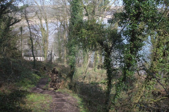
The mud’s quite different. It can be quite a hazard. My first walks from Limeslade to  Brandy Cove, were reasonably mud-free. From Pwll Du onwards, however, mud becomes a frequent peril. It’s just as tiring as sand to walk through but offers the excitement of the possibility of a) slipping and falling on my backside or b) slipping and twisting my ankle. Thankfully, neither of these actually happened. I have taken many photos of my muddy boots. Here’s a selection.

I don’t know why I never see other walkers with mega muddy boots like mine, maybe there are more nimble. Anyway, more of mud and other hazards later.

I’ll start with a lovely mud-free church. St Illytd’s church, Oxwich, is in the most beautiful setting. The first painting I ever sold was of St Illtyd’s Oxwich. Unfortunately, I didn’t keep a decent photo of that painting. St Illtyd’s nestles in the woods by the sea, just short walk from the village of Oxwich. At high tide you can hear the waves just the other side of the graveyard wall. The vicar used to live an rectory even closer to the sea (see Thomas Rothwell’s painting below) but it’s gone now, unfortunately, destroyed by the encroaching tide.

Rothwell, Thomas; The Old Rectory, Oxwich

Rothwell, Thomas; “The Old Rectory, Oxwich” (1790)

The very first religious building was built here in the sixth century. St. Illtyd, a native of Brittany, is meant to have built a small cell here. Illtyd is a very significant figure in Celtic Christianity. He is also known as “Illtud Farchog” in Welsh meaning, “Illtud the Knight”.

3365685416_07deeec3b9.jpg
St Illtyd

You may not have heard of this Celtic saint but he was very active on the Gower peninsula and elsewhere in South Wales. Legend connects him to the legendary King Arthur, claiming that he was the King’s cousin and served him as a young soldier. Even if this is not true, it was not unheard of for knights to get up their fighting life for spiritual conflict and enter a monastery. The village of Ilston not far from Oxwich is named after him as well its church. There is also a church dedicated to Sts. Illtyd and Rhydian in the village of Llanrhidian in North Gower. There are churches and schools which bear his name all over South Wales and in his homeland of Brittany.

Illtyd later left Gower and founded a very important monastic school known as “Cor Tewdws”, in Llanilltud Fawr (Llantwit Major) which is further east along the Glamorgan coast. His school is believed to be Britain’s earliest centre of learning. At its height, it had over 1000 pupils and educated many of the great saints of the age, including Saint David, later patron saint of Wales, Gildas the Historian, and Samson of Dol, founder of a monastery on Caldey Island.

IMG_2109
St Illtyd’s Oxwich

The church you see today, however, is not Illtyd’s construction, although the font inside apparently is. Most of this building was rebuilt in the thirteenth century. What is so interesting about the design of the “new” church is the battlemented tower, which looks more suited to a castle that a church.  Almost all the churches in Gower have these fortified towers. Many Gower churches, nine to be precise, were owned by a crusading order called the “Knights Hospitallers” but the design has nothing to do with crusading in foreign lands and everything to do with homeland security.

St Illtyds Oxwich.JPG
St Illtyd’s Oxwich 2018

In the 12th and 13th centuries, the Severn Estuary was riddled with pirates. In the 12th century Viking raiders – based in Ireland, the Isle of Man and the Scottish Isles – still ravaged the Irish Sea coasts. Lundy Island, far out in the Channel but within easy reach of the Gower by sea, was a pirate lair during the first half of the 13th century.  Raiding vessels could easily send crews ashore to take animals and even people for ransom or slavery. Oxwich church tower, with its battlemented roof, could be used as a look out and as it was built of stone, it they could be used as temporary refuge against robbers long enough for help to arrive.

Oxwich church, then, has a very ancient history and setting which is not as peaceful as it first seems.  Its graveyard is also reputed to be haunted by a supernatural beasts known as a “ceffyl dwr” or water horse. The water horse is a horse-like creature, which was apparently been seen walking on its hind legs, and then vanishing down the well c.1894.  The first written account of a sighting appeared in Rev. J.D. Davies’s “History of West Gower” where he tells of his elder brother and father seeing the beast one night, after they had been fishing in the bay. In a letter published in the Swansea Evening Post in May 1963, Mr David Lewis George of Cardiff wrote, “I recent years a similar white form was seen gliding over the graves in Oxwich churchyard around midnight by an elderly person of unquestionable integrity “, thus making at least three witnesses who claim to have seen the ghostly apparition of Oxwich churchyard.

IMG_1705

We did not see any horse-like creatures on our walk. Once again, I am accompanied by Biddy and Mitzy our dogs and Seamas, my husband. Once we passed the church we are presented with a very long flight of steps cut into the earth.

IMG_2121

Although tiring to climb, these steps are a godsend to walkers. We follow the path through the wood and then climb a lot of steps back down the hill.

IMG_2115-001

Here among the trees are cliffs. They are not obvious. The trees largely hide them but  they are a significant height and there are warning signs. I mentally sniggered at the signs when I first saw them as I thought they were over the top. Turns out they are not. The sun then went in.

IMG_2153

Although there are fences along the top of most of the wooded cliffs, not all of them are fenced off.  We were passing another family on the path and Biddy, our Collie-cross, walked towards what looked like the continuation of the path downhill. It was no such thing. It was a cliff edge. I don’t know if was my yelling her name at the top of my lungs, or her natural good sense but Biddy, thank God, paused at the edge.

IMG_2156
Cliff edge masquerading as a path

Not all dogs have sense. A friend’s dog was killed when he fell off a cliff in West Wales. Several years ago our dog, Dottie, the wired haired terrier, was killed on the main road near our house in Swansea when she ran away from me. Actually, she was running towards the beach. She had bolted out of the park, disregarding my calls. I tried running after her but she was too quick, I could not catch her and there was no gate on the entrance. She never got to the beach. There was a busy main road was in the way. The incident broke my heart and cast a long shadow. It is still a very painful subject for us.

So, we peered over the edge and thanked God that Biddy had stopped in time. If she had gone over the edge she would have probably been killed. I have watched her behaviour on walks since, and realise now that she probably paused from natural caution. Dottie was never cautious. So with that near miss playing on my mind and later on that night, I kept replaying that moment when I was shouting at her to stop in my head, we carried on along the path.

IMG_2178
Mud and my unharmed walking companions

The path is very muddy. The colour reminds me of chocolate. It is very slippy. This is the sort of place that I worry I will twist my ankle. I don’t; I just get very muddy boots. For a lot of the path it is so thickly wooded the sea is hardly visible. Occasionally there are gaps in the trees and if you were feeling agile and adventurous you could climb down to the rocks by the sea.

IMG_2161

Eventually, after a long slippy walk, we leave the trees behind and we have a clear view of Three Cliffs across the bay.

IMG_2210.JPG
Three Cliffs from across Oxwich Bay

We can also see Devon across the Bristol channel. The headland is rocky. Very rocky.

I read the warning sign with some trepidation. They seem fair warnings. I did see an adder one summer years ago at the top of Tor Bay. He was crossing the path. I just stood back and let him go on his way. He was not interested in us.

S_1017_common-adder_Z7850364.2e16d0ba.fill-320x213.jpg
Adder (not the one I saw)

Historically, the main hazard around here was to shipping. If you look at the Thomas Rothwell’s 1790 painting of the old rectory again, you can see how rocky Oxwich Bay is along the east side. The headland is even rockier. It not surprising, then, that the coast of Gower has seen something like 250 shipwrecks. Maybe this is due to the high tidal range in the Bristol Channel. More likely it was due to a rocky shoreline and poor weather. Oxwich Bay and Oxwich Point witnessed the floundering and wrecking of  something like 15 ships in just under 50 years from 1822-1866. Wreckage from ships that had sunk further along the coast would also be washed upon the sands of the bay.

The path above the headland is relatively easy to walk along here. It is flat and dry.

IMG_2262

We stopped for jam sandwiches and biscuits, looking out towards the one-time-home of pirates, Lundy Island. It’s a slither of blue on the horizon.

IMG_2286
Biddy (with her expressive big ears) and Mitzy – 100% concentration on that jam sandwich

The sun is long gone and the sky is covered in clouds. There’s a cold wind. I now regret not bringing my woolly hat but take some satisfaction in the fact that I have my warm padded jacket on.  Craggy rocks loom above the path to Horton.

The path to Horton is long but reasonably straight forward.

There are a couple of detours around fields. These detours look like they have been here for years.

The final detour involves a long steep climb up a valley called Slade, just by a sandy slither of beach.

By the time we reach Horton the tide is retreating. My parents tell me we came on a family holiday to Horton when I was two years old. I don’t remember it. It must have been a happy holiday because my younger brother came into the world nine months later!

Horton is separated from Port Eynon by a short stretch of sand dunes. Although they are so close they are two very distinct communities. Horton, I suspect is slightly posher than Port Eynon. At its heart are some grand Victorian villas. There are also a series of very beautiful exclusive houses with long zig-zagging steps down to beach. That said a large detached house in Port Eynon can cost as much as £800,000 – £1.1 million (or US $1m -S1.5m). Not exactly cheap.

Horton.jpg
House at Horton

Yet, it’s all a bit of façade because behind both Horton and Oxwich are a number of vast large parks, full of static caravans. These static caravans cost upwards of £35,995 to buy  and you pay site fees of £2-3000 each year on top of that. (that’s about US $50,000 and annual fees of  US $3000-4000). These are a bit like American trailer parks but you are not allowed to live in them all year around, they usually close for 4 months over the winter.

IMG_2354
Horton

The sun is shinning for my next walk from Port Eynon and get up the courage to get on the bus again and even make a connection.


Posted on 30 Comments

Gower Coastal Walk: Tor Bay & Oxwich Bay

I am shattered. My legs are so stiff, I can hardly walk up and down stairs. I have been this way for days. My problem is that I can do activities, running, yoga, walking but often “pay for it”afterward. I don’t really understand how much this is to do with life post-PTSD, if at all because you never fully recover from PTSD, but you learn to manage with what you have. Maybe it’s middle age. Maybe I do too much or just can’t tell when I am doing too much. I am pig-headed. When I see a sunny forecast I am looking at maps and bus timetables and planning my next walk. OK. A word about bus timetables. The ones for Gower are very confusing. The ones for the Swansea (including Limeslade, Caswell and Pennard Cliffs) are great. I understood them. The buses ran frequently. Once you get past Pennard Cliffs and change bus companies, however, the timetable becomes impenetrable. I have spent hours looking at the little rows of numbers and columns of place names trying work out how they connect or don’t. I have woken up in the night worrying how I am going to complete this coastal walk. It seems that I can get to several of the places I want to go in the morning OK; Oxwich, Rhossili, Llangennith (if I can get to the bus stop at 7.40am). It’s the coming back that’s a much dodgier affair. There seems to be one bus in the late afternoon. Maybe. If I have downloaded the correct timetable from the internet as there often seem to be several versions and I am not sure when one is the one the bus drivers will be using (see my earlier blog for my rant about lack of tourist or bus information.in Swansea). Part of the problem is that I am trying to get to places outside the main tourist season June-August when there are slightly more buses running. Maybe this wouldn’t matter if I knew that I could walk 20 miles in a day, or 11 miles, but so far I have only done 3 or 4 miles and found them pretty tiring. So this is a long-winded way of saying that I have broken my rules. Just to remind you. They are:- 1. Travel in a clockwise direction around the Gower coast 2. Travel by public transport and by foot. 3. Walk on sunny days. So Rule No. 2. I’ll fess up. For some parts of the coastal walk, I got in my car and drove to the places that I was struggling to figure out the public transport links for. That was until Ceri from woman walking blog recommended traveline.com to me.
Oxwich Map.JPG
Map of Oxwich Bay
Rule 1. Clockwise direction? Not always. This particular walk was done in two parts. The first from Tor Bay in a westerly direction (with both human and canine company) on a breezy, sunny day but the second part was done from Oxwich (alone) in an easterly and thus anti-clockwise direction (and looped back to my car). It wasn’t very sunny. So I broke all the rules on that day. It didn’t feel good but nevermind. I’m just doing it badly. It’s a coping strategy. I came across it recently. The thinking goes, if you are paralyzed by anxiety and a fear of failure: “Just Do It, Badly.”Once the summer bus timetable is action, perhaps I’ll be a perfectionist and do it “properly”. We’ll see. I’ll pick up from last week’s blog about Three Cliffs Bay. The climb up from western side of Three Cliffs Bay itself is pretty tiring as its very sandy but the view at the top is worth every bit of the struggle.
IMG_5297
Top of the Cliffs above Pennard Pill
At the top is an Iron Age fort. The Iron Age was a very long time ago – about 2,500 years.  It has a fantastic view of Three Cliffs Bay (the ramparts are covered in primroses). Following the coastal path around the very windy edge of the cliffs, you eventually reach around the top of Great Tor and Tor Bay below.
IMG_5364
Path around Cliff Tops
IMG_5471
The Spine of Great Tor
At low tide Tor Bay can be reached by walking along the beach from Three Cliffs Bay in the east and also from Oxwich Bay in the west, but at high tide the sea cuts off the little bay. It then can only be reached by a path down from the cliffs. This path is very sandy at the bottom end making it considerably easier to walk down than up it! This is a detour and not part of the coastal path walk!
IMG_5589
Down to Tor Bay
IMG_5592
Empty Beach at Tor Bay
It was a windy day and the clouds and their shadows were racing across the sands. It was really delightful watching the light and colours change on the cliffs tops and beach. We saw only three people and one day on this mid-week walk.
IMG_5525
Light and shadows  on Great Tor
My two canine companions Biddy and Mitzy had a great time, especially when they found something really stinky to roll in, on top of Little Tor. There were streaks of “it” in their coats. Like brown dog-highlights. Urgh! It smelt really bad even out in the fresh air, despite a dip in the sea. It was even worse in close quarters in the car home. Needless to we drove with the windows open and they were bathed as soon as they got through the front door with lots of lovely dog shampoo.
IMG_5605
My walking companions (the ones with 4 legs are smelly)
On the path above Tor Bay is a curious stone building with two archways going nowhere. A useful shelter if you are caught out in the rain or in a hail storm was we were a few months back. It’s actually a lime kiln. Gower is dotted with these buildings in which which limestone was burnt or calcined to produce quicklime.
IMG_5508
The Lime Kiln
IMG_5512
Lime Kiln (Close Up)
The path then undulates along the headland until it reaches little five bar wooden gate with a wonderful view of Nicholston Burrows (dunes) and Oxwich Bay on the other side.
IMG_5574
Oxwich Bay & Nicholaston Burrows
The path continues until you are given the choice of carrying on down through the woods on the right on down to the sandy beach on the left. I took the long sandy path through the dunes down to the beach, the smell of the sea calling me all the way. If the tide is out you can then loop left round to Tor Bay or right and walk along Oxwich Bay. Oxwich Bay is a wide expanse of water and sand. It’has a sandy beach which is about 2 1/2 miles long, flanked by sand dunes, patterned by a maze of tracks. Beyond the dunes lie lakes, woodlands, salt and freshwater marshes. Apparently, it’s rare to have so many different habitats in such a relatively small area in the UK. They are all part of the Oxwich nature reserve. The beach and the dunes are bisected by Nicholaston Pill, a small river that flows out from the marshland and reeds. I’d forgotten that there’s a little wooden bridge over the river, tucked away in the dunes. There was a middle-aged couple sitting on the sand dunes with their dog. I stopped and we had a long chat, in which we discussed in quick succession; the weather, buses, Cardiff, Swansea’s one-way traffic system, the council, the Slip Bridge and buses again.
IMG_1856
Some very large flotsam
Eventually, after a very long walk on soft sand, past much flotsam, I reach the end of the beach. There lies the village of Oxwich. In summer this is a very busy beach.  This is the second largest beach on the Gower peninsula after Llangennith. There is a large car park, a flat beach, a cafe, and toilets so it’s rather popular with visitors, apparently, an incredible a quarter of million of them each year! There are several caravan parks within walking distance too. When we first came to Gower we used to come here and I once attempted to surf here. It didn’t go well as I paddled too far out and got scared.
IMG_1812.JPG
Oxwich Bay Hotel
Set just a step back from the beach is the Oxwich Bay Hotel. It is an imposing building, its steeply pitched tiled roof reminding me of French architecture for some reason. The tiny village Oxwich lies on a road leading inland from the sea. That because this was not a fishing village. It probably won’t surprise you to learn that the woodland areas of Oxwich were quarried for limestone and exported, using Oxwich bay as a small port.  So the cottages of Oxwich were once the homes of the local quarrymen. At the start of the Napoleonic Wars, in which Britain declared war on France, the Royal Navy was forcibly “recruiting”, or press-ganging, men from communities situated along the British coast. This included the Gower coastline. Late one Thursday evening in October 1803, the HM Press Gang called at Oxwich and took 5 sailors, one of whom was a ship’s boy, who had happened to come ashore from a merchant vessel. Once upon a time, all the houses in Oxwich would have been thatched. Now few are except the cottage that has gained fame for being the place the Methodist Minister, John Wesley once stayed in 1764. It was known as the “Nook”. The well-traveled Wesley was impressed by the people of Oxwich as he noted in his diary that “all the people talk English, and are in general, the most plain, loving people in Wales’. There is no pub in Oxwich and it has been suggested that the influence of John Wesley may have had a bearing here!
4c403077606c422d8a0500a32d9c52dd.jpg
John Wesley’s Cottage, Oxwich
So I broke the rules (including the staying on the official coastal path one) but I have made it past my “block”.  I have had to pay the price as must have walked for about 5 miles on the sand. Hence the very stiff calves. Maybe, next time I will take the woodland walk! I did it badly today but I did it. Next time I will walk Oxwich Head and experience mild peril.
Painting of Great Tor, Gower, Gower Walk
Posted on 31 Comments

Pennard Cliffs & Three Cliffs Bay

CefnBryn
Cefn Bryn

Three Cliffs Bay never fails to disappoint. It does not matter how many times I see it. The sight of it always causes an involuntary intake of breath; when I see it from the road, or from the slopes of Cefn Bryn (the long hill that stretches across the Gower Peninsula) or from Pennard Cliffs.

It is particularly spectacular at high tide in the morning light. It is probably the one beach I have visited most often and certainly painted most often, on the Gower coast. It is yet another beach that requires a bit of a walk to get there. There many different routes you can use. I am going to talk about the route I took on this journey along Pennard Cliffs. The village of Pennard lies a short distance to the north of High Pennard, rather confusingly, its the well-heeled village of Southgate that actually skirts the limestone cliffs of Three Cliffs Bay. The bus from Swansea stops at West Cliff, next to a coffee shop, restaurant and shop-cum-post-office. There is also a sizable National Trust Car Park. For years I have parked my car in the car park and walked west to Pobbles Bay and the spectacular views of Three Cliffs, never realising that I was missing a gem, just a bit to the left of the car park.

Three Cliffs Map.JPG
Three Cliffs Bay

It was only because I was walking along the coastal path, from Hunts Bay, that I came across it. The walk itself was relatively easy as the land was flat although covered in gorse bushes. I had thought this part of my walk would be relatively boring as I could not easily see over the cliff edge but I was accompanied by the wonderful rising song of skylarks. The gorse seemed to be home to many birds and flowers; blackbirds, larks, posies of primroses and the golden stars of the celandine (I think). I loved looking at all the wildlife. It was the presence of a bench that alerted me to the fact that there might be some worth looking at nearby. I hadn’t seen a wooden bench since Brandy Cove (there’s one above the bay). Looking at my map, I realised that I was at High Tor. I approached the cliff edge, with great caution is it very high and I do not like heights as my legs go wobbly. What a view! WOW. It was a wonderful panorama of Oxwich Head, Oxwich Bay, Tor Bay, Three Cliffs Bay, craggy limestone cliffs topped off by Cefn Bryn. I made many exclamations. I sat down to eat some sandwiches and drink in the fabulous view. How had I not seen this before?

IMG_1211-001.JPG
View From High Tor towards Three Cliffs Bay
View From High Tor
View From High Tor

I had missed this view because I had always been in a hurry to get to Three Cliffs Bay. What I usually do is hurry along the coastal path along the cliff tops. You pass many beautiful houses set back from the cliff edge on the right, envying their position/view.

There is a gravel road for much of the distance but that ends and then you are faced with a muddy footpath or an even muddier bridle path (path for horses and their riders). The path crosses grassy headland and many gorse bushes, with a golf course to the right.

DSC_0516

Then you get your reward. Three Cliffs Bay. It is a wide split in the limestone cliffs, sliced open over thousands of years by the meandering stream, known as Pennard Pill. It takes its name from the three sea cliffs that jut out into the bay. I have painted this view many times over the years and my treatment of the scene has also changed.

The beach to the left of the three limestone peaks is called Pobbles Bay. At high tide, it is separated from the main beach but at low tide, you can reach it by foot along the sand.

HUman Concern.jpg
Human Concern

This beach is popular with dog walkers, some of whom brave the waters here. I say “brave” because it can be very dangerous to swim at high tide, due to the strong rip currents.There are large warning signs on the other side of Three Cliffs Bay. Sadly, people have died swimming at Three Cliffs Bay; three in the past 4 years. Apparently, it is relatively safe at low and incoming tides.  Fortunately, there are full-time lifeguards at the main Three Cliffs beach during the Easter & Summer holidays and weekends in May and June. I am not sure I have ever gone in the sea here. I prefer Brandy Cove or Port Eynon.

DSC_0560
The path to Pobbles Bay
Shadowed Rocks by Pobbles Bay
Shadowed Rocks at Pobbles Bay

The “Burrows” or sand dunes make for tiring walking but its worth the long climb to the ridge behind the three cliffs.

IMG_5244


Early Morning, Three Cliffs

Depending on the condition the tide may be a long way out and you have a view of a vast stretch of pristine beach, and the snaking Pennard Pill stream feeding into the sea.

Pennard Pill #2
Pennard Pill

A High tide you have the excitement of the incoming sea waves.

The path sweeps around the cliffs tops back inland along an undulating path towards Pennard Castle.

IMG_9261
Pennard Castle

Some time back in the Iron Age someone built a hill fort on the western cliffs above Pennard Pill. All there is left of that is a large circle of raised ground and a good view across the bay. When the Normans came here in the 11th, however, the Braose family decided that the east side (that’s the side closest to Southgate and the golf course) was a much better bet. So they invested in a modern stone castle and a new church here, at the end of the 13th century. Unfortunately, they had made an expensive mistake because the surrounding sand dunes rapidly smothered the site, and by 1400 it had been abandoned. Those Iron Age people clearly understood local topography better than the French invaders.

There is a story that this was the result of a fairies’ curse, which summoned a massive sandstorm to destroy the castle and church. The curse was apparently provoked by the shocking failure to allow the local fairies to dance at the lord’s wedding feast. Now, I do like a good fairy story but I cannot track down the source of this story so I suspect that it was shaggy dog story made up to explain why this stone castle was abandoned within a few generations of it being built. How much more convenient to blame the fairy folk, (after all, Fairy Hill is just down the road so the place must be crawling with the little people once upon a time) than poor building judgement!

IMG_8148.JPG
Pennard Castle (and water tower)

This is where you can follow either the path along the edge of (another Gower) golf course and through the woods down to Parkmill or plunge down a long sandy path to the valley floor. There you can follow the stream to the sea and then cross it on a series of concrete stepping stones.

The path then climbs up another steep path into the wooded headland on which the aforementioned Iron Age fort lies.

There are great views across the bay here too.

Coloured Sands at Three Cliffs.jpg
Coloured Sands at Three Cliffs Bay
Three Cliffs Bay at High Tide.jpg
Three Cliffs at High Tide

The path continues on to Great Tor and Oxwich Bay but I will rest here a while longer and take in the view!

IMG_3131
Flowers on the cliff top

  [maxbutton id=”2″]
 

Posted on 27 Comments

Walking the Gower Coast: Pwll Du and Hunts Bay

In my last blog I quoted Welsh Historian and writer Wynford Vaughn Thomas, who called the Gower Peninsula “a secret people hug to themselves”. Brandy Cove may well be the secret that the people of Bishopston “hug to themselves” because it’s a short walk down a lane from the village for them, but the secluded Pwll Du Bay is much bigger secret as it is only accessible to the public on foot, horseback or bike. Yet, its just along the coast from Brandy Cove.

IMG_0992
Brandy Cove from the Coastal Path

There are two coastal paths you can take here, the one that hugs the coast gets quite difficult in places (so bad you have to use all fours to get up one bit I seem to remember) so I took the path that trails further inland and higher, hoping it would be less arduous.

I checked on my map to make sure that this was a legitimate path, this time. Yes, there are two paths.

Brandy Cove Map.JPG

I have to retrace my steps back up the path back towards Bishopston and then take the path through a field and up into some woods.

There is no sea in sight but I trust the map (and I have walkers going up this path so must led somewhere good).

Once I cross the field and enter woodland, the lands rises but fortunately there are a series of steps cut into the earth. These steps are a godsend as well used paths easily become quagmires, even in what seem to be relatively dry conditions (as is the case with the woodland path around Oxwich Head) .

The step are like a my very own Gower-workout. I have to pause three quarters of the way up, I pretend to myself its to check the view, but really it’s to catch my breath.  At the top there is a wooden stile with a helpful yellow arrow signposting the fact that this is a an official path although not the coastal path. As I come out of the woods and onto the top of headland and I am rewarded with a fantastic view of Brandy Cove and Caswell to the east of me and Pwll Du Cove to the west.

I think about stopping to eat a jam sandwich and a chocolate biscuit but it’s starting to cloud over a bit so I decide to press on to Pwll Du in the hope that it will still be sunny when I get there. Once I cross another stile the path becomes wide enough for 4×4 vehicles. This track is not open to the public.

Once upon a time this track was a lot busier as this was part of the only route between South Gower and Swansea. As I round the corner, Pwll Du Bay comes into sight.

Pwll Du
Pwll Du Bay

Pwll Du, means “Black Pool” in English. I have puzzled over how to convey how the name it sounds (as I am not a Welsh speaker), you can either go to google translate and type in “Pwll Du” and then click on the little speaker icon or accept my shoddy anglo-approximation of “Poulff-Dee” which does not really do justice to the breathy Welsh pronunciation.  I’d welcome other people’s suggestions. I sit down by the river in the sun to eat my “elevenses” which consisted of two jam sandwiches and two chocolate biscuits. The healthy banana was left for later.

Anyway, Pwll Du is a bit of a puzzle. Here’s what looks like a little Brigadoon in the the middle of nowhere that is very difficult to get to.  In Pwll Du. There are three houses, and as you walk into the Bay, you pass another house on the right that has been abandoned.

Part of the answer is in the seclusion of the place. Like Brandy cove, this was a good place for smugglers to bring ashore wines, spirits and tobacco. This carried on in the 17th and 18th century until Prime Minister William the Younger slashed the sky high duties on tea, wine, spirits and tobacco and taxed things like bricks and tiles but also things that rich people liked such as gold and silver plate, men’s hats, ladies’ ribbons, perfumes, hair powder, horses and carriages, sporting licences and most famously, light, or rather windows. If you have ever wondered why the Georgians like to brick up window, it was a form a tax avoidance! The other part of the reason why a tiny community grew up here was lies in the the rocks; The limestone.

IMG_1081
The limestone quarry was to the right of the houses

Pwll Du Bay was ideal, it was made of limestone and had easy access by sea. Limestone was quarried here on a massive scale and up top 30 ships could be moored in the bay at any one time. These thirsty visitors were enough to sustain at least two public houses, “The Ship” and “The Beaufort”. There are suggestions that there may have been as many a 5 pubs in the valley! The abandoned house I passed may have been either ‘The Bull’ or ‘The Star’ and a pub called the ‘New Inn’ apparently lay some way up the valley on the Swansea side of the river . The two pubs on the beach were later converted into tea rooms but are now both private houses. The Ship Cottage can be rented as a holiday cottage.

Pwwl Du’s seclusion also meant that during the Second World War some of the several German submarines that secretly sailed up the Bristol Channel used to surface, under the cover of night, to collect fresh water from Pwll Du. Apparently,  but no one actually saw them doing this so it may just be a good story.

Pwll Du Cottage
Ship Cottage, Pwll Du SOLD


Pwll Du Bay is a sand beach smothered in pebbles and is a popular destination for local secondary schools’ Geography field trips. There were two schools here when I visited.

IMG_1122.JPG
Field work in action

The river that snakes its way down the wooded Bishopston valley seems to be get swallowed up by the pebbles. This is quite odd. I think that this might be what the geography students might be studying. There is a tiny footbridge that crosses the river before it vanishes under the pebbles. I love the wrought iron flourishes that make me wonder if they used to be someone’s garden gate in a former life.

Crossing the Bridge at Pwll Du
Crossing the Bridge at Pwll Du SOLD

Once I had crossed the little bridge I climbed up another steep path with those Gower-steps cut into the earth.

IMG_1147

At the top of the path is a holiday cottage – there is a choice here either carry on the road for a slightly shorter walk or follow the coastal in a large loop around the top of Pwll Du Head, called High Pennard. This used to be an iron age fort and is one of the highest headlands on the Gower. Here the Gower-steps are surrounded by delightful posies of primroses.

The view is well worth stopping for. To the east is Pwll Du Bay (below left) and to the east looks towards Pennard Cliff and Cefn Bryn, which is the name of that russet sandstone ridge off in the distance (below right). Just below you, looking towards Pwll Du, is a cliff known as Graves End. Its called that because its near where a ship called ‘The Caesar’ was wrecked in 1760. Its a very sad story because many of those on board who drowned had not chosen to become sailors but had become “press-ganged” . In other words, they were kidnapped by the navy and forced the serve on the ship. We know that some men from Port Eynon were recruited in this way and “press-ganging” was an occupational hazzard for all young men who lived and worked near the coast. Tragically,  when “The Caesar” sank , many of the press-gang men were locked below deck and so died when the ship hit the rocks. They were buried in a mass grave at Graves End.

If you follow the road, you pass this cottage with old fishing nets and buoys in the garden.


On the otherside of High Pennard is Deep Slade, or Hunts Bay. This is a bay I hadn’t visited before this coastal venture. Day trippers are discouraged from driving up this way by “Private Road” signs. Apparently, it was once a sandy beach, but the sand has pretty much gone, leaving a very rocky cove. The loss of sand has been blamed on sand dredging in the Bristol Channel.

Blue Light on Hunts Bay
Hunts Bay at High Tide SOLD


It was at this stage in my walk I decided I needed to answer the call of nature. There seemed to absolutely no one around. So leaving my rucksack by the road I clambered over a five-bar gate and got behind a suitable hedge. Of course, it was at this moment I hear the clip clopping of a horse and after a few moment a rider (female, thankfully) comes by. She can see my bag and she’s craning her neck to see what I am doing. Drat. I feel very silly. After a moment’s pause I wave to her and shout out to her that I am answering the call of nature (those were not my actual words but you get the idea). This seems to satisfy her and thankfully, she moves on. I wait awhile before I clamber back over the gate. Fortunately, she’s long gone by then!

It’s a ten minute walk to Pennard Cliffs and the bus but I’ll describe this part of the Gower Coast in my next post.

IMG_1162-001.JPG

From High Tor.jpg
From High Tor


Posted on 21 Comments

Walking the Gower Coast: Caswell Bay & Brandy Cove

After my adventures on my first walk along (or rather off) the coastal path from Limeslade to Caswell, I was left with legs that were covered with scratches from the sleeping-beauty-brambles that smothered the path I was stupidly trying follow. I didn’t discover these until later on that day when I was in the bath. I looked down at my legs and marveled at all the scratches that I didn’t realise were there. I had walked just under 3 miles but I was very tired and very stiff the next day. My toes hurt, my legs were stiff and my back ached from carrying my rucksack.  The going up and down hills is more arduous that you’d think.

Caswell Map

It took a weekend’s rest and a sunny forecast to tempt me out again. It was the spring Equinox. The day when light and dark are balanced before the days lengthen into spring. I got up earlier this time and caught the 9.20am 2C bus on Oystermouth Road to Caswell. The same bus driver from my first bus trip to Limeslade was driving this bus.

Unlike the bus to Limeslade that snaked all around the houses Langland before it reached its destination, the bus to Caswell is pretty direct, travelling through the villages of Mumbles and up a hill into Newton then before the long descent  of Caswell Road, past the Summercliffe Chalet park with its very expensive chalets (£150K to buy one, if you are asking). There are some very different chalets nearby, tucked away in the woods and easily missed. These chalet fields are Holtsfield and Owensfield.  They started as holiday huts but became permanent homes after families were bombed out of their homes during the second World War.

At the bottom of the hill is the beach. Caswell is a very popular beach with locals and tourists alike. In the summer the car park fills up and  if you leave too late in the day, they close the car park and you just cannot get in!

After School
After School

When I arrived at Caswell the tide has just turned. High tides make a big difference to how much beach there is here and all along the Gower coast. This is because the Bristol Channel has the second-highest tidal range in the world. The low tides expose vast stretches of golden sands while the high tides flood the bays create cozy bays of sheltered water. When the tide is out there is more than enough beach for everyone.

This morning, however, the high water meant that Caswell Bay was cut into two small bays.

So why are there two bays at Caswell? Apparently it because there are two neighbouring faults, one along Caswell Valley (beneath the car park) and another directly under that ugly block of apartments behind the western arm of the Bay.  At the foot of the western cliff (called Redley Cliff) runs a small brook, which starts at nearby spring.  In the past water from this stream was stored in a massive concrete cistern and supplied to the houses of the bay by gravity-feed from a wind-pump situated on the top of the cliff. You can just about make out the windmill on the top left hand-side of the old postcard below.

OLD CASWELL BAY

We have a wonderful insight into what Caswell used to look like in the mid-19th century, thanks to photography pioneer, John Dillwyn Llewelyn. John was what you might call a Victorian playboy scientist. He was very rich did not have a “proper job”. His father Lewis Weston Dillwyn managed the family-owned Cambrian Pottery in Swansea. This meant he was in the very lucky position of being able to pursue his interests in science, botany and astronomy full-time. John’s wife, Emma, was the cousin of pioneer photographer William Henry Fox Talbot and this clearly inspired John to take up this new science. John actually became a one of the most important amateur photographers in the 1850s and he took photographs of the holiday home, Caswell Cottage, he built at Caswell.

Caswell Cottage.jpg
Caswell Cottage

He was also an inventor of new techniques. One of his innovations was a camera shutter that allowed him to capture the movement of waves at Caswell at approximately 1/25th of a second.

caswell-bay-amp-beach-beautiful-sunny-day-overlooking-caswell-bay-gower-peninsula-wales-uk_4 (1)-001
Redcliffe Appartmments

These photographs of an unspoilt Caswell make me sad because in the 1960s the local planning authority decided that this beautiful bay would be “improved” by the knocking down Caswell Cottage to make a car park and also knocking down Redcliffe House (once home to the family of Dylan Thomas’s poet friend Vernon Watkins) to build the brutalist-style Redcliffe apartment block. As my husband says, “I like 60s’ architecture, but it’s like an office block has been randomly dropped into the countryside”. This makes painting nice paintings of the bay difficult because the 1960s block, in my opinion, is not very pretty. It might be great to live in, with lovely views, but its not great to look at, or paint.

Bay House Caswell.jpg
Bay House, Caswell

Still, at least we are still left with the handsome Bay House. Three sisters Emma, Agnes and Alice Morgan built and lived in this house in 1877. The sisters also planted many of the bay’s distinctive pine trees.

If you look closely at the photo to the right you may well be able to spot a helicopter. This house is currently owned by the flamboyant boss of the Welsh supermarket chain “CK’s” who is a keen helicopter pilot. He’s got into trouble a few years ago when he flew his helicopter into Heathrow airspace and caused a security alert. In Chris Kiley’s defense he was late for lunch at a nearby country house, and although he’d been given directions he didn’t have coordinates! Its seems that he’s gone off living Caswell because the house is up for sale for £2.5 million (that’s around $3.5 million dollars).

Bay House, Caswell.JPG
Bay House, Caswell Bay

Today, the tide was in, so I had to walk along the road, to find the coastal path. Usually I’d walk across the beach and climb up the cliff path, which is what I did in 2016 (see photos below).

I decided to take the higher path and this time I was determined to follow the map. I find it hard to follow instructions, I don’t know whether its my sense of curiosity, laziness or plain stupidity that makes me think I know a better way. Mind you, looking at my Pathfinder Guide, I realise why I find it so difficult. Although the maps are useful, the rest of the page is pretty much solid text, no gaps, bullet points, paragraphs, so its difficult to follow. No wonder I just look at the maps!

Not today. My coastal path map (picked up for free from one of those information points in Swansea) has no instructions just a big map on both sides of the page. That suits me just fine. The map tells me that the path joins the road further up the hill so I start walking. This road, however, does not have a pavement for pedestrians for much of its length so I have to keep stepping back onto a narrow grass verge when cars pass by.

IMG_0941
View From Bay House’s Driveway

Eventually, towards the top of the road I find the path and follow it although it did not feel very “coastal”. In fact the path takes a short cut across Redley Cliff and down a long flight of steps cut into the earth to Brandy Cove. I love going down steps like these.

The woods on the way from Bishopston to Brandy Cove inspired an early painting of mine; Brandy Cove Stile (see below).

Brandy Cove Stile.jpg
Brandy Cove Stile

Writer Wynford Vaughn Thomas called the Gower Peninsula “a secret people hug to themselves”. Brandy Cove is bit of a secret places in Gower because you can only get here on foot. You can walk down narrow lanes and paths from Bishopston village or via the coastal path. It is a little cove that is made of mostly pebbles and rocks at high tide but at low tide looks very different as golden sands stretch out into the Bristol Channel. Its a lovely place to swim in the summer and usually deserted.

I had read somewhere that it used to be known as Hareslade. All the locals call it Brandy Cove, however, thanks to the pirates/smugglers who used to maraud the length of the Bristol Channel and unload their illegal tobacco and alcohol goods here during the eighteenth century. Think Ross Polark with a Welsh accent and you’d be about right.

IMG_0160.JPG
Brandy Cove at Low Tide

In the 19th century Brandy Cove was later home to a silver and lead mine, although mining had probably taken place in this area in Roman times.

Maime StuartOne of the mine shafts was put to a much darker used in the early part of the 20th century when the dismembered body of Mamie Stuart were dumped by her murderer. Mamie, from Sunderland in the industrial North East of England, was dubbed a “chorus girl” by the local press. She had been used to a life on the stage but she’d given that that up and married Cardiff-born George Shotton in 1918 and moved to Swansea. The marriage was mistake. It was a very unhappy one and Mamie wrote to her parents complaining that her new husband beat her. After these complaints they heard no more from her. She vanished.

Her suitcase turned up in a Swansea hotel. Despite a national serach, she was never heard of again. It turned out that there was already a Mrs Shotton who was living in Cardiff with a daughter. George did 18 months’ “hard labour” in prison for bigamy, but the cad got away with murder because by the time her remains were discovered in Brandy Cove in 1961, he had been dead three years. Poor Mamie.

In my next post I carry on and visit one of Gower “hidden” villages and visit a Gower bay that many people have never heard of.

Brandy Cove.jpg
Brandy Cove
Posted on 37 Comments

Walking the Gower Coast; Limeslade and Langland Bays

Gower Coast without a Car 2016
The Old Leaflet

This was all my sister’s idea. She suggested I walk along the Gower coast and paint the bays and beaches. I had no idea how difficult the logistics of this would be. I had the daft idea that catching buses and walking the coastline would be easy. After all I had a jolly looking-leaflet “Gower Coast and Countryside with out a Car” with a photo of a bus on the front.

Sadly, it turns out that Swansea Council have changed their mind and aren’t that keen for walkers to come and visit this “Area of Outstanding Natural Beauty” (since 1956, you know).

Tourist Info.jpg
Closed

I’d picked up that leaflet two years ago. I had called into the Swansea Tourist Office,  sensibly located next to the bus station. There were two helpful ladies who gave me lots of leaflets where told me where I could get up to date bus timetables.

When I tried to revisit them last week, however, I was horrified to discover that the office was closed. There was no notice about where to get tourist information. Swansea council claims that 11,100 people are employed in tourism in Swansea but they can’t find the money to fund two people and some leaflets in a tourism office!

Bus Info.jpg
Bus Station Info Point

Not to be defeated, I called by the bus station, in the hope of getting up-to-date timetables for Gower bus services. I had to wait several long seconds whilst the youth on the information desk pondered over his suduko puzzle, sighed, and looked up. When I asked about buses round Gower he tore off two A5 sheets of paper for the week-day buses to North Gower and to Rhossili. He then went back to his puzzle. I wasn’t filled with confidence about getting around the coast by public transport.

Tescoes IP
Tescos

I went home to look up on the internet where the office had been moved to.  It hadn’t; it was gone. The tourist information office in Mumbles has been closed too. I emailed the tourism people for help. I was tartly informed that information was moved online and supplemented by a series of “information points” around the city where I could get help. I initially thought that these might be sort if dedicated tourism-related computer terminals. turns out that these “information points” are leaflet racks. I wqs informed by the tourism person that they were “a network of Visitor Information Points (VIPs) across the destination, offering a drop-in facility for visitors with plenty of advice, maps and leaflets at the ready!” I didn’t feel very encouraged by this. So I went back into to town to have a look. The first information point I visited was in the foyer of Tescos. There was no one to speak to here.

IMG_20180328_110321 (2)
Grand Theatre

I then visited the foyer of the Grand Theatre where they had a number of racks filled with leaflets. There were staff there. They were sitting behind a glass screen at a counter. There was a queue of people waiting to buy tickets. When the queue went so did the counter staff. I lost heart. I didn’t think they’d thank me for asking them about buses to Port Eynon and I knew that they’d direct me to the bus station, so I left. Whilst was at the Grand Theatre, I did pick up a leaflet which spoke volumes about Swansea Tourism’s much reduced ambitions for tourism the area.

teaserbox_56937528

Instead of “Gower Coast and Countryside without a car”  it’s  now “Mumbles and the City of Swansea without a car.” Swansea and Gower really need the money that tourism can bring to the local economy but the local council just fail to provide the infrastructure that is needed. I’ll come back to the issue of bus timetables later, as it is something that has kept  me awake at night trying to figure out how to go and get back from places in Gower.

Mumbles to Caswell.JPG
Caswell to Mumbles Head

Limeslade. This is where I decided to started my Gower Coastal Walk in 2018. The “First Cymru” buses from Swansea Bus station run every hour along Oystermouth Road. It is a very good service. As a shy teenager I had a terrible fear of speaking to bus drivers. Not anymore. These days, I gabble at them and give them long questions about the right ticket and the correct time.

IMG_0495
My first bus stop

The bus travels along the seafront road to Mumbles and then snakes its way around the bungalows of Langland. Many cheerful white-haired passengers got on and off the bus with their bus passes. Many of them seemed to know each other and they chatted away to each other and waved at friends out of the window. The sunshine has cheered everyone’s spirits. Finally, at the bottom of Plunch Lane, the sea reappeared and I dismounted.

IMG_0507.JPG
The bus at Limeslade

Here there is a little rocky bay called Limeslade Bay, which is a five minute walk round the corner from Mumbles Pier and Bracelet Bay.

Why is Limeslade called Limeslade? Well, limestone is a big feature of the Gower landscape. From Mumbles to Oxwich, the coast is made entirely of Carbonifeous Limestone that has been faulted and folded. There are many little valleys along the Gower coast called “something-slade” and that’s what “slade” means -in an old English word (“slaed”) meaning a low valley, dingle or an open space between banks or woods. Which might surprise you that a Welsh coastline has so many names of Old English origin rather than Welsh. This reflects that fact that Norman landlords claimed the more fertile southern part of the peninsula and left the wilder, less profitable northern parts to the Welsh.

There are two paths you can take from here. There is the official Coastal path which snakes along above the sea following the many inlets. I have taken this path many times before.

IMG_8870.JPG
The Coastal Path

The second one, sneaks up alongside the left hand side of Fortes ice cream parlour, up a steep muddy track onto the Rams Tor. This is the path I took.

IMG_0510
Forte’s, with the steps to the higher path to the left

It is worth the climb. There is a great view of the lighthouse and the Coastguard station, and if its clear enough, further across Swansea Bay to to Port Talbot and Porthcawl.

IMG_9028.JPG
Mumbles Lighthouse from Rams Tor

This is where the coast feels more like West Wales. The stubby trees and gorse bushes all lean lean to the left thanks to the prevailing westerlies. Once on the headland the walk is quite easy, if not a bit muddy. You pass by a few of the houses that lookout over the sea but as you carry on further along the path, the houses recede, with fields in the way. Quite quickly, Langland Bay comes into view. I love the view of the coast where you can see the bays of Gower off into the distance.

Rotherslade

IMG_3727
Rotherslade

There is a small cove before the main sweep of Langland Bay. This is Rotherhide. Beteen the two bays is Storrs Rock which the French Impressionist painter Alfred Sisley painted in 1897 whilst on staying  at the Osborne Hotel, which overlooked both Langland Bay and Rotherslade Bay, which was also called Lady’s Cove. His stay here must have been very a bitter sweet. He had come come  to marry his partner, so as to legitimize their two children, but both he and his wife were dying of cancer. He painted Storr’s Rock at many times of the day.

IMG_3915.JPG
Storr’s Rock 2018


Storr’s Rock (2018)

Langland 

IMG_0587.JPG
Langland Bay

Langland Bay is very popular with surfers and day trippers but its unusual for modern day sea-side towns, as it has not been hollowed out by holiday lets. That’s because Langland is an expensive place to live and its tiny lanes are often filled with Mercedes and BMWs. Wales’s first millionaires, the Merthyr iron-masters the Crawshays, set the tone in the mid-19th century when they built their massive summer residence here. It was originally known as Llan-y-Llan and looks as if it was ripped intact from the Scottish Highlands. It was later part of the Langland Bay Hotel but is now called Langland Bay Manor and been converted into swanky apartments that wont leave much change from £300K.

langland3.jpg
Old Postcard of Langland
IMG_3750.JPG
Langland Bay 2018

The clean lines of green and white beach huts have become another status symbol. These  striking green and white huts were built in Victorian and Edwardian times. They used to be dolled out to families on a lottery basis, at the very reasonable price of £236 for a three months lease. More recently, however, a cash strapped council decided it would raise money by selling some of the refurnished hut’s leases at a whooping £10,000. You would get to use of your hut for ten years and although the huts can be used every days of the year, you cannot sleep in them in overnight. I don’t know if anyone checks this! None of the huts were in use when I walked past but it was a chilly midweek day in March.

IMG_0003.JPG
Langland from Snaple Point

IMG_9978.JPG

Gower Coastal Path from Langland to Caswell

I continued my walk around the bay and again instead of following the official Coastal Path, I climbed up Newton Cliff which is alongside Langland Golf Club to look across Langland Bay.

IMG_0810
Langland Bay from Newton Cliffs at Sunset

After the climb up Newton Cliff I was starting to get tired. This is when I made a stupid mistake. I left the beaten track. In stead of following the footpath down the hill to rejoin the official coastal path, with its easy tarmacked surface, I decided to try and follow what I thought was a path along the top of cliff along the edge of the golf course. The sun had gone in and it started to spot with rain. This was a disaster, I ended up struggling down paths covered in brambles sleeping-beauty-style, only to eventually admit defeat and retrace my steps. It was a long detour. I ended up asking directions from some rather bemused looking golfers. I could tell one of them wanted to tell me off for being on the golf course but I was apologising so much, he just said “you shouldn’t really be here” and then directed me back to the official path.

By the time I reached Caswell Bay, I was very tired indeed. I had eaten the single banana I’d brought to eat long ago so I queued for minutes in the very crowded “Surfside Cafe” and bought a chocolate ice-cream which revived my spirits considerably. I then waited at the bus stop for the hourly bus back to Swansea.

What I learnt

  1. It hard to write notes on a bus.
  2. Take sandwiches.
  3. Stay on the beaten track – if there’s no post it’s not a path.
  4. Look at the map – put it in your pocket, don’t leave it in your rucksack.
  5. Leave longer than you think
  6. Leave the book on Gower History at home.  It’s heavy.
  7. Don’t believe the weather forecast. It can go from warm sun to wind and rain.
  8. Most importantly, check your camera lens for smudges. Most of the photos I took today were no good (see below).
IMG_0675.JPG
Langland Bay with smudge on the left side of the lens!

What I got right

  1. Coat with hood
  2. Walking boots
  3. Bananas are great
  4. Water bottle – its heavy to start with but you end up drinking most of it.

Next post – Will lots of chocolate biscuits see me through to see the stunning views from Pennard Cliffs?

P.S. Here’s some drone footage of the coast and Langland Bay (BTW The sea isn’t usually this colour)

Posted on 10 Comments

Walking the Gower Coast: Mumbles

Mumbles

I love looking at maps. I have been gazing at the map of coastal path around Gower for days now. The Peninsula juts out westwards into the Bristol Chanel. Its about 17 miles in length and 8 miles width at its widest point. I am planning to walk around its coastline, approximately 38 miles in length, maybe a bit less.

I am, however, going to start with a map of Swansea Bay. People who have never been to Swansea make jokes about the place as if its somewhere to avoid. Quite the opposite. The hilly city sits alongside the sparkling sea and beautiful sandy five-mile beach.

Swansea Bay
Swansea Bay

I have decided to illustrate this series of post with my paintings and with (mostly) my own photographs. The paintings have been completed in recent years, some as a result of this trek, other are older. The photos are mostly from 2018 but a few are from my 2016 attempt to walk the Gower coast. I started my first attempt at Mumbles in 2016.

26907770_1925593071038159_2048231183779527812_n.jpg
Photo Credit: Gower Flight Centre

The pretty Victorian village of Mumbles sits at the far end of the western arm of Swansea Bay. This is where my journey around the Gower coast begins.

Round Mumbles Bend.jpg
Round Mumbles Bend

Mumbles was originally a fishing village. It did not catch fish but rather, oysters. It was, for a time, a thriving industry. Part of Mumbles is known as Oystermouth and many people often use the two names interchangeably to mean the same place.

The Strange Afternoon.jpg
The Strange Afternoon (Mumbles & Oystermouth Castle)

Many people often associate South Wales with coal mining, and coal was certainly vital in locating the copper industry in nearby Swansea. It was the need for limestone, however, that changed Mumbles’ fortunes. Limestone was used as a fertilizer, in steel making, pharmaceuticals, and also as a construction aggregate (in other words, gravel).

Tide's In, Mumbles
Tide’s In (Mumbles)

Mumbles was made of limestone and that fact brought the modern world to the front door of this tiny fishing village in 1804 when the Oystermouth railway line was built in order to transport limestone from the quarries of Mumbles to Swansea Docks. This track was the world first passenger line, the Swansea and Mumbles Railway, carrying at first horse-drawn carriages, and later steam locomotives.

Mumbles Pier From Knab Rock.jpg
Mumbles Pier from Knab Rock

The trains also brought many day trippers for a time. The railway is now long gone, closed in 1960, but there remains a sturdy promenade that runs along the sea front where the trains used to run. Locals and visitors alike still love to walk its length and admire the spectacular view across the sweep of Swansea Bay.

Afternoon Stroll in Mumbles.jpg
Afternoon Stroll in Mumbles

The promenade runs up to Verdis, a popular ice-cream parlour and thence to the Mumbles Pier. The Victorian pier was built in the last years of the 19th century and was the last stop for the Railway. Here tourists could catch a paddle steamers for a tour along the River Severn and Bristol Channel. The Pier hosts a great cafe (with self-playing piano), an amusement arcade and tiny art gallery.

Mumbles Piers.jpg
Mumbles Pier

On the other side of Mumbles Head is Bracelet Bay.  Mumbles Head comprises two tidal islands. At low tide those with stout boots can walk out to the islands and look at the much-photographed lighthouse.

Towards Mumbles Lighthouse (2).JPG
Towards Mumbles Lighthouse


The octagonal lighthouse lighthouse was built in 1794 by Swansea architect William Jernegan, who also designed Singleton Abbey which later became part of Swansea University. This was the second attempt to built a lighthouse here. The first one started a few years earlier, designed by someone else, collapsed before it was even finished!

Clouds Gathering Over Mumbles Head
Gathering Clouds over Mumbles Head

This is where the real Gower coast walk begins! In my next post I puzzle over myriad bus timetables and eventually feel brave enough to leave the car behind!
In the meantime here’s a cool video of a drone flying around Mumbles Head.
https://youtu.be/MvGQhPzQlKo

Paintings of Gower Book

UK- See the book on Amazon.co.uk by clicking here

USA – See the book on Amazon.com by clicking here 

Posted on 21 Comments

Welsh Coastal Magazine

Welsh mag 3

I am delighted to have been featured in April’s edition of Welsh Coastal Magazine as part of their ongoing series “Inspirations” on contemporary artists in Wales. I have included some images but you can read the online version here.

If you would like to buy prints from artmajeur.com click here.

Article clip

Clip #1

Posted on 22 Comments

Walking the Gower Coast. The Rules.

Coloured Sands at Three Cliffs.jpg
Coloured Sands at Three Cliffs Bay

One result of developing PTSD over 5 years ago is that for a long time I had limited energy. I honestly cannot tell whether my energy levels have returned to “normal” levels yet, or ever will. I find that it takes me a couple of days to recover from social events (and no, it’s not a hang-over as I don’t drink alcohol) or from traveling/visiting family or another town. Maybe, everyone my age is like, I don’t know.

I used to have ambitions or even a sort of “bucket list” of things I wanted to get round to doing, some time. I don’t much care for the term “bucket list”. If you haven’t heard about the term “bucket list”, it is a list of all the goals you want to achieve, dreams you want to fulfill and life experiences you desire to experience before you die. Here was mine.

  1. Learn to surf
  2. Learn to Meditate
  3. Walk the coastline of Gower
  4. Run a marathon
  5. Walk the pilgrimage route to Santiago del Compostela
  6. Visit Japan

I did learn to surf and I was very keen for a while, but I was never terribly good at it. I also once went on a 10-day meditation course. There was no talking for 10 days. Strangely, that was the easy part. I was running 20-25 miles on a weekly basis when my life took a swift left turn and everything ground to a halt in 2012. I am still active but I don’t run very far at all these days. I know I won’t be able to run a marathon unless I gave up everything else and just trained, ate and slept. There would be no energy left over for painting and making a living, so that’s out of the window. I cant afford to travel, not at the moment so it’s going to have to be number 3.Walk the coastline of Gower.

Gower-Map-M-1024x516.png

I have a curiosity about exploring the whole coastline of Gower. I know and love certain parts of it very well, such as Three Cliffs Bay. As a painter of the Gower peninsula there are parts that I have visited and painted many times. However, there are also parts I have not visited for years, and a few places I have never visited. I did plan and start to walk the Gower coast in 2016, but it all came to a halt as I tried to cope with the repercussions of being made redundant from my teaching post where I had worked since 1999.

So start again. Here are my rules

  1. Travel in a clockwise direction around the Gower coast
  2. Travel by public transport and by foot.
  3. Walk on sunny days.
  4. Erm, that’s it.

I will document the walk with photos, sketches, and paintings. However, I am nervous about this. The big challenge for me will be in terms of my energy levels. The whole coastline is something like 38 miles long and I know I will have to divide that up into many short walks that will be very tiring for me. I will probably need a week to recover in between walks. I am nervous that I won’t have the determination to finish this, or something will happen to put me off, such as in 2016 when I got part way through in 2016 and gave up. I hate not finishing things.

Worms Head Coast Watch Station.jpg
Coast Watch Station, Rhosilli

It will also be challenging for me mentally. When I was younger, I did many brave things on my own. I traveled around the UK and spoke at Academic conferences, I even traveled to Texas very soon after I passed my driving test and drove a hire car. The PTSD has had the result of reducing my life and what I do, either because I get tired or because I am fearful. PTSD means that my brain goes into anxiety mode very easily. My head will worry about the coming back before I have even left the house.  I will convince myself that none of the buses will arrive and I will be stranded in the wilds of the Gower and have to sleep under a bush. Yes, it all sounds stupid when I type it, but that’s the sort of thing that keeps me awake at 3am in the morning.

So I will have to prepare well, take a load of bus timetables and set off early and challenge the fear. A few weeks ago I panicked and jumped into the sea, thinking I was about to get washed off some rocks. Bizarrely, the evidence has given me confidence. The boots and I survived. It was uncomfortable but the boots dried out on my radiator. So I will make a start this week, even if it takes months to complete the challenge.


Posted on 24 Comments

The ever changing landscape

I am very lucky to live close to the sea. I can never get over my excitement at seeing the sea, even when I live so close to it. I would say that all of the Welsh coast is pretty special. The coast along Pembrokeshire, Ceredigion and the Llyn Peninsula are spectacular however, the Gower peninsula is the coast I visit most often as it’s the easiest to get to for to get to and its paintings of the Gower peninsula that work on most often.

swanseaGower has some incredible coastlines and fabulous beaches. I have always wanted to walk its length but never got my act together to do it. I made plans to do so in 2016 but being made redundant from my teaching job in that year, sort of threw everything out of kilter for me.

The best beaches always involve a bit of a hike but its always worth it. From an artist’s point of view its always different. Whether its high tide, low tide, summer, spring or a blustery winter’s day. What’s the main difference between the seasons? The light. Whether the sun is high or low in the sky, the angle of the rays, the quality of the light. Is it sharp or is it hazy?

Drifting Clouds on Three Cliffs
Floating Clouds over Three Cliffs

I have painted Three Cliffs Bay quite a few times. I am find it interesting to reflect on the different ways I have approached what is in some ways the same subject matter. In winter the sea is a grayed jade the wet sands are pinkish, the dry sand different shades of yellow. The colour of foliage is very muted; the grass on the clifftops is more yellow than green and the bracken is brown. The cliffs are warm grey in direct sunlight, a cooler grey in shadow.


Even on brighter days when the sea has more violet the colours of the cliff tops is more yellow ochre than orange.

Coloured Sands at Three Cliffs
Coloured Sands at Three Cliffs Bay

Three Cliffs Bay at High Tide

Three Cliffs Bay at High TideWhat surprised me when I compare these winter paintings with some that I had done in the summer is that the wet and dry sand is the same ruby/pink/yellow tones, although it seems obvious that it would be now I think about it. What is different, is the sky and the colour of the grass and bracken on the cliffs. The sky is a lighter turquoise and the sea is has more jade and turquoise. The clouds reflections in the surf is still violet. The grass is wonderfully verdant, a sharp green.


This is the oldest painting and it was done in high summer when the grass is a deeper green.

Pobbles and Three Cliffs

Of course, looking through these paintings, I immediately wish I had done some autumn paintings when the bracken is a rusty red. I have painted Rhossili Bay in autumn but not Three Cliff. I can’t think why not. Of course, last autumn I was focusing on my “Hollowed Community Project” and painting houses. I hope that I will be able to come back and paint Three Cliffs again this autumn.