


October on Pobbles Bay SOLD

I like to explore nooks and crannies and I usually use a map to help me. This way I can find interesting scenes to paint. I love looking at maps but I didn’t have one in Donegal. I thought I’d get one with the hire car but instead we were given a Stat Nav (Satellite Navigation). You can’t spend hours looking at the lay of the land on a Stat Nav. It spent the holiday in the boot of the car. I thought we’d get one in a filling station but in Ireland you don’t fill up your own car and wander into the garage shop to look at car related stuff and packets of sweet, you have a friendly young chap filing your car up for you! We sort of knew where we were going. My husband, Seamas, had spent hours “driving” down the roads and lanes of Donegal on Street View Google.

So, in the spirit of adventure I turned off the coast road, which runs from the airport to Dungloe, in search of the sea. The roads are narrow but fortunately we didn’t meet anyone coming the other way. After following an undulating single track road, it widened out and then seemingly vanished over a hill into the sea. I didn’t fancy doing a lot of reversing so I parked up to explore on foot. Over the other side of the rise was the beach. It was low tide. The track I’d been on ran down to beach and then started up again on a island on the other side of the beach.

This is Fall Island and it is only 300 metres long. There is only one lone house on the island. The house was shut up for the winter.

I was fascinated by the rocky landscape and the houses perched on the rocks. These rocks are made of granite. Granite is an igneous rock which it was once magma which crystallised as it cooled down. It’s a dense and useful rock. It can be cut, carved and shaped. It is also resistant to water and pollution.

The granite rocks along the coastline are massive. Monumental. Their edges smoothed by the sea and the wind.


 Finally, my favourite recent painting is the one I did of Muckish mountain. I loved the massive rounded clouds that seemed to be echoing the humped shape of the mountain.


I love painting the coast, particularly if it’s rocky. Owey Island, lies just a short distance off Cruit Island near Kincasslagh in west County Donegal. Strictly speaking there have been no permanent residents since the 1970s. [Photos from http://www.welovedonegal.com/islands-owey.html]


There is no electricity or mains water, yet plenty of people visit and many visit during the summer months. If you want to visit, there is a ferry service run by Dan the Ferryman.

The name Owey, in Irish Gaelic “uaigh”, means cave. The island is a cavers, kayakers and rock climbers’ paradise.


The island is encircled by massive rock stacks and it also has an underground lake. As I am cave-phobic this video is the closest I will ever get to it!
I am fascinated by rock stacks and Donegal has plenty of them. I like to think of how these massive structures have gradually been eroded by wind and waves over thousands of years, forming first sea arches and then stacks.
I also love the colour of the rocks and the wild Atlantic Ocean. The ocean is incredible shades of blues, greens and mauves, mixed in with browns and frothing surf. Although I feel I am getting better at representing the layers of Donegal sky and clouds, but capturing the movement of the seas is still frustrating me.

If you to find out more about Owey Island see Ian Miller’s Unique Ascent’s website for detailed descriptions and incredible videos.
Just thought I’d add a post script about the “Holy Jaysus Wall”. I think if you look at photo of it you will understand the name. It makes me feel ill just looking at it!


Irish climber and alpinist John McCune, climbed it in 2014.
Here’s a fascinating film clip from the 1970s about Owey Island’s postman, Neil McGonagle, who used to visit the dwindling population on Owey Island by small boat four times a week to maintain the island’s contact with the outside world.
https://www.rte.ie/archives/2018/0205/938419-owey-island-postman/


I wonder whether the post to Arranmore Island, Donegal, goes astray a lot. There are two other islands with similar names off the coast of Ireland and Scotland. There are the Aran Islands off Galway Bay to the south as well as the Scottish Isle of Arran. Arranmore or Árainn Mhór, in Irish Gaelic.

It lies off the west coast of County Donegal, Ireland. It is the largest inhabited island off County Donegal, with a population of 514 in 2011, down from 528 in 2006, 543 in 2002, and over 600 in 1996. The island is part of the Donegal Gaeltacht, with most of the inhabitants speaking Ulster Irish.
There is a frequent ferry service from Burtonport and this old cottage was spotted nestling into the rocks of one of many islands, Inishcoo, en route to Arranmore. There is no ferry service to the many little islands scattered off the coast of West Donegal. People get to these remote islands in their own little boats. There are landing stages and steps down to sea cut into the rocks. Of course, you could always swim to Inishcoo. Amazingly, the local cows do.
To buy any of my landscape paintings click here


Once-upon-a-time I worked full time as a teacher in school of just under 2,000 pupils and I would teach approximately 150 pupils in a day. That’s a lot of faces to put names to every day. I was pretty good at learning all those names too. These days, however, I might only speak to a handful of people in a day; my husband, my neighbour and local shopkeepers. So, when presented with an opportunity to met with and chat with to new people I relish it. Clyne Christmas market gave me a lovely opportunity to talk to all sorts of people.
I am pretty new to running a stall, I did it once about 4 years ago. I really enjoyed it back then but teaching commitments meant that I did not have the energy to keep doing it. That has changed now. I have the energy and the time to pursue this and yesterday I had a stall at the first Clyne Farm Christmas market. I realise that I have a lot to learn.
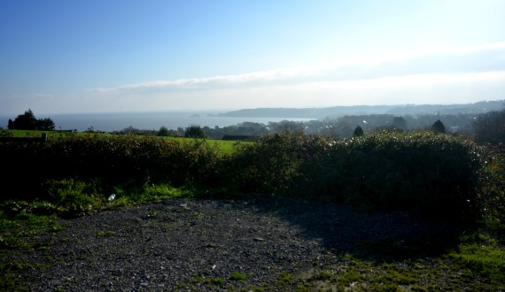
Clyne Farm sits on top of Clyne Common, high up above Swansea. It has sweeping views towards the sea-side village of Mumbles and across the massive Swansea Bay.
Once upon a time it was a riding stables but in recent times it has transformed itself into an top-class accommodation and activity centre.


Yesterday was their first Christmas Market and we were blessed with sparkling crisp sunshine. The photos above were taken in the first half an hour before it got busy. The crowds ebb and flow. After a quite half an hour, it is quickly jammed with families carrying babies wrapped up to the eyes in jump suits and bobble hats. The little girls are drawn to the “Sparkly Bow” stall further down my aisle. The table covered in glittery objects is exactly the right height to catch a 5-year-old’s attention – at eye-level.
This first onslaught is followed by another wave of families with dogs on leads, and in carried in their arms. There are lots of woolly coated “cockerpoos” (Cocker Spaniels Crossed with Poodles) and some sharp-eyed border collies. They take in everything. Later as people leave for lunch in the other hall, it becomes calmer. People are clutching bags with their purchases. I recognise some people who came around earlier return to buy. It’s in the post-lunch calm that I make most of my sales. I chat with many of the people in the hall. My cards of Mumbles Pier starts a number of conversations about a controversial development of the Pier Head area that the local community (Mumbles Action Group) are currently fighting.

I manage a quick break and visit some of the animals on the farm. I’d met Ted the collie and Flo the goat and her surrogate daughters, the sheep Brillo and Lucy, yesterday.


Along a muddy tack there children’s pony rides on offer. I had to make a special journey along a different muddy path to see Peggy the Pig. She is massive. I give her a pat on her broad back and was surprised that her back was covered in bristles, not wiry hair. Her floppy ears cover her eyes, like nature’s sunshades, but it can’t be easy for her to see. I was told by Sarah who works at Clyne, that Peggy is pretty laid back and is a “morning” pig. She is active in the morning and spends her afternoons sleeping. Someone speculates that she’s a Gloucester Old Spot. I assume that they have only one big spot but looking it up later it seems that they were probably right and she’s an “Old Spot”.

The hall is filled with bright sunshine but by the late afternoon, I’m starting to feel the cold. Although there’s carpet in the hall the concrete floor underneath is cold. I run to my car to fetch my woolly hat. As the afternoon wears on I notice that the tip of my nose is numb! After 5 hours in the hall, my feet are starting to feel like blocks of ice. The girl opposite me is wearing thin daps and ends up sitting on her chair with her feet tucked under her. At four o’clock the sun is low in the sky and someone mentions that there’s Christmas Parade in town at 4pm. That seemed to be the signal for the stall-holders to pack up and within minutes the hall is bustling with activity as the stalls are rapidly dismantled. I drive home with the sun setting over Clyne Common.

What I learnt


We didn’t get an “Indian Summer” in September, which when we usually get one in Wales. What we have had, instead, is a series of sunny days in late October/early November. The sparkling autumn light is stunning. From a painter’s point of view is more interesting than summer light. So last week I drove down to Three Cliffs Bay to enjoy the light. I was surprised by the dark blue of the calm sea. It was quite a different colour from the summer sea.

I was hoping that there would be plenty of orange bracken and there was. Not on the slope of the the Three Cliffs, as they are covered in grass, but on the slopes of Cefn Bryn, in distance.

These colours sum up the Welsh landscape for me. In fact, I think I like the Welsh landscape in autumn/winter best. The red and the green of the bracken and the grass also put me in mind of the red and the green of the Welsh flag.


I find it ironic that there’s less light around but its better quality, from an artists’ point of view. I still have not adjusted to the clocks going back last month, and I am still waking at 5 -5.30am! It does not seem to matter what time I go to bed, I awake in the dark feeling ready to rise. So I get up and here I am tapping away at my computer in the dark waiting for the sun to rise. Soon I will have to get my SAD lamp out to stop the slow slide in winter gloom. Before, you ask, yes, SAD lamps work for me.
Does anyone else suffer from this problem? Does anyone have any tips for sleeping in later?
Update: I sat with my SAD lamp on for 20 minutes around 7 pm last night and it seemed to help me go back to sleep when I awoke at 4.30 am, and I didn’t get that “wake up” surge of hormones til 6.30. A definite improvement.
To buy landscape paintings of Gower click here

I sounds mad, but I didn’t have a map when I was driving around Donegal. I sort of hoped I could buy one in a petrol station but I never did. The Hire Car people lent us a Sat Nav but I could not be bothered to plug it in and it stayed in the boot the whole week.
I am very lackadaisical when it comes to planning holidays, I think all my energy goes into the logistics of getting there. Anyway, I assumed that my husband would tell which places were worth visiting. Afterall, he had spent hours “flying” up and down the roads of Donegal on StreetView. I sort of knew where I wanted to go; Bunbeg, Bloodyforeland, Falcaragh, Dunfanaghy, Derryveagh, Kincasslagh and Dungloe and the distances between them were not very great.

On the only properly sunny afternoon we had in Donegal, I took a left off the road from Dungloe to Kincasslagh. The sign said “Cruit Island Golf Club”. I reasoned that golf clubs are usually located in beautiful places, near the coast. So I followed a single track road and over a small concrete bridge on to Cruit Island. If you look at the map above, you can see that Cruit Island is long, three miles long, in fact.


Cruit Island at Low Tide
After a pleasant drive along a single track road, and passing what can only be called mansions at the north end of the island, we reached the golf club. Now in the UK golf clubs can be funny about other people coming onto their property, but there was nowhere to turn the car so I kept driving. Eventually we reached the golf club car park which looks out across wild waves to an island. This was no calm inland lough. This was the Wild Atlantic. The wind was fierce and the waves crashed and boomed.

It was mesmerising. The island was just across the turquoise water. It was dotted with houses, some clearly derelict, others in good order. I didn’t know it at the time but this was Owey island.

It turns out that Owey island is uninhabited for much of the year, having no permanent residents, but people do live there in the summer months. It was last inhabited on a full-time basis in the mid 1970s. The last residents were three old boys who were moved to the mainland of Donegal, or as the islanders call it, Ireland. All the houses were built on the south side of the island, facing Cruit Island Golf Club. The north of the island is too rocky and too exposed to the north Atlantic Ocean gales.

My eye was drawn to one building in particular. Standing on the brow of a hill, its missing roof caught my attention. It had also had a walled yard behind it. I was too far away to be able to tell whether this was a derelict old building or an incomplete new one. There are many incomplete “new” buildings littering the Irish landscape.

This turned out to be the old school. The walled yard was the play ground. It was a tiny school with just one teacher who would have to teach all ages of the small number of island children. It was a school for the younger children, and when they were old enough the children would then be sent to the mainland for their secondary school education.
Apparently, the school children had to bring a sod of turf to school each morning. The turf was fuel for the fire and the idea was that they provided the heating for the school room in the cold months. It has been pointed out that as the teacher’s table and chair were at the front of the room, they would usually sit right in front of the fire. When I used to be a teacher, I used to teach in a “temporary” demountable classroom (it had been there for 40 years) and in winter, I would often stand next to the gas fire, myself. So I liked that idea!
Available landscape paintings can be seen here: https://emmacownie.artweb.com/available-paintings-donegal-ireland
To read more about life on Owey Island see: http://www.welovedonegal.com/islands-owey.html


In Steven Spielberg film “Close Encounters” (1977) Richard Dreyfus experiences a close encounter with a UFO and subsequently becomes increasingly obsessed with subliminal, mental images of a mountain-like shape and begins to make models of it, including one made from his mash potatoes.

I bring this up because my husband got a bit like that with Mount Errigal. It has a very distinctive shape and it can be seen from miles around. My husband was always pointing it out to me. His father used to help run a boxing gym called Errigal in Derry, Northern Ireland, so it has an added resonance for him. Again and again he’d announce “There’s Errigal” to me.


It looks like it should be an extinct volcano, but I’m not sure entirely that it is. We saw it when we flew in from Dublin, from the runway at the airport, from the beach at Carrickfinn, From Bunbeg beach, from the Rosses, from Gweedore. Its barren surface is rather moon-like, but when the sun catches its slopes its quite mesmerising. When it was hidden by cloud you knew the sun wasn’t going to come out for some time. The surface isn’t covered with snow but light-coloured quartzite scree that glows pink in the sun.
I would like to climb it one day. I have been told it only takes a couple of hours (from the other side). In the meantime there is a nice time-lapse film of clouds floating past Errigal for you to watch.
You can purchase my Donegal landscape paintings here


The Rosses (in Gaelic, Na Rosa) is a region in the west of County Donegal, Ireland. The name comes from “Ros”, the Irish word for headland. It is a curiously rocky place. Not rocky, in the sense that national parks in the American west, like Utah and Arizona, are made of 100% rock, but rather the bedrock is covered with a thin layer of earth, with slabs of rocks and boulders poking through. It’s a barren but beautiful landscape, studded with a myriad of lakes and inlets of the sea.

It may feel like the edge of the known world but this area has been inhabited “since time immemorial” according to Wikipedia. Coastal places like the Rosses, in Donegal, looked out onto a massive highway – the sea. Missionary Celtic saints were busy in this area in the 6th century AD. These saints relished a challenge and liked to travelled up and down the Celtic waterways to spread Christianity to nearby Scotland. In the 1990s it was fashionable to argue that these Irish monks had in fact, “saved civilisation” by copying the books being destroyed elsewhere by Germanic invaders, eventually bringing them back to the places from which the books had come. Part of this movement included women like St. Crona or St. Crone (Cróine) , a female religious of royal blood. She found a monastery in Termon near Dungloe. She was a cousin of the the better known St. Columba (St. Columcille in Irish) one of the Twelve Apostles of Ireland, who founded the monastic settlement at Iona.
Much later (about a thousand years or so) in the 16th century, a number of ships from the Spanish Armada sank off or landed off its coast. Some 24 to 26 Spanish Armada ships are believed to have foundered off the Irish coast in 1588 while returning from a failed invasion of England by King Philip II. This is not just local myth as the wrecks of two Spanish ships were discovered by archaeologists in shallow water near Burtonport, Donegal, in 2008/9.

What happened to the survivors of these wreck is unclear. We know that as many as 9,000 Spanish soldiers and sailors lost their lives off the Atlantic coast of Ireland, either through drowning or were killed by English troops or Irish chieftains after they were washed ashore. However, not all died. Some Irish who were sympathetic to the Spaniards sheltered them and some kept them on as soldiers. Local legend, credits black-haired locals as being descents of these men, but they are possibly the descents of much earlier people who came from the Iberian peninsula after the end of the last ice age.
I found this area both beautiful fascinating. Donegal manages to combine a sense of isolation with company, should you want it. This area is littered with houses, old and modern. Many homes are built on the rocks, or have massive rocks in their gardens. People have had to work around the boulders and outcrops.The prevalence of pines dotted across the landscape gives the area a Scots or Canadian feel to it; Caledonian in fact.

Cruit Island
Although in many senses there is plenty of space, houses seem to huddle together in clusters, isolated but within sight of others. A lot of them (the newer ones, anyway) face out towards the Atlantic Ocean. It seems that in many cases old cramped cottages have been replaced by larger modern buildings. Many tiny cottages, or abandoned derelict buildings are overshadowed by bigger ones. The smaller cottages ended up as holiday homes for visitors. Most of the houses are painted white, but with some older stone cottages and out-houses are left “au naturel”.
On one of the few sunny afternoons we had, we raced round taking photographs of the houses on the rocks. Each bend in the narrow road revealed different vistas. It was hard to decide which one I liked the best. Not only did these houses look out to the sea, behind them were hills and mountains. My painting “Round the Rosses” captures a typical cluster of old and new homes perched on the top of rocky landscape. The light from the afternoon sun glints in the windows of the large house, that faces out to the ocean. The older, smaller buildings look to the east; away from the force of rain and storms and towards the rising sun.

Round the Rosses (SOLD)
